The official 2015 warm sunshine and BBQ thread...
Discussion


First of all today is the nadir in terms of temperature. Friday will be warm and humid in the South, widespread thunder likely amongst heavy rain. The weekend will remain unsettled as the low system nudges us from the SW. It then gets squeezed out (after the w/e, of course) by the Azores high.
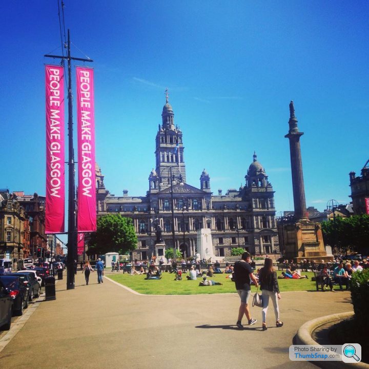
High pressure should last at least a week - meaning MG Chris will be happy Temps hard to pin down at the moment, but mid 20s in the South is likely and it could go higher.
There may be a few very cold nights, and some frost shocks for elevated areas north of the M62 for Sunday night, Monday night, Tues night.
High pressure should last at least a week - meaning MG Chris will be happy
Temps hard to pin down at the moment, but mid 20s in the South is likely and it could go higher. There may be a few very cold nights, and some frost shocks for elevated areas north of the M62 for Sunday night, Monday night, Tues night.
Puggit said:
First of all today is the nadir in terms of temperature. Friday will be warm and humid in the South, widespread thunder likely amongst heavy rain. The weekend will remain unsettled as the low system nudges us from the SW. It then gets squeezed out (after the w/e, of course) by the Azores high.
High pressure should last at least a week - meaning MG Chris will be happy Temps hard to pin down at the moment, but mid 20s in the South is likely and it could go higher.
There may be a few very cold nights, and some frost shocks for elevated areas north of the M62 for Sunday night, Monday night, Tues night.
Yippe im happy now. If it does rain will be blaming you for it though High pressure should last at least a week - meaning MG Chris will be happy
Temps hard to pin down at the moment, but mid 20s in the South is likely and it could go higher. There may be a few very cold nights, and some frost shocks for elevated areas north of the M62 for Sunday night, Monday night, Tues night.

Puggster, fancy having a crack at the Festival of Speed forecast (June 26-29 at Goodwood)?
We're down en mass from Mission Motorsport with a massive stand and we're all camping for 5 nights. Last year was stonking, red hot and dry all weekend.
At least this year we have the British Army cooks coming down with us to square away our morning bacon and evening curries.
We're down en mass from Mission Motorsport with a massive stand and we're all camping for 5 nights. Last year was stonking, red hot and dry all weekend.
At least this year we have the British Army cooks coming down with us to square away our morning bacon and evening curries.
benjj said:
Puggster, fancy having a crack at the Festival of Speed forecast (June 26-29 at Goodwood)?
We're down en mass from Mission Motorsport with a massive stand and we're all camping for 5 nights. Last year was stonking, red hot and dry all weekend.
At least this year we have the British Army cooks coming down with us to square away our morning bacon and evening curries.
Too far out - but the current money is on the settled weather ending before Goodwood. Of course, this doesn't mean it will happen, and doesn't mean settled weather won't return.We're down en mass from Mission Motorsport with a massive stand and we're all camping for 5 nights. Last year was stonking, red hot and dry all weekend.
At least this year we have the British Army cooks coming down with us to square away our morning bacon and evening curries.
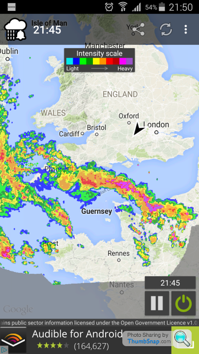
Tomorrow's storm activity is due to be highest South of Birmingham. It's going to be isolated storms in 2 phases. First of all around dawn, and not getting very far north.
Then a line of showers will pepp up in the afternoon. This will be slow moving and might eventually reach the M62 by Saturday lunch before fizzling out.
Anyone caught in the storms will know about it. 10cm of rain could fall if you get both storm systems. Others will wonder what the fuss is about.
After a cool and unsettled w/e, next week is firming up for pleasant summer's weather. But - not as hot as it could have been. Inland southern areas may reach mid-20s, so very pleasant. The high pressure will stretch up from the SW, so Devon/Cornwall are the places to be. A cool NErly from the North Sea is likely, so eastern areas will be pegged back significantly compared to inland western areas.
 I've even opened the doors to get some warmth in the house.
mcelliott said:
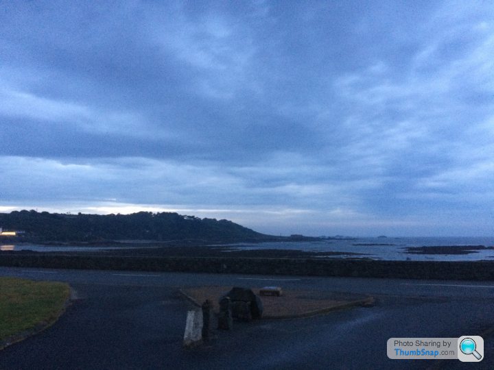
Guernsey being hit by a thunder storm and cloud burst of biblical proportions.
You might enjoy this. It's strangely addictive trying to predict the next hit and in which direction the storm is heading.http://www.lightningmaps.org/realtime
drivin_me_nuts said:
mcelliott said:
Guernsey being hit by a thunder storm and cloud burst of biblical proportions.
You might enjoy this. It's strangely addictive trying to predict the next hit and in which direction the storm is heading.http://www.lightningmaps.org/realtime

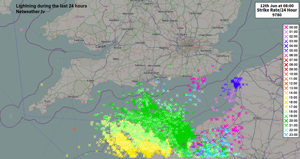
Storm cell now cleared, don'e know what the rainfall totals were but couldn't have been far off a month's worth in half an hour. Pic below taken about half an hour ago. Some more storms forecast through the night with some very thundery activity tomorrow from mid-morning onwards. Should be interesting.
Gassing Station | The Lounge | Top of Page | What's New | My Stuff