Weather Balloon Photography
Discussion


Dave, which GPS did you go for in teh end?
We spent a lot of time looking for one and struggled to find anything that worked any better than an iphone. All the other ones seemed to need direct line of sight to sattelites to work, and we thought this was a bit risky as the thing could easily end up out of sight of one
We spent a lot of time looking for one and struggled to find anything that worked any better than an iphone. All the other ones seemed to need direct line of sight to sattelites to work, and we thought this was a bit risky as the thing could easily end up out of sight of one
I did use a GPS/GSM tracker thing once - the kind of thing sold to attach to wandering cats or grannies so you can find them if they get lost. It was temperamental, very poor at getting a lock and none of these things work above 18km. Waste of time/money IMO.
Other than that I use GSM modules connected to the flight computer. Lots have been tried by others and there's a list of ones known to work at high altitudes and another of those known not to work. First time I used an olde Jupiter 11 module - because I had one - and that worked fine but was very power-hungry. Now I use either a Lassen IQ (reliable and low power but not the most sensitive) or uBlox modules which, with a helical antenna, are very sensitive indeed.
Dave
daveake said:
I did use a GPS/GSM tracker thing once - the kind of thing sold to attach to wandering cats or grannies so you can find them if they get lost. It was temperamental, very poor at getting a lock and none of these things work above 18km. Waste of time/money IMO.
We bought one of these and it wasn't cheap. We had specifically asked whether it needed line-of-sight and was told "No, it wouldn't work if it did as your pet may well hide under things". And yet when it arrived it did indeed need line-of-sight. Useless.Dave said:
Other than that I use GSM modules connected to the flight computer. Lots have been tried by others and there's a list of ones known to work at high altitudes and another of those known not to work. First time I used an olde Jupiter 11 module - because I had one - and that worked fine but was very power-hungry. Now I use either a Lassen IQ (reliable and low power but not the most sensitive) or uBlox modules which, with a helical antenna, are very sensitive indeed.
Dave
Excuse my ignorance but I genuinely don't know what any of that means. What are those modules?Dave
The GPS modules are little circuit boards that feed the GPS data out on a wire which I then connect to a little single-board computer. So the computer knows where it is and can then relay that information down to the ground using a radio link. So basically the module + my computer + a little radio transmitter are together equivalent to the device you tried. Except it works a lot better.
Dave
Dave
Well, the altitude attempt failed (we suspect a bad batch of balloons) but the photographic flight went very well, reaching an altitude of over 38km (125,500 feet). See my blog for a write-up.
Meanwhile here's a sample picture:
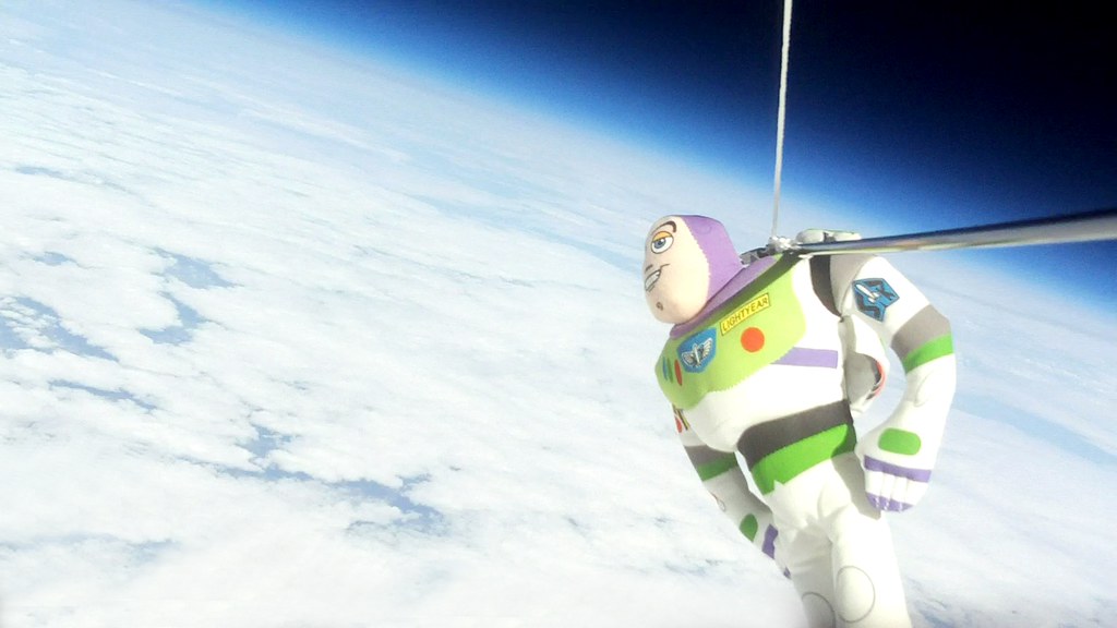
Buzz In Space 2 by daveake, on Flickr
Meanwhile here's a sample picture:
Buzz In Space 2 by daveake, on Flickr
daveake said:
Well, the altitude attempt failed (we suspect a bad batch of balloons) but the photographic flight went very well, reaching an altitude of over 38km (125,500 feet). See my blog for a write-up.
Meanwhile here's a sample picture:
Buzz In Space 2 by daveake, on Flickr
Buzz looks inflatable Dave, how come he didn't explode at Altitude??Meanwhile here's a sample picture:
Buzz In Space 2 by daveake, on Flickr
daveake said:
blindswelledrat said:
Dave, are you getting permission to launch beforehand?
Yes, of course! I apply to the CAA 4+ weeks beforehand and they confirm with a permission certificate before the launch, plus they issue A NOTAM to cover the flight.Dave
I do like all this stuff too - mind if I pinch one of your photos for a bit of desktop wallpaper?

ccr32 said:
Did you launch from around the Didcot/Oxford area? If so, I remember seeing the NOTAM's when doing a bit of planning in SkyDemon before flying on Saturday..!
West of Didcot, and about 5 miles south of Wantage.ccr32 said:
I do like all this stuff too - mind if I pinch one of your photos for a bit of desktop wallpaper?
Yes, no problem Weather permitting, I should be launching again on Saturday morning, about 11am.
The interesting thing this time is that my payload is carrying a webcam connected to a Raspberry Pi flight computer that will be sending down live images. There's little bandwidth on these flights so each image - a massive 432 x 240 pixels - takes 8 minutes or so to transmit, so the flight duration of 2 hours or so will only result in about 30 images. However it should be exciting seeing those come in.
The same flight will also carry a GoPro for HD video.
There will also be a second flight by a friend, who's going for the altitude record.
You can watch the action live. Images will be at http://sanslogic.co.uk/ssdv/live and a map at http://spacenear.us/tracker/
Dave
Gassing Station | Photography & Video | Top of Page | What's New | My Stuff