RB-29 'over-exposed' crash site.
Discussion


Ian D B said:
richw_82 said:
dr_gn said:
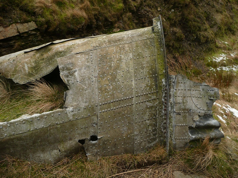
Absolutely no question. Rich thanks for photos. You can identify every single rivet! Thank you very much. Over the past few days I have gone from saying "Balls" to "they have a point actually" to this morning I was texting a pal who's been watching this thread and we were both saying you probably have it right in spite of what everyone else has been saying. This removes any doubt. Amazing what you see when you look at something without prejudice. I will get back up to Ashton Clough and take another look around!
Ian
dr_gn said:
mybrainhurts said:
Ayahuasca said:
Ian D B said:
a crater on the moors which was always held to be a V1 site on the moors in the Peak District was later shown to have been created by a parachute mine
I noticed a small, perfectly circular, lake just north of the Doctors Gate path and south of the stream, about 70 metres SW from the southern end of the Dakota gully that looks almost man-made. Could that be a crater?These links are to photos of bomb craters on the moors, referenced above;
Parachute mine crater and fragments on Howden Moor
http://aircrashsites.co.uk/air-raids-bomb-sites/ge...
V1 flying bomb crater and fragment on Howden Moor
http://aircrashsites.co.uk/air-raids-bomb-sites/v1...
V1 flying bomb crater near Buxton
http://aircrashsites.co.uk/air-raids-bomb-sites/01...
Just had a look on Amazon at that book, think I will get a copy. I am interested in the history of how our landscape has been used by humans especially with regards routes and roads; the trans-Pennine crossings from the pack horse routes to the M62 for example, though I am not convinced by the Roman Road theory. There is a huge rectangular lump of stone overlooking J22 of the M62 (the Saddleworth exit) called the 'Way Stone' which is on 'Waystone Edge' which doesn't really need much explaining...
I have just bought a narrowboat and its grand, this evening at sunset I was chugging along a stretch of cut knowing that at the start of the industrial revolution these quiet waters of the midlands were like motorways, designed taking contours and valleys into account and were marvels of engineering. Anyway I am getting OT. Still buzzing about the Dakota wing!
Ian
Edited by Ian D B on Saturday 11th January 21:02
Are any of these ponds adjacent to Dukes Road (bridleway from about half way along the road that Strines pub is on, to Back Tor)? In fact it's the bridleway closest to the Hunter crash mentioned previously.
We've found a few pools when out walking there recently.
ETA Its a great book, from 1925:
http://en.wikipedia.org/wiki/The_Old_Straight_Trac...
Read the ley line stuff with a pinch of salt, but it is so nicely written that it's easy to want to believe it and try to ignore the later computer analyses of the theories...
Edited by dr_gn on Saturday 11th January 23:08
Ayahuasca said:
I noticed a small, perfectly circular, lake just north of the Doctors Gate path and south of the stream, about 70 metres SW from the southern end of the Dakota gully that looks almost man-made. Could that be a crater?
I noticed that pool today, not sure what it is. I am checking with a pal, will get back to you if anything comes to light. Can see it here on OS map;http://binged.it/1adDhqa
dr_gn said:
Most people would have just written "Balls", rather than just thinking it and then considering it a bit further. I think by taking a more cerebral approach, richw82 has simply provided you with absolute proof without it turning into a huge inernet forum bun fight as usually happens.
Aye. Can't be arsed with that sort of thing, life's too short. Either the details we record are accurate or they are not and someone will hopefully provide evidence to show that so our records can be changed, which is what happened here. The keyboard warriors I leave to youtube!You may be interested to read that with my pal Paul we went back up there today to see it again in a new light, so to speak. Funny thing is, looking at it again (having previously never questioned that it was a chunk of fuselage) we were asking how we could possibly have thought it was anything other than a bit of wing!
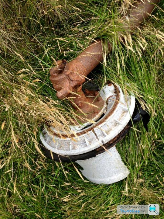
We looked around for where the fuselage section might be if it was buried beneath a landslide of mud and rock. We did not expect to have any success but took a metal detector and poked around in a few likely looking places anyway.
We also searched further up the clough, the two gullies which branch above this wing section which themselves split further up. All I found was a ladies Sekonda watch on a velcro strap which was still working (and was an hour ahead meaning it was lost in summertime) but no fuselage section, not even a fragment of metal to show it had been there.
My guess is if there was once something big enough for 3 lads to shelter in and it was washed down during a storm, then either someone has lifted it or it is well and truly buried and lost. Probably it is in someone's shed.
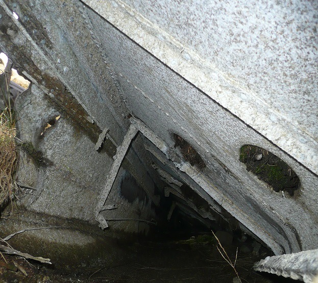
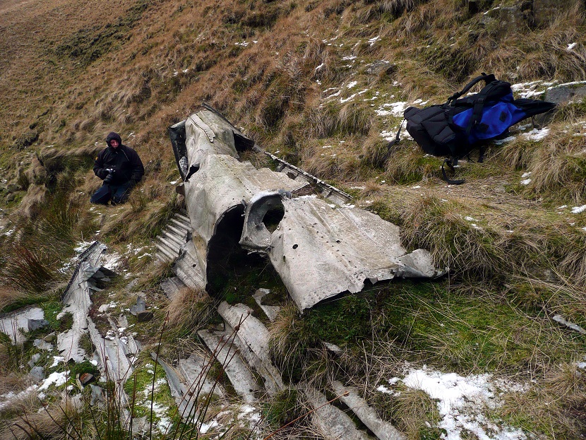
Here are some photos from today.
Looking through the hole
The other side


Not much left of that Lanc.
Interestingly, when hiking up there you can feel that it is a wild, pristine country...but I read that Bleaklow is one of the most polluted and contaminated areas in the country. Nothing much grows there because it can't due to contamination deposited there over the past couple of hundred years by the dark, satanic mills..
It is a good place to test your navigation skills on a foggy day.
Ayahuasca said:
Not much left of that Lanc.
Interestingly, when hiking up there you can feel that it is a wild, pristine country...but I read that Bleaklow is one of the most polluted and contaminated areas in the country. Nothing much grows there because it can't due to contamination deposited there over the past couple of hundred years by the dark, satanic mills..
It is a good place to test your navigation skills on a foggy day.
I wouldn't say nothing much grows there! Most of these sites are in open country, and it's hard work traversing the bracken, heather and bilberries. Pretty exhausting in fact compared with a walk on a path. Saw two mountain hares up there too.Interestingly, when hiking up there you can feel that it is a wild, pristine country...but I read that Bleaklow is one of the most polluted and contaminated areas in the country. Nothing much grows there because it can't due to contamination deposited there over the past couple of hundred years by the dark, satanic mills..
It is a good place to test your navigation skills on a foggy day.
Ayahuasca said:
Not much left of that Lanc.
Interestingly, when hiking up there you can feel that it is a wild, pristine country...but I read that Bleaklow is one of the most polluted and contaminated areas in the country. Nothing much grows there because it can't due to contamination deposited there over the past couple of hundred years by the dark, satanic mills..
It is a good place to test your navigation skills on a foggy day.
When we were doing the Pennine Way, my father and I rescued a group of teenage girls who were lost in thick fog on Bleaklow. They were doing their Duke of Edinburgh's award and they clearly had no idea what they were doing, and they had barely legible, photocopied maps Not clever.Interestingly, when hiking up there you can feel that it is a wild, pristine country...but I read that Bleaklow is one of the most polluted and contaminated areas in the country. Nothing much grows there because it can't due to contamination deposited there over the past couple of hundred years by the dark, satanic mills..
It is a good place to test your navigation skills on a foggy day.
I love that part of the world.
A fascinating thread.
Reminded of driving my Troopy to a Douglas Dakota DC-3 in Iceland, which crashed in the black sands of Sólheimasandur in South Iceland in 1973, one of four then based at the US Navy base in Keflavík.
The crew survived and the wreck remains in a desolate location. Albeit now closed to vehicle access due to fools ignoring the marked tracks.
Inkyfingers said:
When we were doing the Pennine Way, my father and I rescued a group of teenage girls who were lost in thick fog on Bleaklow. They were doing their Duke of Edinburgh's award and they clearly had no idea what they were doing, and they had barely legible, photocopied maps Not clever.
I love that part of the world.
Navigating in the jungle is a lot like navigating in fog i.e. no visibility. Without a map you make it slightly harder, but without a compass you are screwed.I love that part of the world.
Gassing Station | Boats, Planes & Trains | Top of Page | What's New | My Stuff