Fastest commercial jet airliner speed?
Discussion


mybrainhurts said:
brenflys777 said:
Eric Mc said:
Reminds me of a certain lady politician named Dianne.
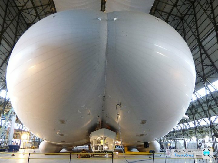
'Go around'. I say again, 'Go around'.Frankly I'd rather be strapped to the Hindenburg.
I'll happily push the envelope but there's no way I'd post that letter.
According to the RAF chaps I jumpseated with back in the '90's the VC10 would quite happily sit at Mach 0.98 across the pond with the clackers circuit breakers pulled.
The Boeing 787 cruises at around 0.86-0.87 and interestingly enough there is no VMO/MMO limitation listed, it is a variable number apparently !
The Boeing 787 cruises at around 0.86-0.87 and interestingly enough there is no VMO/MMO limitation listed, it is a variable number apparently !
brenflys777 said:
The A380 happily cruises around 0.85M and we don't exceed 0.89M but in terms of ground speed this was the fastest I've travelled in a commercial airliner - with a Ground Speed of 704 knots or 810 MPH thanks to a 198 knot jetstream! 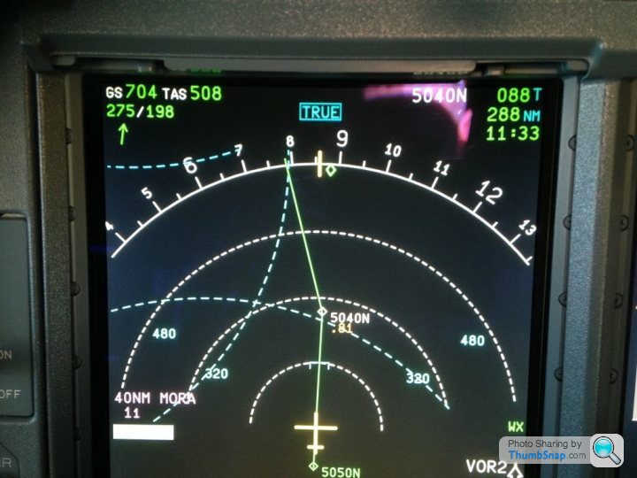
Thats an interesting instrument. Can you take us through what all that means please??williamp said:
brenflys777 said:
The A380 happily cruises around 0.85M and we don't exceed 0.89M but in terms of ground speed this was the fastest I've travelled in a commercial airliner - with a Ground Speed of 704 knots or 810 MPH thanks to a 198 knot jetstream!
Thats an interesting instrument. Can you take us through what all that means please??Middle top shows the compass is set to TRUE rather than Magnetic North.
Top right shows next waypoint on the route, heading to it, distance in nautical miles and time passing over it.
The semi circle is the compass orientated to direction of travel.
The dotted semi circles are ranges of 320 and 480 nautical miles.
Bottom left is the MORA - mimimum on route altitude in 40 miles of track - 11 is 1100 feet representing no obstacles as it's over the Atlantic.
Bottom middle is the last waypoint 5050N which is 50 degrees North and 50 degrees West, there's a green line which represents the planned track from that waypoint to the next at 5040N ( 50 degrees North 40 degrees West) .
Bottom right - the wx symbol shows the weather radar is on and the VOR symbol is a navigation beacon - normally it would have an arrow on the compass but there aren't any beacons across the Atlantic so it's blank.
Hope that makes sense - it's amazing the amount of information displayed that you subconsciously absorb - Seems madly complicated when writing it down as an explanation!
brenflys777 said:
williamp said:
brenflys777 said:
The A380 happily cruises around 0.85M and we don't exceed 0.89M but in terms of ground speed this was the fastest I've travelled in a commercial airliner - with a Ground Speed of 704 knots or 810 MPH thanks to a 198 knot jetstream!
Thats an interesting instrument. Can you take us through what all that means please??Middle top shows the compass is set to TRUE rather than Magnetic North.
Top right shows next waypoint on the route, heading to it, distance in nautical miles and time passing over it.
The semi circle is the compass orientated to direction of travel.
The dotted semi circles are ranges of 320 and 480 nautical miles.
Bottom left is the MORA - mimimum on route altitude in 40 miles of track - 11 is 1100 feet representing no obstacles as it's over the Atlantic.
Bottom middle is the last waypoint 5050N which is 50 degrees North and 50 degrees West, there's a green line which represents the planned track from that waypoint to the next at 5040N ( 50 degrees North 40 degrees West) .
Bottom right - the wx symbol shows the weather radar is on and the VOR symbol is a navigation beacon - normally it would have an arrow on the compass but there aren't any beacons across the Atlantic so it's blank.
Hope that makes sense - it's amazing the amount of information displayed that you subconsciously absorb - Seems madly complicated when writing it down as an explanation!
Gassing Station | Boats, Planes & Trains | Top of Page | What's New | My Stuff