Discussion


Riley Blue said:
Thanks for posting, however those maps don't show timings for me on Android, just the waypoint names. Is anyone able to give me etas for Severn Bridges and St Athan please?
Edit : just seen the above post! Thanks!

From Vulcan Twitter page https://twitter.com/xh558 : INITIAL PLANNED DEPARTURE SET AT 1300 (1pm local). Await updates on leg times over each location. *Please do not travel to Doncaster*.
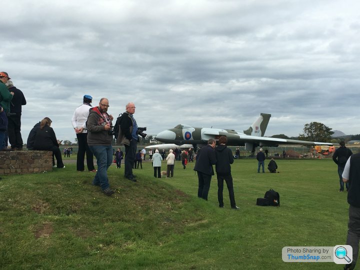
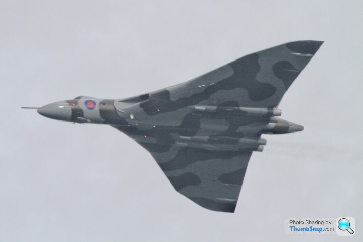
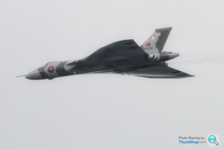
I got a few nice shots from almost immediately under the flight path as she passed to the east of Darlington.
Glorious, just glorious.
It felt as though we could reach out and touch her.
Worth the 20 minute hike to some high ground.
I was there with my daughter, parents and two farmers in the middle of nowhere as she came pretty much right at us. Got some good yarns from the farmers harking back to their younger days when RAF Leeming was in full swing too. That and flying crop sprayers in the 70s.
I'll upload the shots tomorrow evening on here.
FYI I downloaded this app yesterday evening to try - https://play.google.com/store/apps/details?id=com....
Phone was 100% charged when I went to bed, this morning I woke up and it was down to 23%. Battery useage pointed at that app.
Phone was 100% charged when I went to bed, this morning I woke up and it was down to 23%. Battery useage pointed at that app.
Did anyone just view on the flight path?
If so, was it reasonably low, and did it follow the advertised path pretty closely? I was planning on comparing the App tracker with the path (to get an idea if it was worth heading out to the middle of nowhere tomorrow) but the tracker never worked today.
If so, was it reasonably low, and did it follow the advertised path pretty closely? I was planning on comparing the App tracker with the path (to get an idea if it was worth heading out to the middle of nowhere tomorrow) but the tracker never worked today.
ukaskew said:
Did anyone just view on the flight path?
If so, was it reasonably low, and did it follow the advertised path pretty closely? I was planning on comparing the App tracker with the path (to get an idea if it was worth heading out to the middle of nowhere tomorrow) but the tracker never worked today.
We were pretty much underneath where the path indicated she would be and agreeably low If so, was it reasonably low, and did it follow the advertised path pretty closely? I was planning on comparing the App tracker with the path (to get an idea if it was worth heading out to the middle of nowhere tomorrow) but the tracker never worked today.

fathomfive said:
ukaskew said:
Did anyone just view on the flight path?
We were pretty much underneath where the path indicated she would be and agreeably low
Lucky you, hundreds of people were waiting under the flightpath near Chesterfield but the tour was ended after Heanor so XH558 could join the helicopter photo shoot that was obviously considered more important than the fans - a real slap in the face for those who have supported the project for years.We were pretty much underneath where the path indicated she would be and agreeably low
Gassing Station | Boats, Planes & Trains | Top of Page | What's New | My Stuff