Discussion


Tankman104c said:
I'm planning a trip before the end of September so have found this topic very useful.
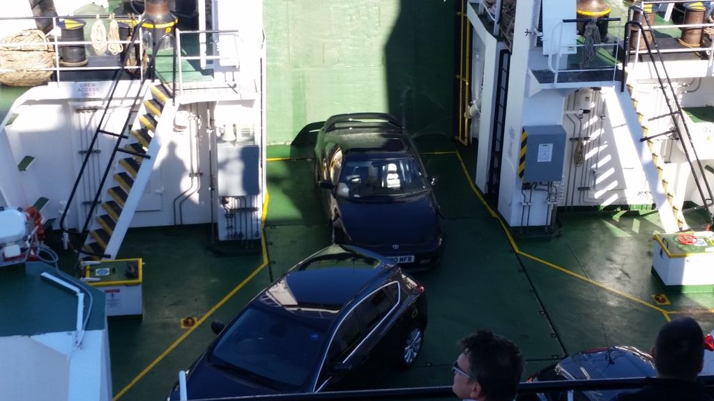
One question though - what are the ferries running between the islands like for ground clearance on their ramps? I'm hoping to take my Mercedes SL which isn't that bad on clearance!
Cheers
Russ
If you have a word with the crew, they will let you on first or last - and add some planks of wood to make it happen. They are used to it. Don't just try and drive on… depending on the location it can be a pretty dramatic angle.One question though - what are the ferries running between the islands like for ground clearance on their ramps? I'm hoping to take my Mercedes SL which isn't that bad on clearance!
Cheers
Russ


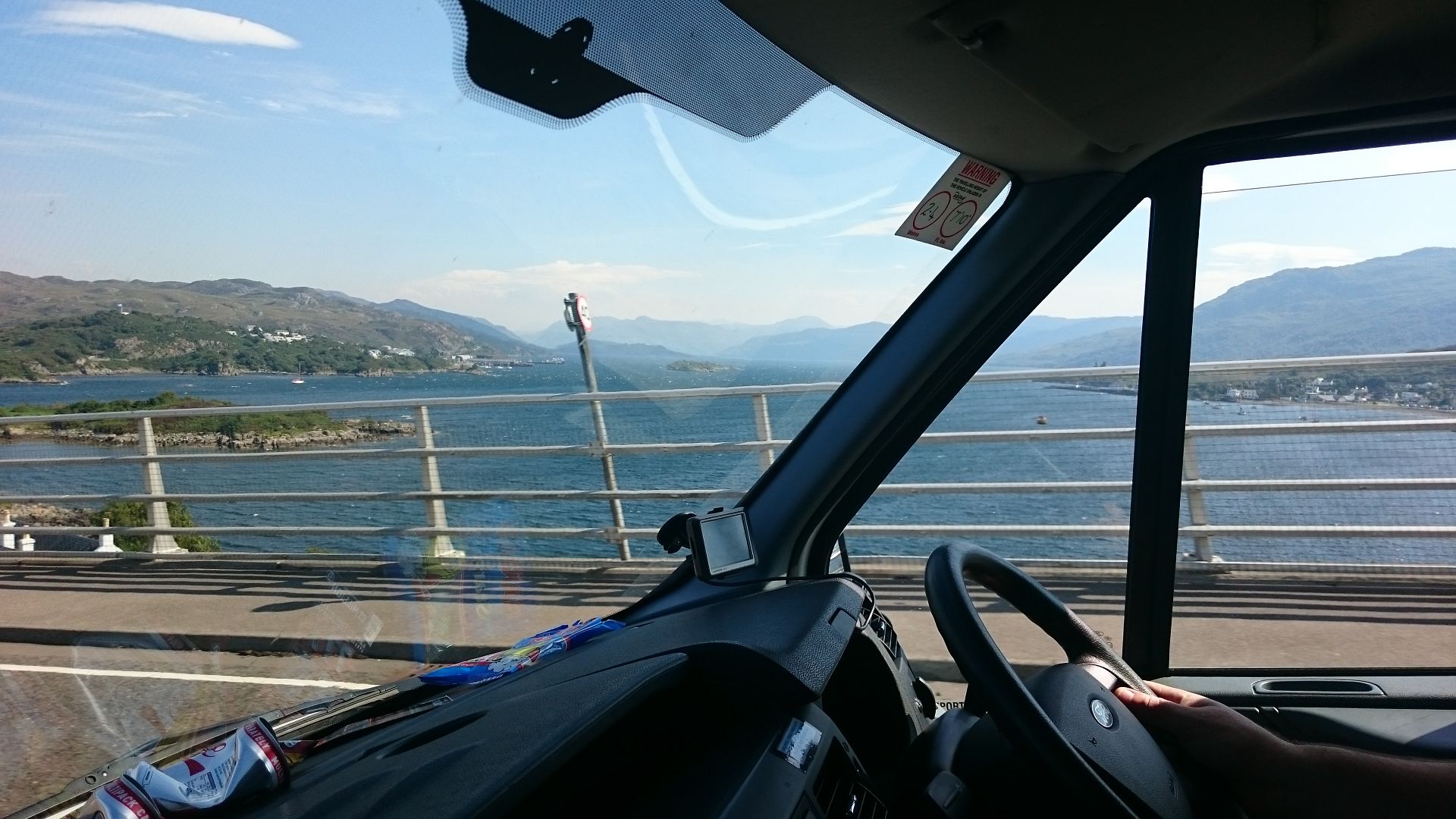
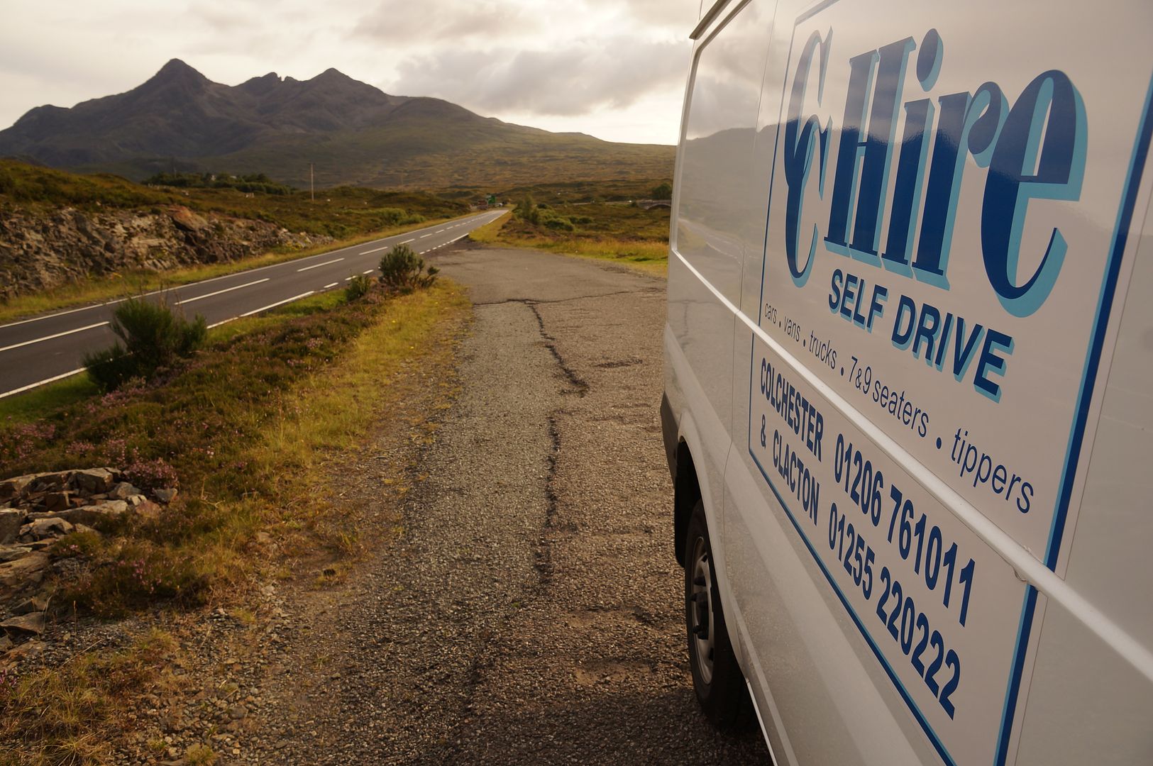
Recently a friend and I went from Essex to the Isle of Skye for 5 days in a hired Transit van full of furniture to help kit out a recently purchased holiday cottage whilst having a small holiday at the same time. The weather forecast basically said that the weather would be raining almost the entire time, but thankfully turned out to be completely inaccurate as we had great weather. Cornering in the Transit was a bit scary, but overall it was quite good fun on the roads and surprisingly very comfortable for the 12 hour drive.
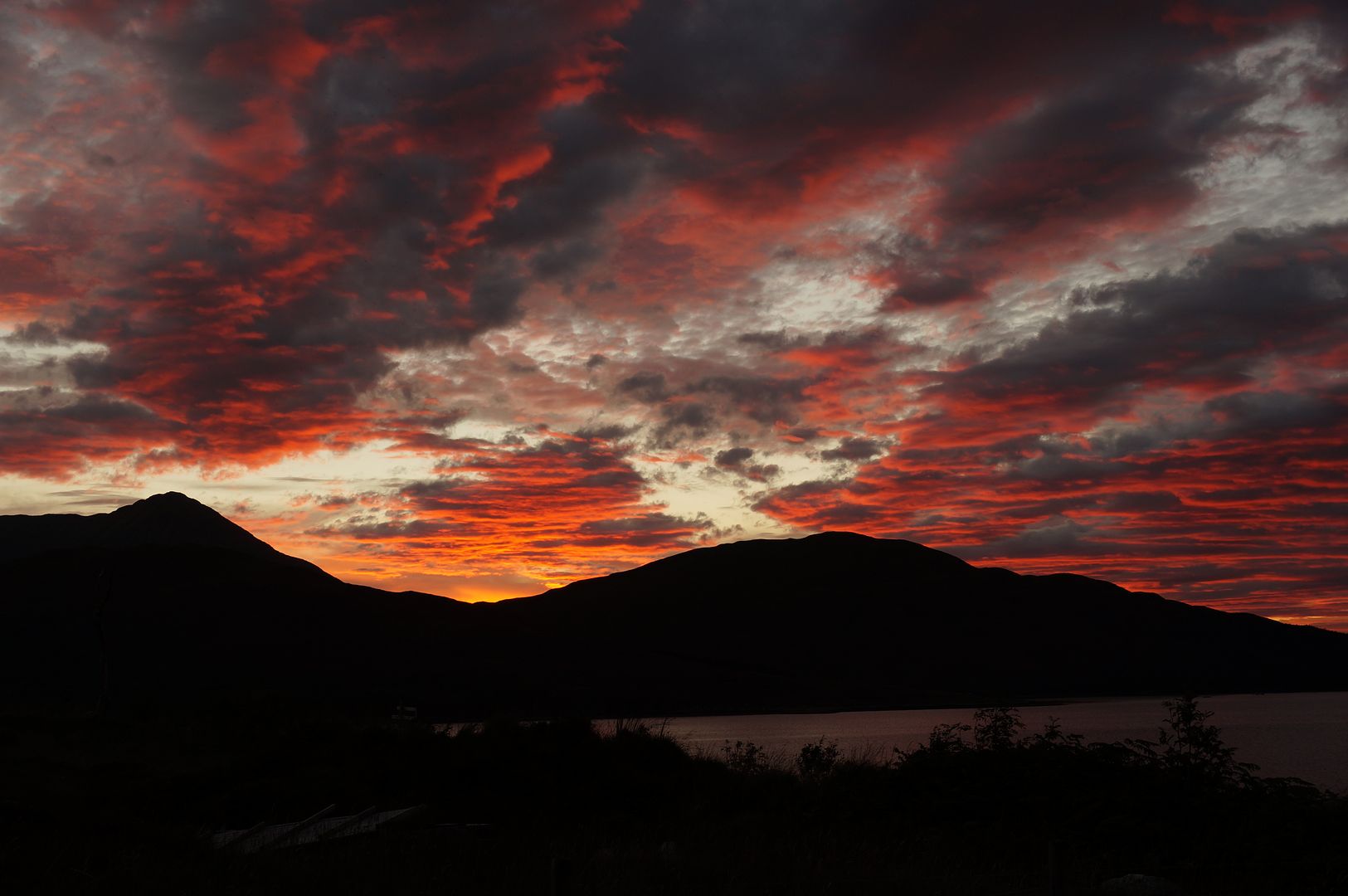
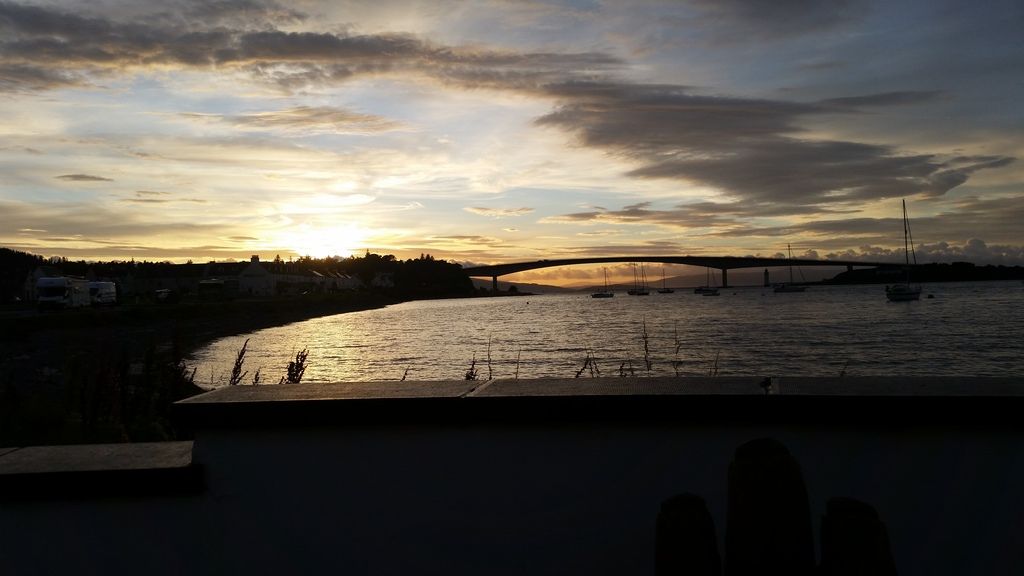
We had a fantastic sunset every night from the cottage, the only con was the midges. Being mid August, there were many.
In terms of roads, I can't think of any I didn't enjoy. We did a few trips to Portree and Fort William, and apart from quite a few dawdlers and camper vans, they're really good fun to drive. Overtaking took some careful planning in the van, with only 100hp and a small torque band to work with.
The bridge to Skye
Colchester represent!
Sunset
We're looking at going back up in early November; wonderful place, and when sharing driving, the 12 hour drive from Essex really isn't all that bad, even in a van.
Edited by George7 on Sunday 13th September 18:18
Who me said:
Thinking my memory was playing tricks, I had a look at your (RD)location. South ( Fort William side) of he bridge, no sign of a side road on satellite view, and indeed if the road position had changed, (which is not shown on google) the dirt road would have to cross under/over the rail line . Which if on the north(Glenfinnan side ) it doesn't have to ,as the rail line has crossed over the low rail bridge,to put the railway on the other side of the A830. 
Er, yes, indeed it doesn't have to.My point was/is that your compass appears to be defective.

The A830 is north of the railway on the Fort William side of the bridge and south of it on the Glenfinnan side.
Map view - https://goo.gl/maps/T887R
Satellite view - https://goo.gl/maps/ZHHcJ
The track is quite clear in both.
As I mentioned previously, Streetview only shows the junction with the A830.
The Google camera car hasn't ventured as far as the car park where the logging road begins.
sjabrown said:
Start of the track in the photo here: http://www.geograph.org.uk/photo/4203923
Trees tend to cover the track at the Glenfinnan end ?shielding it from satellite view.
Here's an earlier view of the same location from a slightly different camera angle - http://www.geograph.org.uk/photo/2456029Trees tend to cover the track at the Glenfinnan end ?shielding it from satellite view.
If you zoom in on the satellite view it is clearly after the bridge over the River Callop.
Who me said:
Thanks, sja- restored my sanity. I was thinking I needed a term in the place near the golf course in Inverness.
your link clearly shows the track starting on the Glenfinnan side of the rail bridge.
Never said it didn't. Only that you had got your cardinal points mixed up. your link clearly shows the track starting on the Glenfinnan side of the rail bridge.


not an attempt to create ,but a jovial attempt to defuse before aggro takes over .
The A830 is a road I've been on as boy and man for a lot of years. My first memory is of a rocky cart track over the heights of the road between Lochailort and Glenfinnan ,with a steep drop into the loch below.I drove this road ( in it's single track days in things like morris 1000 vans etc) several times a week, and often several times a day. So I think I can say I know this section of road fairly well .
slippydiff -I'd suggest that someone has got his (lower photo of yours) in a twist . Perhaps I should (BEEN MORE PEDANTIC and)have said "in a direction a few points north of west from the low rail bridge and at a distance of no more that 100 yards in this direction (i'e toward the Monument from the low bridge)", as it's only on that side of the bridge that a track could head toward Loch Shiel ,without having a need to cross the rail line.
The A830 is a road I've been on as boy and man for a lot of years. My first memory is of a rocky cart track over the heights of the road between Lochailort and Glenfinnan ,with a steep drop into the loch below.I drove this road ( in it's single track days in things like morris 1000 vans etc) several times a week, and often several times a day. So I think I can say I know this section of road fairly well .
slippydiff -I'd suggest that someone has got his (lower photo of yours) in a twist
. Perhaps I should (BEEN MORE PEDANTIC and)have said "in a direction a few points north of west from the low rail bridge and at a distance of no more that 100 yards in this direction (i'e toward the Monument from the low bridge)", as it's only on that side of the bridge that a track could head toward Loch Shiel ,without having a need to cross the rail line. Who me said:
not an attempt to create ,but a jovial attempt to defuse before aggro takes over .
I'm really not trying to start a cross border war, honest. 
Who me said:
The A830 is a road I've been on as boy and man for a lot of years. My first memory is of a rocky cart track over the heights of the road between Lochailort and Glenfinnan ,with a steep drop into the loch below.I drove this road ( in it's single track days in things like morris 1000 vans etc) several times a week, and often several times a day. So I think I can say I know this section of road fairly well .
Nor am I gainsaying your knowledge of the actual A830 road which is far greater than mine. That's not the issue between us.What I'm querying is its orientation on a map and your interpretation thereof.
Who me said:
slippydiff -I'd suggest that someone has got his (lower photo of yours) in a twist.
Not me, sir. . (see below).
Who me said:
Perhaps I should (BEEN MORE PEDANTIC and)have said "in a direction a few points north of west from the low rail bridge and at a distance of no more that 100 yards in this direction (i'e toward the Monument from the low bridge)", as it's only on that side of the bridge that a track could head toward Loch Shiel ,without having a need to cross the rail line.
This - https://goo.gl/maps/sGvKr - is the section of the A830 from the low bridge to the start of the track which leads to the point in the photo which sjabrown linked to.I agree 100% with your last sentence, but I still don't get how you can say that the point of divergence from the A830 is north of west from the bridge.
To my uneducated eyes, unless the Google Maps projection is way off beam, it's south of due west.
In the spirit of friendly debate, please would you do me the favour of explaining where and how I have got it wrong?
Looking at the map, the road does go south west for a bit, but from my memories of the road (having driven it several thousands of times), I'd put it in a north west( or at worst west) direction .I'd suggest the google map view is a tad exaggerated on the loop, as that shown would make the corner quite severe, and a lot slower than I know it is .
My last throw of the dice. Satellite view - https://goo.gl/maps/NCy07
Not sure how that can be distorted enough to put the end point north of the east to west axis.
If and when I next visit that particular part of Scotland maybe we should meet up for a site survey.
Then we can settle our differences over a dram or two of this.
Not sure how that can be distorted enough to put the end point north of the east to west axis.
If and when I next visit that particular part of Scotland maybe we should meet up for a site survey.
Then we can settle our differences over a dram or two of this.
Just got back from a 4 day trip! It was a spontaneous trip with not much planning, as I have some time off work and the girlfriend is working away I thought i'd have a break and explore more of the Highlands. I've already been to the highlands, in Feb 2013. That was Manchester to Thurso Via Tomintoul. In one hit. The roads were barely passable due to snow, A policeman in a Land rover stopped me at the Ski Centre and asked me where I was going to advise me of the snow situation, he said it was passable, but a bit dangerous. We made it okay. After Thurso it was down to Fort Augustus for a few nights, so it wasn't really much exploring, just a there and back kind of trip.
Anyway, onto this time...
Day 1 - https://goo.gl/maps/0XwU7 - Bury to Kingussie Via Tomintoul stopping at Perth for fuel and dinner.
Set off at 8.45am Sunday, arrived at the hotel around 4.30pm. The Carringoms is where I saw the most petrolhead cars, VX220s, MX5s, many 911s and a GTR. The scenery looks mighty different without the snow. Not really much to report as today was just used to travel into Scotland. After some dinner in the local pub, a walk around the town I watched the Sleeper train to London arrive and depart then it was back to the hotel to book tomorrow nights stay. As I had done the trip on a whim, I had an idea of where to stay, but hadn't actually booked anything. Around 11pm I had tomorrows accommodation booked.
Day 2 - https://goo.gl/maps/l0CmI - Kingussie To Kyleakin Via Mallaig and a lap of Skye. I needed an early start in order to keep to schedule, the hotel I was at didn't serve breakfast until 9.15am and the cafes in Kingussie not opening until 9 I hit the road around 8.40am with no breakfast until Fort William. Luxurious (not!) breakfast in Fort William consisting of a Bacon and Egg Mcmuffin. After eating I checked the ferry times and the next one was 10.45am. The time now? 9.40am. Better get a shift on! The rush for the ferry did actually made me enjoy the road and the car, just flowing from bend to bend, overtaking with ease. I screamed into the ferry terminal with brakes on fire at about 10.30am to be told it was full and i'd be on standby for this crossing. Balls. After buying my tickets, boarding had almost finished, with us in the standby lane waiting for the coaches to go on. Everyone on standby was waved on, I had made it. Just! Quite literally just.
Skye was full of traffic, for the first 10 miles it was almost torture! The further north I headed the more the traffic thinned out until I turned left for the first loop and I had the road to myself. Continuing round it was time for a fuel stop at Uig where the coast road becomes single track, this was incredibly hard work as I'd hit traffic coming the other way every 30 seconds, the views were spectacular but negotiating past all the oncoming dutch motor homes was becoming rather tiring. Arrived at the hotel in Kyleakin around 4.15pm.
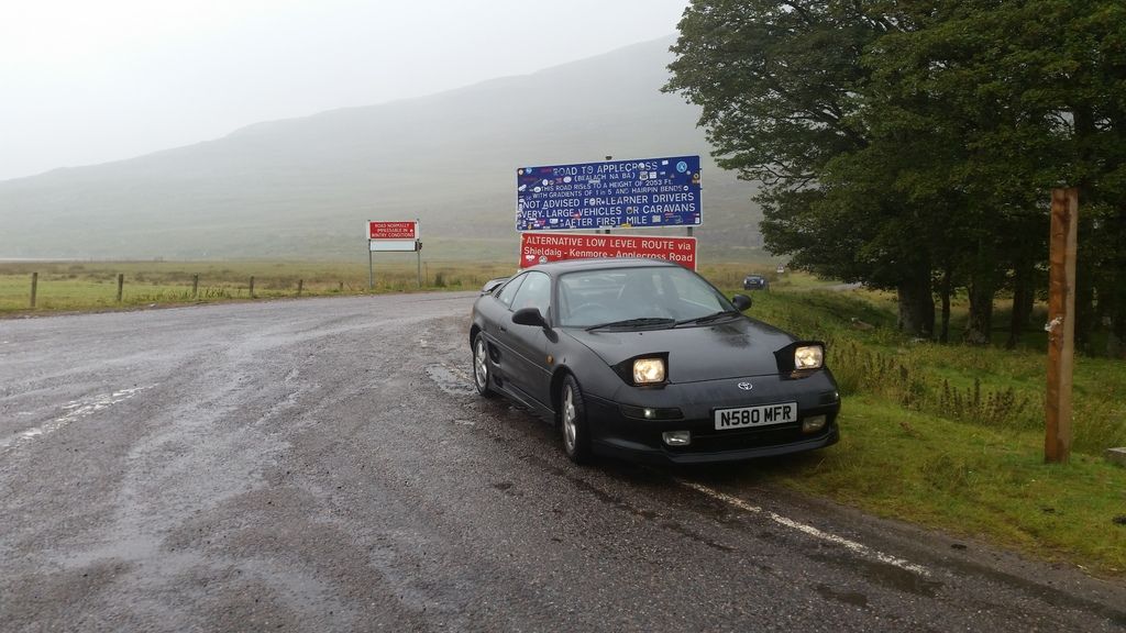
Day 3 - https://goo.gl/maps/JZKnC - Kyleakin to Inveraray Via Applecross and Fort Augustus. I was originally planning this to be a short day, ending in Fort William but I had little success with finding a hotel, and any with rooms available seemed to be at a premium (Ben Nevis premium?). I was thinking of just finding a place to stay once there, but I booked the hotel in Inveraray as i'd rather not be knocking on doors after 6 hours driving to be told 'no room at the inn!'
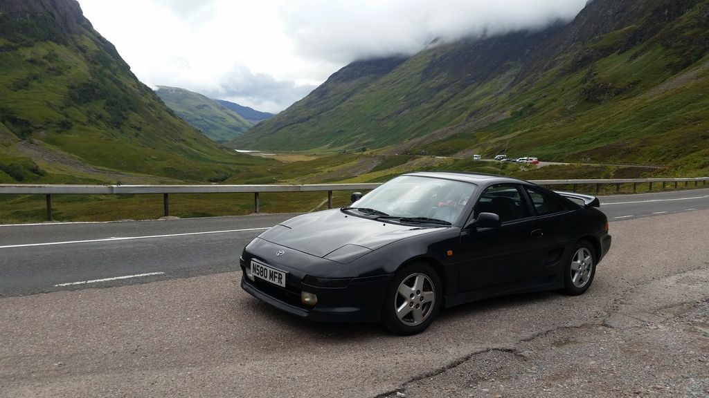
Sadly the weather was poor which did kind of spoil Applecross, but it was amazing anyway. Low cloud had made visibility a matter of meters when ascending the mountain road but coming down the other side it cleared up to reveal a great view of the sea! The single track road provided excellent views, but it did start to drag a little towards the end. Dinner was at a nice cafe in Drumnadrochit before some nice winding loch-side roads into Fort Augustus. After Fort Augustus the traffic built up with coaches creating a back log with no-one at the front overtaking. I did my best to leapfrog, but it was a lot of effort to pass 10 cars and a coach to have 10 minutes of flying along until hitting the next road train. The road south out of Fort William provided many great views, and great driving, the long straights near the adventure centre were fast. Very fast. I think the best road of the lot was the A819 into Inveraray, very twisty but opening up for short periods to allow some leg stretching.
Day 4 - https://goo.gl/maps/qsQaZ - Inveraray to Bury.
This was never going to be a good driving day but the first hour or so finished off the highlands nicely, excellent views and excellent roads. The traffic was light so progress was easy, while waiting for overtaking opportunities, it's brilliant to see those crazy Scottish drivers hustle a fully laden lorry full of logs around at 56mph round the twisty bits, not slowing for anything!
One memorable moment was catching upto an old Citroen Berlingo which was really beating it along, 60-70mph probably touching 80 on the straights. In the next village it turned right and I caught a look at the driver. An old lady, probably in her 70s!
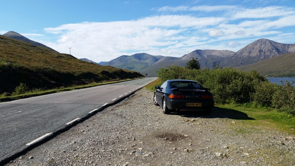
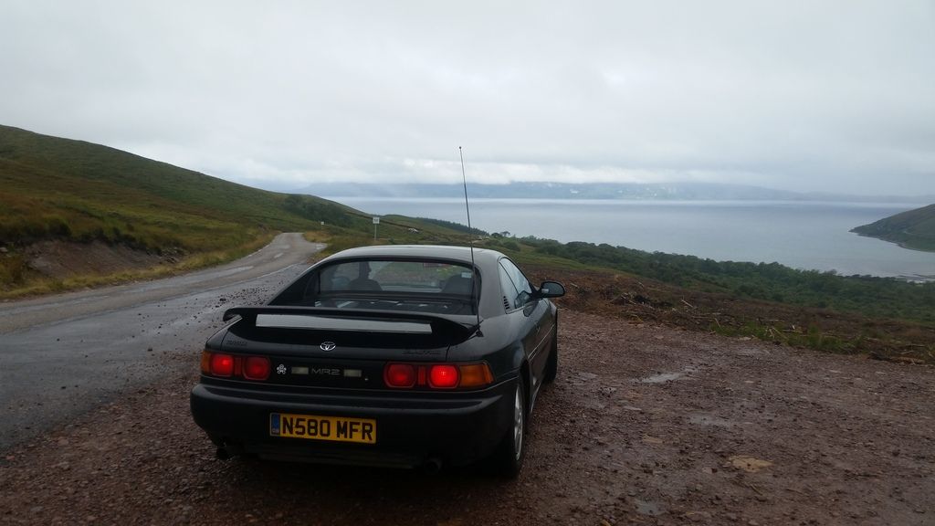
Total mileage was around 1100 I think, the MR2 is nearly celebrating its 150,000th mile!
The car performed brilliantly, not a single problem and returned almost 35mpg! Not bad for a car getting on for 20 years old.
Anyway, onto this time...
Day 1 - https://goo.gl/maps/0XwU7 - Bury to Kingussie Via Tomintoul stopping at Perth for fuel and dinner.
Set off at 8.45am Sunday, arrived at the hotel around 4.30pm. The Carringoms is where I saw the most petrolhead cars, VX220s, MX5s, many 911s and a GTR. The scenery looks mighty different without the snow. Not really much to report as today was just used to travel into Scotland. After some dinner in the local pub, a walk around the town I watched the Sleeper train to London arrive and depart then it was back to the hotel to book tomorrow nights stay. As I had done the trip on a whim, I had an idea of where to stay, but hadn't actually booked anything. Around 11pm I had tomorrows accommodation booked.

Day 2 - https://goo.gl/maps/l0CmI - Kingussie To Kyleakin Via Mallaig and a lap of Skye. I needed an early start in order to keep to schedule, the hotel I was at didn't serve breakfast until 9.15am and the cafes in Kingussie not opening until 9 I hit the road around 8.40am with no breakfast until Fort William. Luxurious (not!) breakfast in Fort William consisting of a Bacon and Egg Mcmuffin. After eating I checked the ferry times and the next one was 10.45am. The time now? 9.40am. Better get a shift on! The rush for the ferry did actually made me enjoy the road and the car, just flowing from bend to bend, overtaking with ease. I screamed into the ferry terminal with brakes on fire at about 10.30am to be told it was full and i'd be on standby for this crossing. Balls. After buying my tickets, boarding had almost finished, with us in the standby lane waiting for the coaches to go on. Everyone on standby was waved on, I had made it. Just! Quite literally just.

Skye was full of traffic, for the first 10 miles it was almost torture! The further north I headed the more the traffic thinned out until I turned left for the first loop and I had the road to myself. Continuing round it was time for a fuel stop at Uig where the coast road becomes single track, this was incredibly hard work as I'd hit traffic coming the other way every 30 seconds, the views were spectacular but negotiating past all the oncoming dutch motor homes was becoming rather tiring. Arrived at the hotel in Kyleakin around 4.15pm.


Day 3 - https://goo.gl/maps/JZKnC - Kyleakin to Inveraray Via Applecross and Fort Augustus. I was originally planning this to be a short day, ending in Fort William but I had little success with finding a hotel, and any with rooms available seemed to be at a premium (Ben Nevis premium?). I was thinking of just finding a place to stay once there, but I booked the hotel in Inveraray as i'd rather not be knocking on doors after 6 hours driving to be told 'no room at the inn!'
Sadly the weather was poor which did kind of spoil Applecross, but it was amazing anyway. Low cloud had made visibility a matter of meters when ascending the mountain road but coming down the other side it cleared up to reveal a great view of the sea! The single track road provided excellent views, but it did start to drag a little towards the end. Dinner was at a nice cafe in Drumnadrochit before some nice winding loch-side roads into Fort Augustus. After Fort Augustus the traffic built up with coaches creating a back log with no-one at the front overtaking. I did my best to leapfrog, but it was a lot of effort to pass 10 cars and a coach to have 10 minutes of flying along until hitting the next road train. The road south out of Fort William provided many great views, and great driving, the long straights near the adventure centre were fast. Very fast
. I think the best road of the lot was the A819 into Inveraray, very twisty but opening up for short periods to allow some leg stretching. 


Day 4 - https://goo.gl/maps/qsQaZ - Inveraray to Bury.
This was never going to be a good driving day but the first hour or so finished off the highlands nicely, excellent views and excellent roads. The traffic was light so progress was easy, while waiting for overtaking opportunities, it's brilliant to see those crazy Scottish drivers hustle a fully laden lorry full of logs around at 56mph round the twisty bits, not slowing for anything!
One memorable moment was catching upto an old Citroen Berlingo which was really beating it along, 60-70mph probably touching 80 on the straights. In the next village it turned right and I caught a look at the driver. An old lady, probably in her 70s!
Total mileage was around 1100 I think, the MR2 is nearly celebrating its 150,000th mile!
The car performed brilliantly, not a single problem and returned almost 35mpg! Not bad for a car getting on for 20 years old.
Edited by James2593 on Thursday 17th September 08:42
Who me said:
Looking at the map, the road does go south west for a bit, but from my memories of the road (having driven it several thousands of times), I'd put it in a north west( or at worst west) direction .I'd suggest the google map view is a tad exaggerated on the loop, as that shown would make the corner quite severe, and a lot slower than I know it is .
Red Devil said:
My last throw of the dice. Satellite view - https://goo.gl/maps/NCy07
Not sure how that can be distorted enough to put the end point north of the east to west axis.
If and when I next visit that particular part of Scotland maybe we should meet up for a site survey.
Then we can settle our differences over a dram or two of this.
Not sure how that can be distorted enough to put the end point north of the east to west axis.
If and when I next visit that particular part of Scotland maybe we should meet up for a site survey.
Then we can settle our differences over a dram or two of this.

The turn off to the track is geographically south of the rail bridge.
If I was to give it a (general) direction from the rail bridge I would just say it was west of it.
James2593 said:
Just got back from a 4 day trip! It was a spontaneous trip with not much planning, as I have some time off work and the girlfriend is working away I thought i'd have a break and explore more of the Highlands.
Nice write up. Your route missed out one of the best bits in Skye though. The unclassified road from Uig to Staffin - stunning.
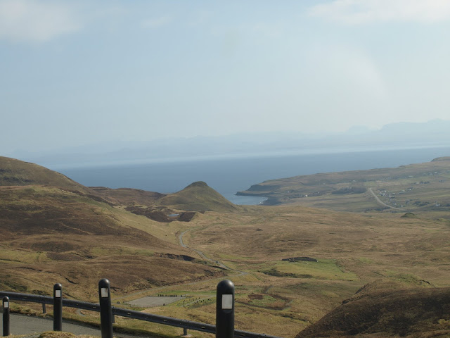
If time allows it's well worth stopping to explore the Quirang and climb to the summit of Meall na Suiramach.

James2593 said:
Total mileage was around 1100 I think, the MR2 is nearly celebrating its 150,000th mile!
The car performed brilliantly, not a single problem and returned almost 35mpg! Not bad for a car getting on for 20 years old.
Great choice of car btw. The car performed brilliantly, not a single problem and returned almost 35mpg! Not bad for a car getting on for 20 years old.
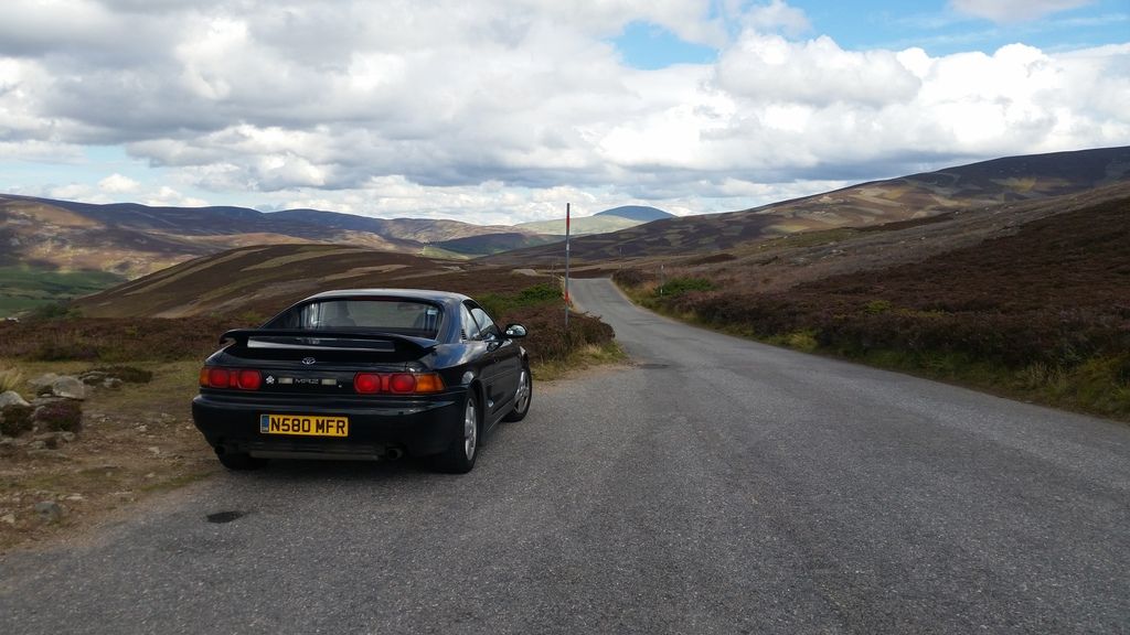
 It looks a bit lonely in this photo though...
It needs some friends.


That was 5 years ago.
The best time to go imo is in the spring. Almost zero traffic and no midges.
Have always been lucky with the weather as can be seen from the strong shadows in the above photos.
This one is from mid-April this year: cloudless skies for 5 days.

Devil points on offer for anyone who can guess the location.
Sorry but there is little more tragic than encountering a line of identical cars in a Highlands layby, often being photographed to create a picture showung ..err ..a line of identical cars . God knows I have done it myself but I learned many years ago that the best way to really enjoy driving in Britain's best scenery is with a friend, but best of all solo.And as said above , on single trackers convoys are plain daft
James2593 said:
Just got back from a 4 day trip! It was a spontaneous trip with not much planning, as I have some time off work and the girlfriend is working away I thought i'd have a break and explore more of the Highlands.
Good write up! I've driven most of those roads, but spread out over a few trips. Were they mostly full days driving?Craikeybaby said:
Good write up! I've driven most of those roads, but spread out over a few trips. Were they mostly full days driving?
Yeah, was around 7 hours driving a day plus a 45min-1 hour stop for dinner and a few 5 minute scenery stops for photos. Other than that, it was constant driving.James2593 said:
One memorable moment was catching upto an old Citroen Berlingo which was really beating it along, 60-70mph probably touching 80 on the straights. In the next village it turned right and I caught a look at the driver. An old lady, probably in her 70s!
Reminds me of my first trip up that way on a motorbike. I was doing 80-90 along a road with wide open sweeping bends & just enjoying the ride when a Merc Sprinter came past doing about 100! LWB monster one too, he must have spent the last two miles winding it up to speed as it was all down hill.
Never underestimate locals.
Oh, those fast straights south of Fort William, favourite spot for speed cameras.
Gassing Station | Roads | Top of Page | What's New | My Stuff