Discussion


coppice said:
Sorry but there is little more tragic than encountering a line of identical cars in a Highlands layby, often being photographed to create a picture showung ..err ..a line of identical cars . God knows I have done it myself but I learned many years ago that the best way to really enjoy driving in Britain's best scenery is with a friend, but best of all solo.And as said above , on single trackers convoys are plain daft
You're entitled to your opinion of course but why the need to be so dismissive because it doesn't suit your book? Your preference is to do it with a friend: mine is to do it with several. I wouldn't dream of criticising your choice so perhaps you might consider reciprocating the courtesy. Our cars are similar (not all identical if you care to look again) because we belong to an owners club. My apologies for not realising that that is infra dig. We don't have any problems with other traffic, as mentioned by the previous poster, because at the time of year we go there isn't any worth talking about. It's well before the tourists in their motor homes have dragged themselves up there. This year, for example, our route took in this section of the A836 - https://goo.gl/maps/3Sv9Z - near enough 35 miles of single track. Over the entire distance we encountered just 4 oncoming cars and we never saw anyone else going our way. Those 4 drivers were not held up for more than a few seconds. We are polite and all of us make a point of thanking people for their patience. In return we almost invariably get a smile and often a wave as well.
The only time it ever became an issue was in 2013 when we met an opposing convoy of Porsches (whose cars were even more like clones than ours!). A bit of shuffling the deck was needed but we got it sorted without coming to blows.
 I posted a photo of that encounter back on page 25.
JM said:
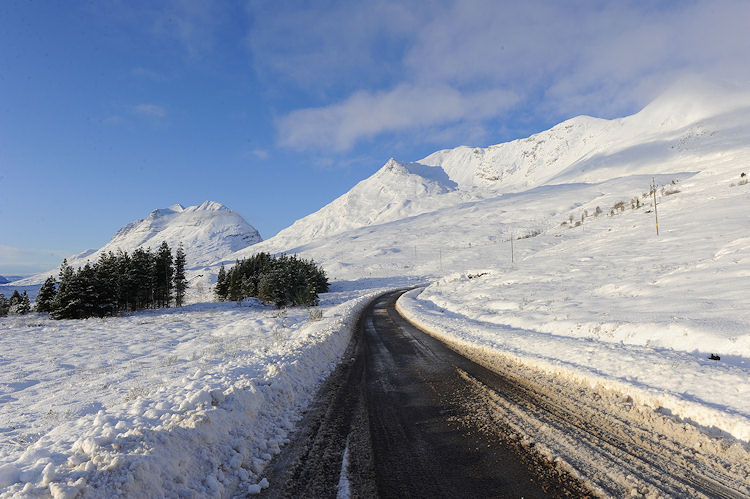
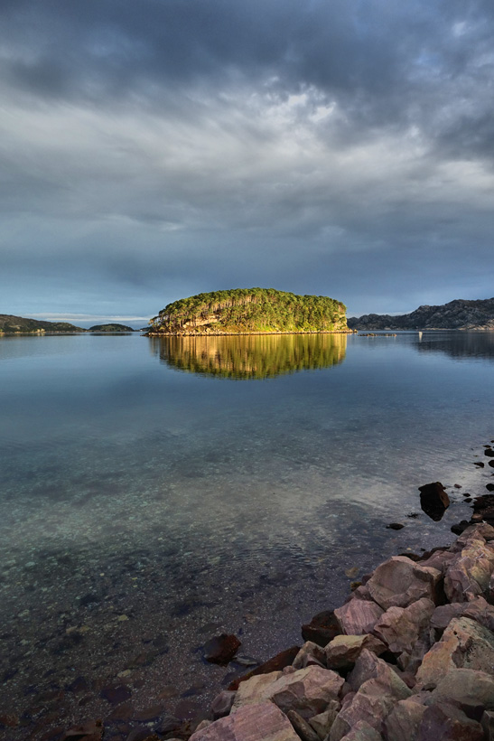
The Lecht, or Cairnwell?
Only 5 points 'cos you hedged your bet.  - https://goo.gl/maps/M7Z0b
We had gone on well ahead of the rest of the group so that I could take some action shots of them coming over the brow of the hill.
It was glorious sunny day without a single cloud to be seen anywhere in the immediate vicinity.
So I had plenty of time to grab all but the last photo below while awaiting their arrival.


Red Devil said:
coppice said:
Sorry but there is little more tragic than encountering a line of identical cars in a Highlands layby, often being photographed to create a picture showung ..err ..a line of identical cars . God knows I have done it myself but I learned many years ago that the best way to really enjoy driving in Britain's best scenery is with a friend, but best of all solo.And as said above , on single trackers convoys are plain daft
You're entitled to your opinion of course but why the need to be so dismissive because it doesn't suit your book? Your preference is to do it with a friend: mine is to do it with several. I wouldn't dream of criticising your choice so perhaps you might consider reciprocating the courtesy. Our cars are similar (not all identical if you care to look again) because we belong to an owners club. My apologies for not realising that that is infra dig. What would be the best route around Skye? We have the current routes planned:
Day 1 Staying at The Drovers by Loch Lomond
Day 2 - Heading back down the same sort of way, but would like to go to Skye instead of heading so far south as we are stopping back at Drovers. I'm up for changing this one to take in anything else.
Thanks in advance!
Day 1 Staying at The Drovers by Loch Lomond
Day 2 - Heading back down the same sort of way, but would like to go to Skye instead of heading so far south as we are stopping back at Drovers. I'm up for changing this one to take in anything else.
Thanks in advance!
coppice said:
Because the internet is about expressing opinions - amongst other things. And it really wouldn't be much fun if we all agreed or missed an opportunity to take cheap shots - tongue in cheek of course. I would absolutely defend your right to drive around in convoy but having tried it several times it really isn't for me .
I agree. Open road and nothing around but the scenery and wildlife is about perfect.theboyfold said:
Day 2 - Heading back down the same sort of way, but would like to go to Skye instead of heading so far south as we are stopping back at Drovers.
That route looks a bit odd. Why are you heading up the A832 from Achnasheen to end at a cattle grid in the middle of nowhere? 
The A835 from Ullapool to Gorstan is a fabulous road (fast and flowing) but I would be prepared to sacrifice a large chunk of it.
Gorstan to Achnasheen is probably the most actively policed bit of road in the Highlands (they lurk in the laybys near Achanalt).
Perhaps best avoided? (A friend of mine got busted on that stretch and his case comes up tomorrow at Inverness Sheriff Court).

My choice would be to turn right at Braemar Junction (near the Corrieschalloch Gorge) onto the A832 and follow it all the way to Achnasheen.
https://goo.gl/maps/PDmX2 - it's quite a bit longer that way but with more variety: a lot of elevation changes as it follows the contours.
theboyfold said:
What would be the best route around Skye?
Try this - https://goo.gl/maps/PDmX2 - best done clockwise imo.If you have time, also include the B8083 from Broadford to Elgol (and back) - https://goo.gl/maps/ht6aR
It's a nice leisurely and relaxed drive as it winds around the shores of Loch Slapin.
Red Devil said:
theboyfold said:
Day 2 - Heading back down the same sort of way, but would like to go to Skye instead of heading so far south as we are stopping back at Drovers.
That route looks a bit odd. Why are you heading up the A832 from Achnasheen to end at a cattle grid in the middle of nowhere? The A835 from Ullapool to Gorstan is a fabulous road (fast and flowing) but I would be prepared to sacrifice a large chunk of it.
Gorstan to Achnasheen is probably the most actively policed bit of road in the Highlands (they lurk in the laybys near Achanalt).
Perhaps best avoided? (A friend of mine got busted on that stretch and his case comes up tomorrow at Inverness Sheriff Court).
My choice would be to turn right at Braemar Junction (near the Corrieschalloch Gorge) onto the A832 and follow it all the way to Achnasheen.
https://goo.gl/maps/PDmX2 - it's quite a bit longer that way but with more variety: a lot of elevation changes as it follows the contours.
theboyfold said:
What would be the best route around Skye?
Try this - https://goo.gl/maps/PDmX2 - best done clockwise imo.If you have time, also include the B8083 from Broadford to Elgol (and back) - https://goo.gl/maps/ht6aR
It's a nice leisurely and relaxed drive as it winds around the shores of Loch Slapin.
Thanks for the routes, the first two are the same, you seem to be missing the route around Skye, can you post that one again please
theboyfold said:
Red Devil said:
theboyfold said:
Day 2 - Heading back down the same sort of way, but would like to go to Skye instead of heading so far south as we are stopping back at Drovers.
That route looks a bit odd. Why are you heading up the A832 from Achnasheen to end at a cattle grid in the middle of nowhere? The A835 from Ullapool to Gorstan is a fabulous road (fast and flowing) but I would be prepared to sacrifice a large chunk of it.
Gorstan to Achnasheen is probably the most actively policed bit of road in the Highlands (they lurk in the laybys near Achanalt).
Perhaps best avoided? (A friend of mine got busted on that stretch and his case comes up tomorrow at Inverness Sheriff Court).
My choice would be to turn right at Braemar Junction (near the Corrieschalloch Gorge) onto the A832 and follow it all the way to Achnasheen.
https://goo.gl/maps/PDmX2 - it's quite a bit longer that way but with more variety: a lot of elevation changes as it follows the contours.
theboyfold said:
What would be the best route around Skye?
Try this - https://goo.gl/maps/PDmX2 - best done clockwise imo.If you have time, also include the B8083 from Broadford to Elgol (and back) - https://goo.gl/maps/ht6aR
It's a nice leisurely and relaxed drive as it winds around the shores of Loch Slapin.
Thanks for the routes, the first two are the same, you seem to be missing the route around Skye, can you post that one again please
Red Devil said:
Try this - https://goo.gl/maps/PDmX2 - best done clockwise imo.
If you have time, also include the B8083 from Broadford to Elgol (and back) - https://goo.gl/maps/ht6aR
It's a nice leisurely and relaxed drive as it winds around the shores of Loch Slapin.
Something like this: https://goo.gl/maps/FT0tHIf you have time, also include the B8083 from Broadford to Elgol (and back) - https://goo.gl/maps/ht6aR
It's a nice leisurely and relaxed drive as it winds around the shores of Loch Slapin.
theboyfold said:
Thanks for the routes, the first two are the same, you seem to be missing the route around Skye, can you post that one again please
Ooops - my apologies: finger trouble. 
theboyfold said:
Something like this: https://goo.gl/maps/FT0tH
Close, but no cigar. Here you go - https://goo.gl/maps/WHMvC - I have already posted the Elgol route in a separate link.
I prefer the Uig to Staffin road past the Quiraing to the A855 round the top of the island. YMMV.
Red Devil said:
theboyfold said:
Thanks for the routes, the first two are the same, you seem to be missing the route around Skye, can you post that one again please
Ooops - my apologies: finger trouble. theboyfold said:
Something like this: https://goo.gl/maps/FT0tH
Close, but no cigar. Here you go - https://goo.gl/maps/WHMvC - I have already posted the Elgol route in a separate link.
I prefer the Uig to Staffin road past the Quiraing to the A855 round the top of the island. YMMV.
Red Devil said:
I agree 100% with your last sentence, but I still don't get how you can say that the point of divergence from the A830 is north of west from the bridge.
To my uneducated eyes, unless the Google Maps projection is way off beam, it's south of due west.
In the spirit of friendly debate, please would you do me the favour of explaining where and how I have got it wrong?
RD, simple- I OMITTED to qualify my direction WRT any place. perhaps if I'd mentioned WNW ,heading toward Glenfinnan. that would have made matters clearer. i was trying not to ention place names ( e.g. I could have said looking NW from the bridge toward Mallaig, but I KNOW the rail line does not cross the road at right angles -I've passed under it several hundred times in a lot of years, so I only gave the general direction as viewed on a lot larger scale than you chose to do . From memory, that particular bridge is known as the bridge at Drumsallie (even though it's approx 1mile past the place).So I could have said approx 35 yards after the Drumsallie bridge, but then a lot of folks would be wpndering where Drumsallie is. To my uneducated eyes, unless the Google Maps projection is way off beam, it's south of due west.
In the spirit of friendly debate, please would you do me the favour of explaining where and how I have got it wrong?
theboyfold said:
What would be the best route around Skye? We have the current routes planned:
Day 1 Staying at The Drovers by Loch Lomond
Day 2 - Heading back down the same sort of way, but would like to go to Skye instead of heading so far south as we are stopping back at Drovers. I'm up for changing this one to take in anything else.
Thanks in advance!
I'm also not sure what's happening on your second map (twice going off the route to nowhere in particular). You should leave Ullapool and then take the coastal route south (Via Gairloch) rather than retracing your steps Ullapool Gorston is a nice road, but it's not as scenic as the coast road. I'd add Torridon Applecross in too - some of the best scenery in the UK. Day 1 Staying at The Drovers by Loch Lomond
Day 2 - Heading back down the same sort of way, but would like to go to Skye instead of heading so far south as we are stopping back at Drovers. I'm up for changing this one to take in anything else.
Thanks in advance!
Gorston - Achnasheen, as mentioned often has a speed camera (as does the road south of Ullapool). It is also a very good place to write off your car by hitting deer (as happened two days ago, closing the road for a while).
My route will take longer - but it's worth it - unless it's pissing down, then you might as well take the short route.
BTW I assume you wanted to take in Glen Docherty … the reason for the diversion?
If so, and you DO take the coast road south, just go on for a few miles when you get to Kinlochewe.
This was it the other day... approaching from Kinlochewe.
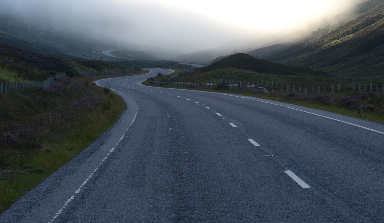
This time of year you'll often be in the clouds in both Glen Docherty and on the route from Applecross…. but if it's clear, this is the view 10 minutes after you leave Applecross:
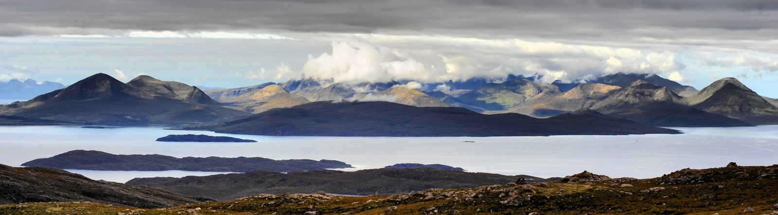
so… in essence, the weather should make a lot of your decisions for you. Having said that, yesterday morning was 99% cloud… but the 1% created something special.
Who me said:
RD, simple- I OMITTED to qualify my direction WRT any place. perhaps if I'd mentioned WNW ,heading toward Glenfinnan. that would have made matters clearer.
Sorry, not to me.  Now if you had said the junction is WSW from the bridge, this discussion would never have even got off the ground.
 Ill give it one more try - http://www.streetmap.co.uk/map.srf?x=192500&y=...
The N/S & E/W grid lines are helpful here. If you zoom in a couple of clicks you will find one now bisects the A830 between the bridge and the junction.
Any point above that line is to the north of it, and any below is to the south. Now project another one which interests the bridge itself.
It becomes even more conclusive that the compass direction of the junction from the bridge simply can't have any north component in it.
Who me said:
i was trying not to ention place names ( e.g. I could have said looking NW from the bridge toward Mallaig, but I KNOW the rail line does not cross the road at right angles -I've passed under it several hundred times in a lot of years, so I only gave the general direction as viewed on a lot larger scale than you chose to do . From memory, that particular bridge is known as the bridge at Drumsallie (even though it's approx 1mile past the place).So I could have said approx 35 yards after the Drumsallie bridge, but then a lot of folks would be wpndering where Drumsallie is.
Oh quite, but only those who cba to find out. - http://www.streetmap.co.uk/map.srf?x=195500&y=... (total time taken from scratch: 20 seconds)How can the angle at which rail crosses road make any difference to the relative locations of the bridge and junction?
I'm also finding it hard to understand your argument about scale. Large or small, a map can't magically alter any compass point (or bearing)!
As I see it the only way your argument can stand up is if the plotted lines of both road and rail are hopelessly wrong.
The definitive map for the UK is the Ordnance Survey. Maybe you know something it doesn't? - https://www.ordnancesurvey.co.uk/osmaps/
(Requires manual navigation to afind the relevant location).
If none of the above convinces you, I'm done as I'm fresh out of ideas.

I am toying with the idea of heading over to the Outer Hebrides (Harris and Lewis) in the next week or two (mix of business and pleasure most likely).
Although I know Skye and the Highlands well, the outer bits I don't.
For logistical reasons it looks as if I will need to get the ferry from/to Uig to Tarbert and other way Stornoway to Ullapool.
Anyone know what ramp access is like for something like an Evora, which is reasonably low slung? (leaving a wide car on a congested ferry car deck is also not appealing!)
The other option I have is my bike, but it is a hefty tourer and slippery decks aren't fun - it is also quite an exposed crossing, so assume it will need well strapped down? (only ever done the Armadale ferry on the bike before, and never in the Evora). Bike is cheaper and less likely to have issues with short notice booking I would imagine.
s2kjock said:
I am toying with the idea of heading over to the Outer Hebrides (Harris and Lewis) in the next week or two (mix of business and pleasure most likely).
Although I know Skye and the Highlands well, the outer bits I don't.
For logistical reasons it looks as if I will need to get the ferry from/to Uig to Tarbert and other way Stornoway to Ullapool.
Anyone know what ramp access is like for something like an Evora, which is reasonably low slung? (leaving a wide car on a congested ferry car deck is also not appealing!)
I believe the crew are reasonably well versed in getting low cars on and off the ferries. Although I know Skye and the Highlands well, the outer bits I don't.
For logistical reasons it looks as if I will need to get the ferry from/to Uig to Tarbert and other way Stornoway to Ullapool.
Anyone know what ramp access is like for something like an Evora, which is reasonably low slung? (leaving a wide car on a congested ferry car deck is also not appealing!)
If in doubt contact CalMac with your approximate dates and routes, and they should be able to advise if there are any potential tidal issues etc.
I did the trip the other way round in my MX-5, the roads on the idlands are great!
Stornoway/Ullapool shouldn't be a problem, it was quite a big ferry.
Tarbert was a smaller boat/port I don't remember being particularly concerned getting on/off the boat there, but the MX-5 isn't as low as an Evora. I can't even remember getting of the boat at Uig. I seem to remember there being a fair few bikes though and the crew strapping them down.
s2kjock said:
I am toying with the idea of heading over to the Outer Hebrides (Harris and Lewis) in the next week or two (mix of business and pleasure most likely).
Although I know Skye and the Highlands well, the outer bits I don't.
For logistical reasons it looks as if I will need to get the ferry from/to Uig to Tarbert and other way Stornoway to Ullapool.
Anyone know what ramp access is like for something like an Evora, which is reasonably low slung? (leaving a wide car on a congested ferry car deck is also not appealing!)
The other option I have is my bike, but it is a hefty tourer and slippery decks aren't fun - it is also quite an exposed crossing, so assume it will need well strapped down? (only ever done the Armadale ferry on the bike before, and never in the Evora). Bike is cheaper and less likely to have issues with short notice booking I would imagine.
If you just mention to the crew when you arrive, they will put you on either first or last using some planks of wood to help the angle. Uig isn't too bad but Tarbet can be a bit tricky. The hotel at Rodel on S. Harris looks crap from the outside, but it's quite nice inside. We stay there every year.Although I know Skye and the Highlands well, the outer bits I don't.
For logistical reasons it looks as if I will need to get the ferry from/to Uig to Tarbert and other way Stornoway to Ullapool.
Anyone know what ramp access is like for something like an Evora, which is reasonably low slung? (leaving a wide car on a congested ferry car deck is also not appealing!)
The other option I have is my bike, but it is a hefty tourer and slippery decks aren't fun - it is also quite an exposed crossing, so assume it will need well strapped down? (only ever done the Armadale ferry on the bike before, and never in the Evora). Bike is cheaper and less likely to have issues with short notice booking I would imagine.
Edited by GetCarter on Friday 18th September 15:44
Who me said:
RD, simple- I OMITTED to qualify my direction WRT any place. perhaps if I'd mentioned WNW ,heading toward Glenfinnan. that would have made matters clearer.
Sorry, not to me. Now if you had said the junction is WSW from the bridge, this discussion would never have even got off the ground. Ill give it one more try - http://www.streetmap.co.uk/map.srf?x=192500&y=...
The N/S & E/W grid lines are helpful here. If you zoom in a couple of clicks you will find one now bisects the A830 between the bridge and the junction.
Any point above that line is to the north of it, and any below is to the south. Now project another one which interests the bridge itself.
It becomes even more conclusive that the compass direction of the junction from the bridge simply can't have any north component in it.
Who me said:
i was trying not to ention place names ( e.g. I could have said looking NW from the bridge toward Mallaig, but I KNOW the rail line does not cross the road at right angles -I've passed under it several hundred times in a lot of years, so I only gave the general direction as viewed on a lot larger scale than you chose to do . From memory, that particular bridge is known as the bridge at Drumsallie (even though it's approx 1mile past the place).So I could have said approx 35 yards after the Drumsallie bridge, but then a lot of folks would be wpndering where Drumsallie is.
Oh quite, but only those who cba to find out. - http://www.streetmap.co.uk/map.srf?x=195500&y=... (total time taken from scratch: 20 seconds)How can the angle at which rail crosses road make any difference to the relative locations of the bridge and junction?
I'm also finding it hard to understand your argument about scale. Large or small, a map can't magically alter any compass point (or bearing)!
As I see it the only way your argument can stand up is if the plotted lines of both road and rail are hopelessly wrong.
The definitive map for the UK is the Ordnance Survey. Maybe you know something it doesn't? - https://www.ordnancesurvey.co.uk/osmaps/
(Requires manual navigation to afind the relevant location).
If none of the above convinces you, I'm done as I'm fresh out of ideas.
Gassing Station | Roads | Top of Page | What's New | My Stuff