Garmin satnavs, are they the worst?
Discussion


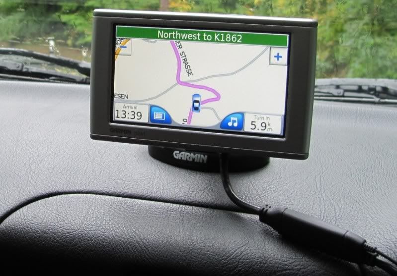
I bought a new Garmin satnav a short while ago. It is fine when you get near where you are going, and need the local directions, but the problems arise when setting a longer journey.
My guess is that the algorithms it uses, to calculate the quickest route, work on assuming you will average the speed limit on all roads, hence 70mph on a motorway (which is do-able) but also 60mph on unrestricted country lanes (which is not do-able). Hence it believes the direct route across country is also the quickest and will take you off down meandering country lanes for miles if you let it. It will even suggest leaving the motorway to pick up another road and then join the mway further on...
Ironically I had a Garmin before which did the same thing but had hoped they may have improved the software. Checking routes on theaa.com which I guess uses the same basic idea, that will default to motorway so the other extreme but generally likely to be a lot faster in reality.
Finally as an example, I drove from Lancaster to Durham on Saturday across the A66 and it took us to the right address. Coming back home so the reverse, it ignored the A66 and wanted to take us directly across country...
This effectively renders it pretty useless, are other makes better than Garmin or do I need to go old school and get the map out?
(I do have it set to fastest route and "avoid motorways" is not flagged)
They're all useless ultimately if you ask me. Having said that my Go 1005 works pretty well. I have 3 satnavs, 2 Garmin and 1 TomTom and they pretty much calculate the same route. I think the trick with Garmin (at least for me) is not to have the FM traffic stuff enabled.
Make sure you have the latest maps and software although Garmin makes it so painful to update these days.
Perhaps disabling the sharing of route data if is enabled. It could be influencing the choice of routes.
Make sure you have the latest maps and software although Garmin makes it so painful to update these days.
Perhaps disabling the sharing of route data if is enabled. It could be influencing the choice of routes.
I'm a big fan of the Google maps sat nav. I've not yet known it to calculate a stupid route, the big advantage is that it calculates in real time depending by on traffic conditions. Going across London is generally accurate to within a few minutes which is quite an achievement.
Downsides: There are a few features it doesn't have and it's a PITA that it has to be online to calculate a route.
Downsides: There are a few features it doesn't have and it's a PITA that it has to be online to calculate a route.
I was sick of my TomTom One as it only had space on it for one map at a time and no card slot for expanding it. Plus I felt the screen was on the small side.
I bought a Garmin Nuvi that was on offer in Aldi last week for £89 and I'm really pleased it it.
I'm using it in France right now it got me here perfectly.
Full UK and Europe maps built in.
Free lifetime updates of all maps, speed cameras and speed limits.
Card slot in case you want to add more maps.
Lane guidance feature which is really good.
Lots of useful features that actually work such as locations of petrol stations, supermarkets, restaurants, parking etc.
Decent size screen and really thin.
Having come from TomTom I'm certainly satisfied with the Garmin, especially for £89.
I bought a Garmin Nuvi that was on offer in Aldi last week for £89 and I'm really pleased it it.
I'm using it in France right now
it got me here perfectly.Full UK and Europe maps built in.
Free lifetime updates of all maps, speed cameras and speed limits.
Card slot in case you want to add more maps.
Lane guidance feature which is really good.
Lots of useful features that actually work such as locations of petrol stations, supermarkets, restaurants, parking etc.
Decent size screen and really thin.
Having come from TomTom I'm certainly satisfied with the Garmin, especially for £89.
Every time I come to upgrade (usually because the battery is on the way out) I end up buying a Garmin. Did it again this year but as is normal it ends up going back. Bought a Garmin 2599 and it suffered from everything above, routing off main roads onto tiny back roads just to rejoin the main road later. Drove me nuts. The DAB based traffic seemed a bit intermittent too.
Sent it back and now have a new TomTom Go5100. Lifetime (worldwide) maps, traffic and speed cameras, micro SD slot which can hold the other maps if you want it to. The new interface will take a bit of getting used to but do like being able to set destinations and routes on the Mac and sync them across the to SatNav. The old Go 1000 couldn't hold the latest Europe map and I had to select a smaller section of it, the 5100 has a couple of Gb left after loading the whole map.
Sure the TomToms generally seem to cost more that the Garmins but for me they're worth the extra. I know a couple of people who swear by Garmins though and don't like TomToms.
I got a Driving job back in Sept '13 & have used a Garmin Satnav since. The first I had (already had before starting) decided it didn't like to be charged anymore & thought I was connecting it to a PC every time I connected the charger, so got another Garmin. So far, so good. My routing doesn't seem to have the same problems as yours though. Good to me! :-)
I've used 3 generations of Garmin units and they were all fine. I've also used a TomTom and that was mostly good too.
The Bose head unit we have in our new Mazda 6 uses TomTom navigation and it makes some hilarious mistakes. I noticed that in Canada the Tom Tom maps were not as good as the Garmin ones (both were supposed to cover all of North America).
For all the systems I've used, especially those with traffic information, the predicted arrival times have been amazingly accurate. That goes for the UK, Australia, Singapore the U.S. and Canada.
So far my favourite is still the Garmin nuvi 2555LMT. It's inexpensive, comes with "lifetime" map updates and traffic information and sells in the US for only $100 + tax. It also warns you of traffic cameras etc and shows the prevailing speed limits fairly accurately.
I reckon it's still a good idea to have an old fashioned paper map handy because technology isn't foolproof :-)
On my last trip to Australia (2 weeks ago) I tried using Google maps on my iPhone. It wasn't as good as a "proper" satnav, but it was free and surprisingly accurate. Also a $40 prepaid SIM (near enough £20) was easily enough data and phone calls for a month.
Edited by MadDog1962 on Sunday 24th May 06:36
Last Friday I would have said my old TomTom was the worst thing in the world.I needed to find a tyre place before they closed.it kept send me in a circle,then just shut down.something it has never done before or since.
Google maps kept crashing too,I managed to download tom tom for android,the free version,and that got me to my destination,just in time to see them lock the shutter. An a to z now resides in the car
Google maps kept crashing too,I managed to download tom tom for android,the free version,and that got me to my destination,just in time to see them lock the shutter. An a to z now resides in the car
Have pretty much stopped using mine since Garmin stopped the support which allowed you to create a route in Google maps, refine it with the drop and drag, create a route file and then upload to the device. Everything now seems to have to be done in Base Camp. :hate:
I'm about to start looking for a hand held device for walks and so on. Anything that forces me to use Base Camp will be automatically excluded unless they've improved things immensely since the last time when the mouse ended up being thrown at the wall.
I'm about to start looking for a hand held device for walks and so on. Anything that forces me to use Base Camp will be automatically excluded unless they've improved things immensely since the last time when the mouse ended up being thrown at the wall.
I am so pleased I found this thread.
I have a Garmin with Western Europe, but I have most problems in France when I select "avoid Toll roads".The routes it chooses then are just complete bonkers. Last time out, towing my track car, it avoided two large tows connected by good roads and sent me through 10, or more villages with speed humps and 25 junction changes through which you would need to be Sebastian Ogier to average the speed limits. Google maps suggested 1hr 45min for the direct route but Garmin's route took me 2hrs 25mins. When I just followed the signed route on the way home, Google were correct.
It's other great fault is that it seems to mentally draw a vector for a route and finds roads nearest by, so from Versailles heading south, it only wants to take you through the town centre, whereas Google maps shows that if you head north for 300m you get on a dual carriageway road that skirts the urban core.
At least I now know that Tom Toms and others do the same. Presumably what I need is something that dynamically uses Google maps. Anybody got any suggestions?
rdjohn said:
I am so pleased I found this thread.
I have a Garmin with Western Europe, but I have most problems in France when I select "avoid Toll roads".The routes it chooses then are just complete bonkers. Last time out, towing my track car, it avoided two large tows connected by good roads and sent me through 10, or more villages with speed humps and 25 junction changes through which you would need to be Sebastian Ogier to average the speed limits. Google maps suggested 1hr 45min for the direct route but Garmin's route took me 2hrs 25mins. When I just followed the signed route on the way home, Google were correct.
It's other great fault is that it seems to mentally draw a vector for a route and finds roads nearest by, so from Versailles heading south, it only wants to take you through the town centre, whereas Google maps shows that if you head north for 300m you get on a dual carriageway road that skirts the urban core.
At least I now know that Tom Toms and others do the same. Presumably what I need is something that dynamically uses Google maps. Anybody got any suggestions?
Presumably as Google owns Waze?I have a Garmin with Western Europe, but I have most problems in France when I select "avoid Toll roads".The routes it chooses then are just complete bonkers. Last time out, towing my track car, it avoided two large tows connected by good roads and sent me through 10, or more villages with speed humps and 25 junction changes through which you would need to be Sebastian Ogier to average the speed limits. Google maps suggested 1hr 45min for the direct route but Garmin's route took me 2hrs 25mins. When I just followed the signed route on the way home, Google were correct.
It's other great fault is that it seems to mentally draw a vector for a route and finds roads nearest by, so from Versailles heading south, it only wants to take you through the town centre, whereas Google maps shows that if you head north for 300m you get on a dual carriageway road that skirts the urban core.
At least I now know that Tom Toms and others do the same. Presumably what I need is something that dynamically uses Google maps. Anybody got any suggestions?
But then you need a fair old data package on your phone.
I bought my nüvi 660 at the end of 2006 and it's still going strong! Updating the maps has become a bit of a pain though as the Western Europe set is too large for the internal memory - even after deleting the images, music, voices etc.
I use it for guidance most of the time. But rather than following its suggestions slavishly, I use it as guidance which I combine with my own route knowledge - the SatNav can't really be expected to know about the latest Oxford roadworks embuggerances, for example.
I leave all the audio off, the traffic function is pretty useless but all in all it's a good little unit:
Some of the later Garmins are less intuitive and have poor vehicle power connectors - they got things right first time with the nüvi 660 (as did Nokia with the 6310i phone!) and I have no intention of buying any newer GPS just yet.
2 or 3 times now I've had the unit freeze, which required a reboot. Oddly enough I was close to non-mainstream HGVs at the time, so perhaps someone was using a GPS jammer to avoid their truck being tracked?
I use it for guidance most of the time. But rather than following its suggestions slavishly, I use it as guidance which I combine with my own route knowledge - the SatNav can't really be expected to know about the latest Oxford roadworks embuggerances, for example.
I leave all the audio off, the traffic function is pretty useless but all in all it's a good little unit:

Some of the later Garmins are less intuitive and have poor vehicle power connectors - they got things right first time with the nüvi 660 (as did Nokia with the 6310i phone!) and I have no intention of buying any newer GPS just yet.
2 or 3 times now I've had the unit freeze, which required a reboot. Oddly enough I was close to non-mainstream HGVs at the time, so perhaps someone was using a GPS jammer to avoid their truck being tracked?
Edited by nickwilcock on Sunday 30th August 15:11
FiF said:
Have pretty much stopped using mine since Garmin stopped the support which allowed you to create a route in Google maps, refine it with the drop and drag, create a route file and then upload to the device. Everything now seems to have to be done in Base Camp. :hate:
I was miffed about this also.However, you can still do it in a roundabout way;
- Plan your route on on Google Maps
- GO to gpsvisualizer.com/convert_input
- Paste the Google Maps URL into the relevant field and select GPX
- Hit Convert
- Save the file to the PC
- Transfer it to the Garmin and import
Seems to work for me so far
Gassing Station | In-Car Electronics | Top of Page | What's New | My Stuff