What GPS for the bike
Discussion


I'm fairly new to cycling but now managing 25mile rides with ease, including a few hills / soth downs etc.
What I would like is a bike computer / GPS that is very easy to use. My main goal is to be able to track where I have been, plot a route from where i am back to the car using roads / bridleways, and look at what elevation I have achieved in a day.
Also the ability to upload this into some form of diary would be great so that I can see if I am improving.
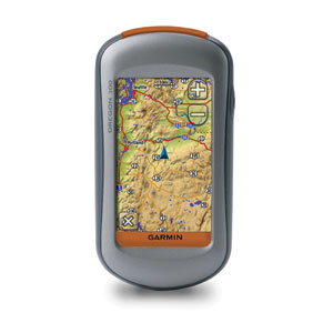
I am looking at a Garmin Edge 605. will this do the job, or is there a better option.
Many thanks for your help, so far the PH biking thread has cost me over £3k so all good

iPhone4 with MapMyRide app.
http://www.google.co.uk/#q=iphone+4+bike+holder&am...
any of those holders.
http://www.google.co.uk/#q=iphone+4+bike+holder&am...
any of those holders.

I couldn't consider an iphone app if it will kill the battery. I am frequently out for 6 or 7 hours so having to charge up on the way and way back each time would be a pain. (and I dont have an iphone).
Also concerns regarding the coverage. On my BB i lose mapping when i lose phone signal. Is it the same on an iphone?
Simond S said:
Also concerns regarding the coverage. On my BB i lose mapping when i lose phone signal. Is it the same on an iphone?
No you down load the maps before you go most apps cache the maps also. It's mote a limitation on battery life. I have a battery that plugs into the phone but it only does 1 and a bit recharge. If you have an iPhone you're comparing a 59p app to £200? dedicated gps units though.I use an Oregon 300 which is mainly meant for hiking treking etc but works fine for biking. You can even add a cadence sensor to it. The plus is that is can also double up as a car sat nav (if you don't already have one) and you can make your own maps for it as well. I have 2 mounts, one on my Trek SLR road bike and one on my GT Avalanche MTB.
Any of the Garmin eTrex range would do just as good though, but you probably wouldn't be able to use a cadence sensor on the cheaper ones.
Any of the Garmin eTrex range would do just as good though, but you probably wouldn't be able to use a cadence sensor on the cheaper ones.
I've been using my Nokia N8, with the Sports Tracker application.
It'll also connect to a Polar Bluetooth Wearlink so it'll also track heart rate along with everything else.
Probably *the* cheapest option is for one of the "lower end" Nokias - something like the 5230 (or whatever has replaced it), install Ovi Maps, download the full set of UK maps, install Sports Tracker (which can use either Open Streetmap or Ovi Maps data), and away you go.
There was a thread on this a little while ago which might help.
My answer would be the Edge 800: does everything, waterproof, light, good battery life, talks to most sensors. Not a trivial price though.
My answer would be the Edge 800: does everything, waterproof, light, good battery life, talks to most sensors. Not a trivial price though.
Simond S said:
What I would like is a bike computer / GPS that is very easy to use. My main goal is to be able to track where I have been, plot a route from where i am back to the car using roads / bridleways, and look at what elevation I have achieved in a day.
As everyone else has pointed out, your above requirements are met by the Garmin 800 with the 1:50000 OS maps.Evans are about the cheapest I can find
http://www.evanscycles.com/products/garmin/edge-80...
If you don't want the cadence sensor or HRM then buy the 800 & maps individually
itsnotarace said:
As everyone else has pointed out, your above requirements are met by the Garmin 800 with the 1:50000 OS maps.
Evans are about the cheapest I can find
http://www.evanscycles.com/products/garmin/edge-80...
If you don't want the cadence sensor or HRM then buy the 800 & maps individually
thats one heck of a price!Evans are about the cheapest I can find
http://www.evanscycles.com/products/garmin/edge-80...
If you don't want the cadence sensor or HRM then buy the 800 & maps individually
Nokia 5230 - £100 (or less if you shop around)
Ovi Maps + navteq maps for pretty much the whole world - £free
Sports Tracker app - free
Polar Wearlink hrm strap to link in with the Sports Tracker app (maybe even endomondo?) - circa £50
Then factor in a few quid for a waterproof case (Nokia, Krussel, Otterbox).
Half the price of the Garmin, larger screen, and only obviously missing the cadence sensor.
Similarly, endomondo or other solutions are available for Android or iOS devices - and will in time offer more flexibility.
itsnotarace said:
Do they allow you to route from place to place on the device itself (eg postcode search) and do they show bridleways?
Postcode search is fine on Ovi maps; sports tracker is intended more for mapping a route that you already know.Bridleways - not sure on Ovi, but sports tracker making use of Open Streetmap data you could readily check on the http://www.openstreetmap.org/ site for any of your locations (you could do similar with the Ovi maps - check on http:/maps.ovi.com
Gassing Station | Pedal Powered | Top of Page | What's New | My Stuff