World War Two: Evidence of damage/stuff left over now.
Discussion


I thought I would start a thread about physical evidence of the Second World War you can still see today. It came out of a thread I started about a war damaged house.
The recent anniversary of the end of WWII and the Battle of Britain has sparked my interest in the physical impact the war had on our towns and cities. I've realised that you can still see plenty of war stuff today from out of place 1950s/60s buildings built on bomb sites to the stumps of railings taken away for the war effort.
I live in Tynemouth on the coast near Newcastle and there's still quite a lot to see. A random walk with the dog this morning produced these.
Below a window sill in my house. A barrage balloon broke free from the golf course and got stuck in our Elm tree. It's steel hawser tether sawed its mark into a few things including our window sill
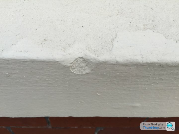
Not much I know but it's a start.
The recent anniversary of the end of WWII and the Battle of Britain has sparked my interest in the physical impact the war had on our towns and cities. I've realised that you can still see plenty of war stuff today from out of place 1950s/60s buildings built on bomb sites to the stumps of railings taken away for the war effort.
I live in Tynemouth on the coast near Newcastle and there's still quite a lot to see. A random walk with the dog this morning produced these.
Below a window sill in my house. A barrage balloon broke free from the golf course and got stuck in our Elm tree. It's steel hawser tether sawed its mark into a few things including our window sill
Not much I know but it's a start.
Edited by wildcat45 on Friday 11th September 12:23
For some reason it won't let me upload multiple images.
Round the corner you can just make out 'E' and 'W' from an 'EWS' sign which sugnified the proximity of an emergency water supply . It used to be much clearer when I was a kid back in the 1980s.
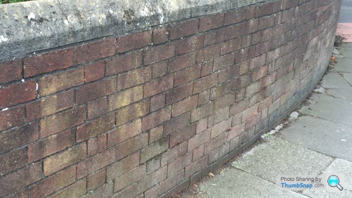
Round the corner you can just make out 'E' and 'W' from an 'EWS' sign which sugnified the proximity of an emergency water supply . It used to be much clearer when I was a kid back in the 1980s.
Edited by wildcat45 on Friday 11th September 11:15
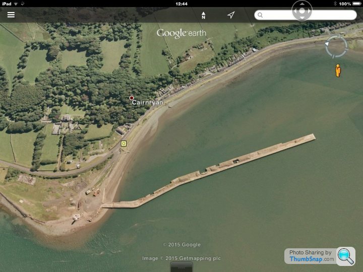
Cairnryan Military Port on Loch Ryan in SW Scotland was built to get supplies and military gear into the UK. The main jetty is derelict and unsafe now but it is still there. It was used until about 20 years ago as a ship scrap yard. The famous Ark Royal - from the 1970s TV series "Sailor" - ended her days there along with her sister ship Eagle and other warships of the 1950s like Bulwark, Albion and Blake.
Chris Type R said:
There's one of these (part of a Mulberry harbour) outside my brother's house in Littlestone-on-sea 
More info: http://www.combinedops.com/Mulberry%20Harbours.htm
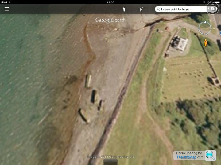
Just up from Cairnryan are these. I used to play in and around them when I was a kid. My Dad - who grew up in the area during WWII called them "Beetles" I forget exactly but they were either small parts of Mulberry Harbour or prototype caissons built round the coast on Wigtown Bay.More info: http://www.combinedops.com/Mulberry%20Harbours.htm
Edited by Chris Type R on Friday 11th September 12:26
Alfa numeric said:
There's evidence of bomb damage from WWI on London's embankment- a zeppelin dropped a bomb near Cleoptra's needle and ruptured a gas main, killing a tram driver and two of his passengers. The damage is still visible:

It's commemorated by a plaque on the base:

I was looking at that a few months ago. It is quite sobering isn't it?It's commemorated by a plaque on the base:
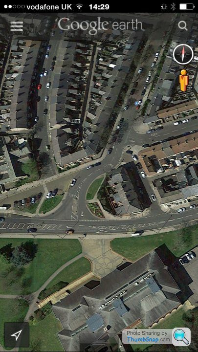
Amazing what Google Earth shows.
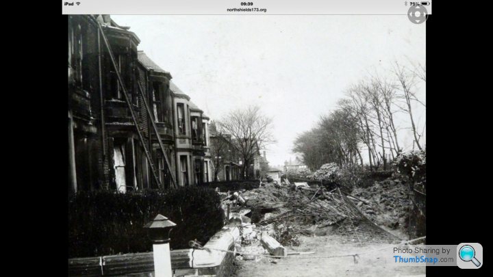
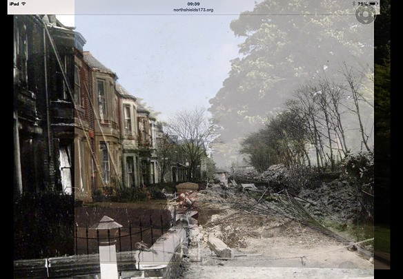
Here is a fuzzy crop from a Luftwaffe target map of North Shields.
Note the triangular set of buildings.
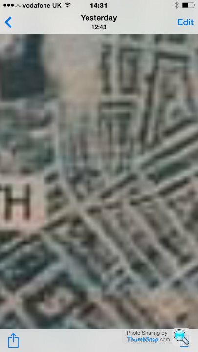
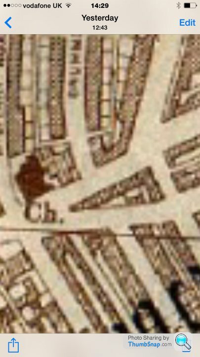
The next image is the location on a map that I found on line which marks where the bombs fell. That's the red dot on the left. See the triangular set of buildings there.
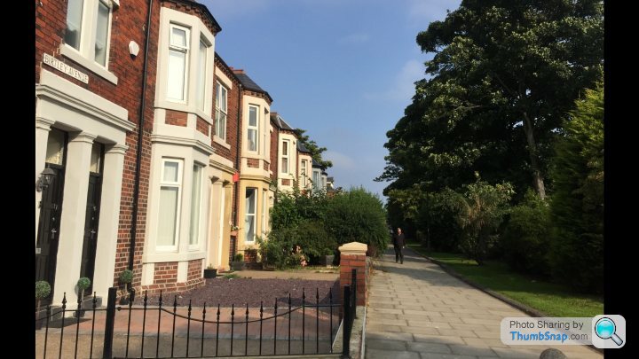
One of the buildings that was destroyed was made of glazed bricks. You can still see them inside the hoarding that you can see in the middle right of this Google Earth image. They are all pock marked with shrapnel.
That bomb took out a whole block. They never bothered rebuilding as you can see.
Here is a fuzzy crop from a Luftwaffe target map of North Shields.
Note the triangular set of buildings.
The next image is the location on a map that I found on line which marks where the bombs fell. That's the red dot on the left. See the triangular set of buildings there.
One of the buildings that was destroyed was made of glazed bricks. You can still see them inside the hoarding that you can see in the middle right of this Google Earth image. They are all pock marked with shrapnel.
That bomb took out a whole block. They never bothered rebuilding as you can see.
Edited by wildcat45 on Friday 11th September 14:44
Mr Happy said:
I'm sure that this building in Hull was left as it was when it was hit by one of the hundreds of bombs dropped there during WW2.
I was going to mention this, but I don't know where it is in Hull. What street is it on?The odd thing is I love stuff like this - hence the thread - I lived in Hill for three years and knew nothing about it.
Hull, like parts of Sunderland is one of those forgotten victims of bombing. Both places really took a pasting and it's hard to explain, but it seems in some way parts of those towns never really recovered from the Blitz. I wish I could describe it better.

GuinnessMK said:
We live one street over from the East Coast Mainline. At the end of our street is a Church which is basically just the village hall bit. The main bit got blown up and there is now a sheltered housing thing there.
We live probably 150 metres away yet our next door neighbour has a different bay window to ours. Ours is the original brick, slates and stone, but theirs is a wooden and felt roof thing. Turned out one of the big stones from the church got blown through their bay window demolishing it.
Further down the street there is a bomb shelter, and in the surrounding streets there are loads of infill houses, or just empty plots.
Is this near me by any chance? HEATON perhaps? I'm in Tynemouth.We live probably 150 metres away yet our next door neighbour has a different bay window to ours. Ours is the original brick, slates and stone, but theirs is a wooden and felt roof thing. Turned out one of the big stones from the church got blown through their bay window demolishing it.
Further down the street there is a bomb shelter, and in the surrounding streets there are loads of infill houses, or just empty plots.
Not really evidence of bomb damage today but the post above reminded me of what my Dad told me about living in post war London. Parents moved there after he left national service, so early 1950s.
St Paul's was the tallest thing on the devastated skyline. He was telling me about it about 15 years ago when he was showing me their old home in Highgate. Standing on the Heath it was he told me the one defining feature on the skyline.
Also in the area around Fleet Street and Ludgate Hill bars opened in bombed out cellars amongst the clumps of London Pride. I wish I'd paid more attention. The stuff he knew about London and its role in the war made for a better tour than any Blue Badge guide could give.
Ian_H said:
Is that in Jesmond near to Newcastle? I had a great aunt who lived there and you could see where the railings had been cut and she still had an air raid shelter in the back yard. This is going back about 30 years.
No, Birtley Avenue in Tynemouth. Just up from the Metro station.OpulentBob said:
There's this monster WW2 radar tower still visible from miles around in Essex:
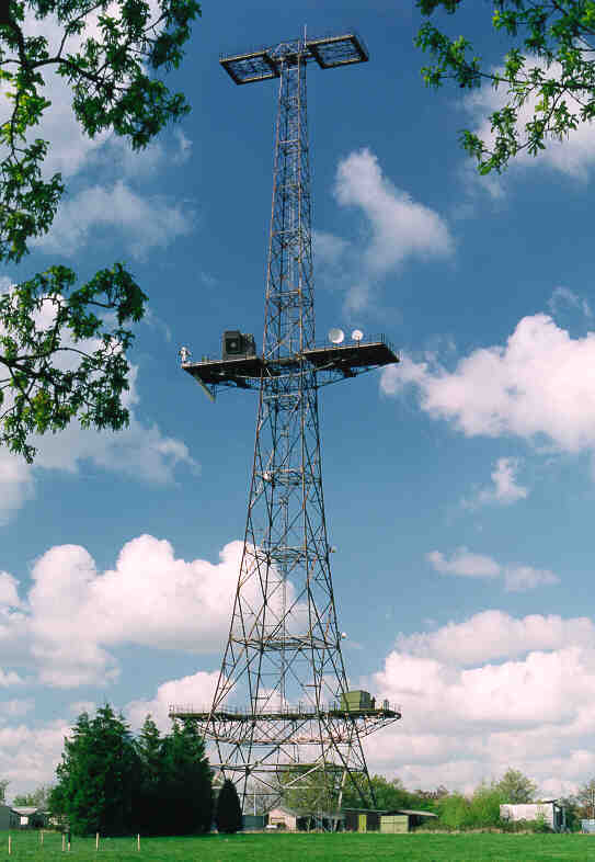
More info: http://greatbaddow.org.uk/info/great-baddow-tower
Google map link
https://www.google.co.uk/maps/@51.7074325,0.497591...
Great link. Thanks. I wonder if BAE still use it? Looks like it's got some modern comes gear on it. White dishes. Microwave? Or up/downlinks?More info: http://greatbaddow.org.uk/info/great-baddow-tower
Google map link
https://www.google.co.uk/maps/@51.7074325,0.497591...
Martin4x4 said:
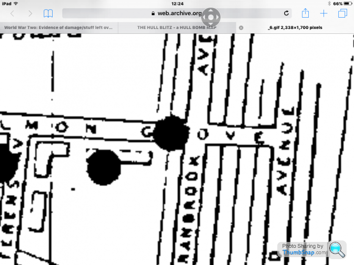
Hull is largely forgotten as blitz target despite being one of, if not the most heavily bombed city in the UK with 95% of its home being destroyed or damaged. The Humber docks made Hull a valuable target and the estuary made it an easy target to find. At a time when accurate night time bombing was nearly impossible, the Estuary acted like a big arrow pointing at the cities heart.
This is a few hundred meters from my home.

The Hull Blitz map shows many of the sticks of bombs dropped on Hull. Take note of the gaps in the sticks, WW2 bombs were notoriously unreliable with about 1 in 4 not exploding on impact. My house actually sits in one of those gaps, the house south east of me destroyed by direct hit and now a pub car park, the building to north west of me also destroyed. My home should be long gone, but seemingly sits in the path one of those duds.
As a kid, we used to go to Fraisthorpe beach where anti-invasion Bunkers & Anti-Tank Traps can still be found today.
https://commons.wikimedia.org/wiki/Category:Coasta...
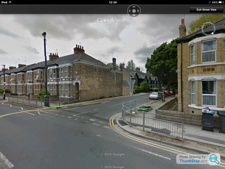
Still can't believe I lived there for three years and didn't know about this. Sadly the map on the link requires me to download some software which I can't do. I lived in Cranbrook Avenue and Grafton Street. Without seeing the map, I guess the Grafton pub site was a former bomb site, and perhaps the petrol station at the Beverly Road end?This is a few hundred meters from my home.
The Hull Blitz map shows many of the sticks of bombs dropped on Hull. Take note of the gaps in the sticks, WW2 bombs were notoriously unreliable with about 1 in 4 not exploding on impact. My house actually sits in one of those gaps, the house south east of me destroyed by direct hit and now a pub car park, the building to north west of me also destroyed. My home should be long gone, but seemingly sits in the path one of those duds.
As a kid, we used to go to Fraisthorpe beach where anti-invasion Bunkers & Anti-Tank Traps can still be found today.
https://commons.wikimedia.org/wiki/Category:Coasta...
Edited by Martin4x4 on Tuesday 22 September 22:55
Martin4x4 said:
Here is an older static image version on the internet archive, you want map 6 and yes it look like both the Grafton Pub and the Chapel opposite were built on bomb sites, but not the petrol station.
https://web.archive.org/web/20140403010309/http://...
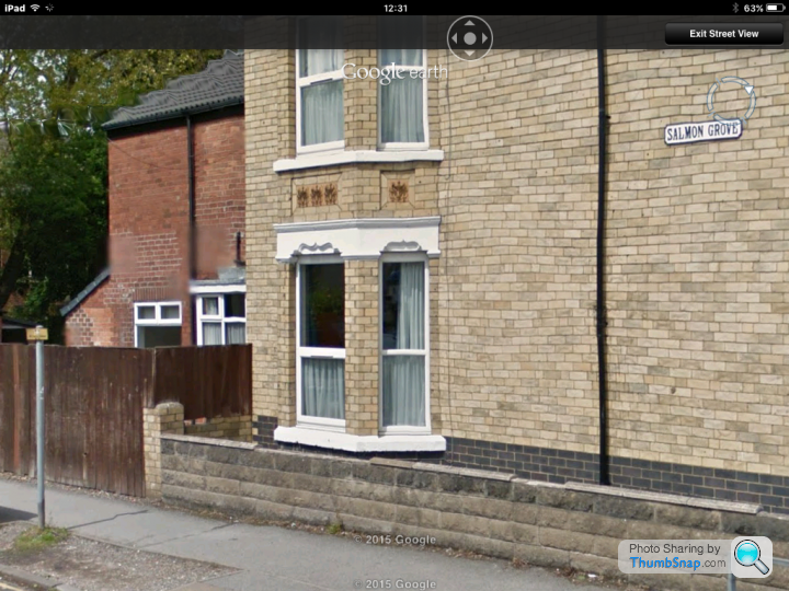
Thanks for that. Fascinating. It appears a bomb dropped right next to my old house on the junction of Salmin Grove and Cranbrook Avenue. https://web.archive.org/web/20140403010309/http://...
And you can see the damage today on Sreet View.
 n
n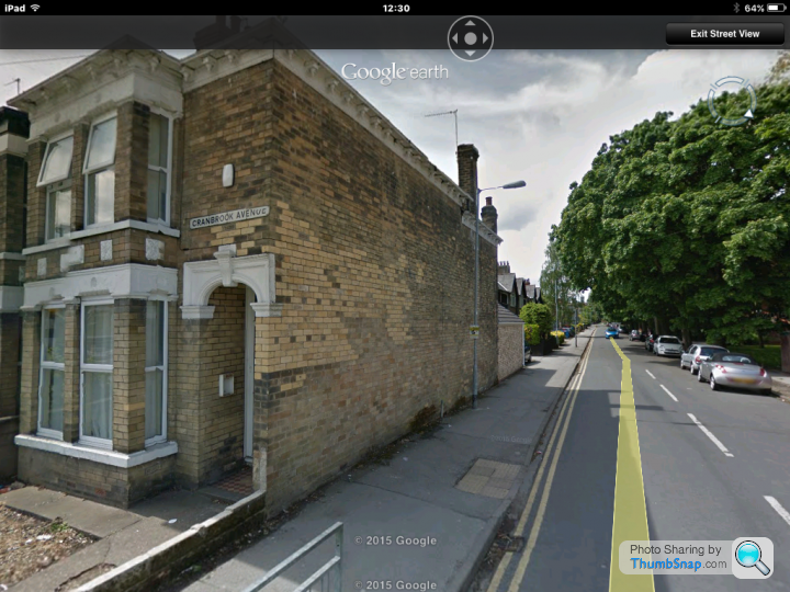
That's looking down Salmon Grove from Cranbrook. Maybe the surrounding buildings were badly damaged as there is no repair evidence suggesting whole new walls.
Celtic Dragon said:
Has anybody got any experiance or tips on tracing WW2 buildings? In my archery club, we have 2 ww2 buildings and what looks like a base for an mast of some sort, or atleast a tether for 1.
Recent ground works have uncovered what looks like the entrance to a tunnel, and we'd like to know what the area was used for before we go messing around any futher, for obvious reasons. Looking at the brick and stone work, its consistant with the other buildings that were in use / built in the area, and the 2 buildings mentioned above are prefab concrete. I have found empty .303 cases or part of cases around the woods and local rumours confirm that it was MOD occupied in the war.
We're also close to RAF Tempsford, a SOE station, and the local Manor house opposite was used as accomodation for agents and RAF flying out.
The buildings are safe to be in and arround, but the tunnel is the bit that concerns us, as there appears to be subsidance over the top, and we need to know if we'll have to get the area safety checked plus we're nosey!! The rumours are that the site was a fuel dump, which given the SOE links to the area, and the mast base, I don't believe. A dump wouldn't need a radio (I'd expect fixed comms), and this base must be 6 tons, so a big mast was attached, to big for a telephone line mast. A radio listening station would be consistant with the forces in the area, proximoty to Chicksands, Bletchley and London.
Could the base be the remains of a water tower? A lot of bases had them?Recent ground works have uncovered what looks like the entrance to a tunnel, and we'd like to know what the area was used for before we go messing around any futher, for obvious reasons. Looking at the brick and stone work, its consistant with the other buildings that were in use / built in the area, and the 2 buildings mentioned above are prefab concrete. I have found empty .303 cases or part of cases around the woods and local rumours confirm that it was MOD occupied in the war.
We're also close to RAF Tempsford, a SOE station, and the local Manor house opposite was used as accomodation for agents and RAF flying out.
The buildings are safe to be in and arround, but the tunnel is the bit that concerns us, as there appears to be subsidance over the top, and we need to know if we'll have to get the area safety checked plus we're nosey!! The rumours are that the site was a fuel dump, which given the SOE links to the area, and the mast base, I don't believe. A dump wouldn't need a radio (I'd expect fixed comms), and this base must be 6 tons, so a big mast was attached, to big for a telephone line mast. A radio listening station would be consistant with the forces in the area, proximoty to Chicksands, Bletchley and London.
First port of call in finding out more about the place would be finding out who owns it now. It may have deeds. You could try the MOD for info, maybe the local council or the Land Registry.
Gassing Station | The Lounge | Top of Page | What's New | My Stuff