A short Australian Road Trip
Discussion


I thought I'd post this in case some of you find it useful / interesting.
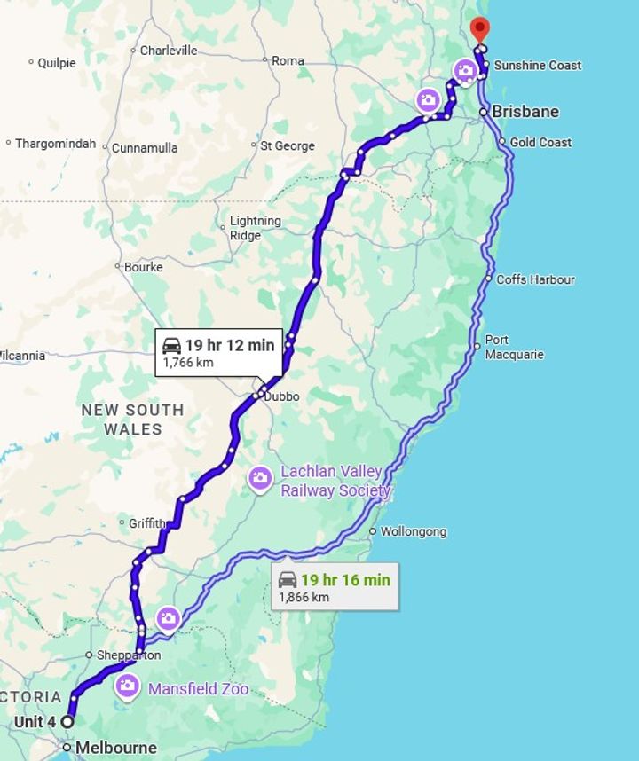
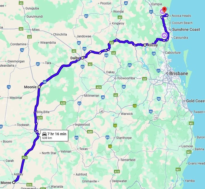
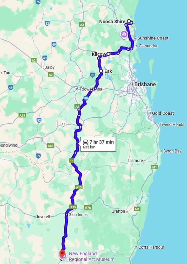
We’ve just returned from a road trip holiday, driving from just outside Melbourne in Victoria to near Noosa in Queensland. I didn’t go the most direct route and instead went a “maybe we’ll see some interesting things” way – although to be honest there are really only 2 ways to go: inland or across to Sydney and up the coast.
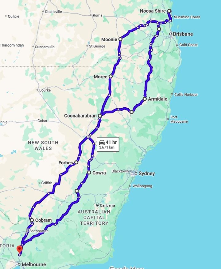
We did a figure of 8 loop through parts that most people, particularly overseas tourists, won’t venture in to, so hopefully this shows a little bit of Australia away from the state capitals and the urban sprawl (about 70% of the population live in the cities, and 90% live within 50km of the coast).
I didn’t go all PH “powerfully built director” and attempt to dominate the trip by doing it in one go while amped up on Redbull. Instead, I split the trip across 3 days each way, aiming for about 7 hours of driving + 2 hours of breaks every day.
To be honest, you could probably spend a week (if not longer) each way if you did a half day of driving and then stopped to experience the local touristy things in each largish town. As a result, this is a bit of a flying visit with first impressions.
The car I used is irrelevant (it is nothing special – it’s a white SUV) suffice to say it coped with no issues.
I'll add each day as a separate post to avoid any massive quoting issues
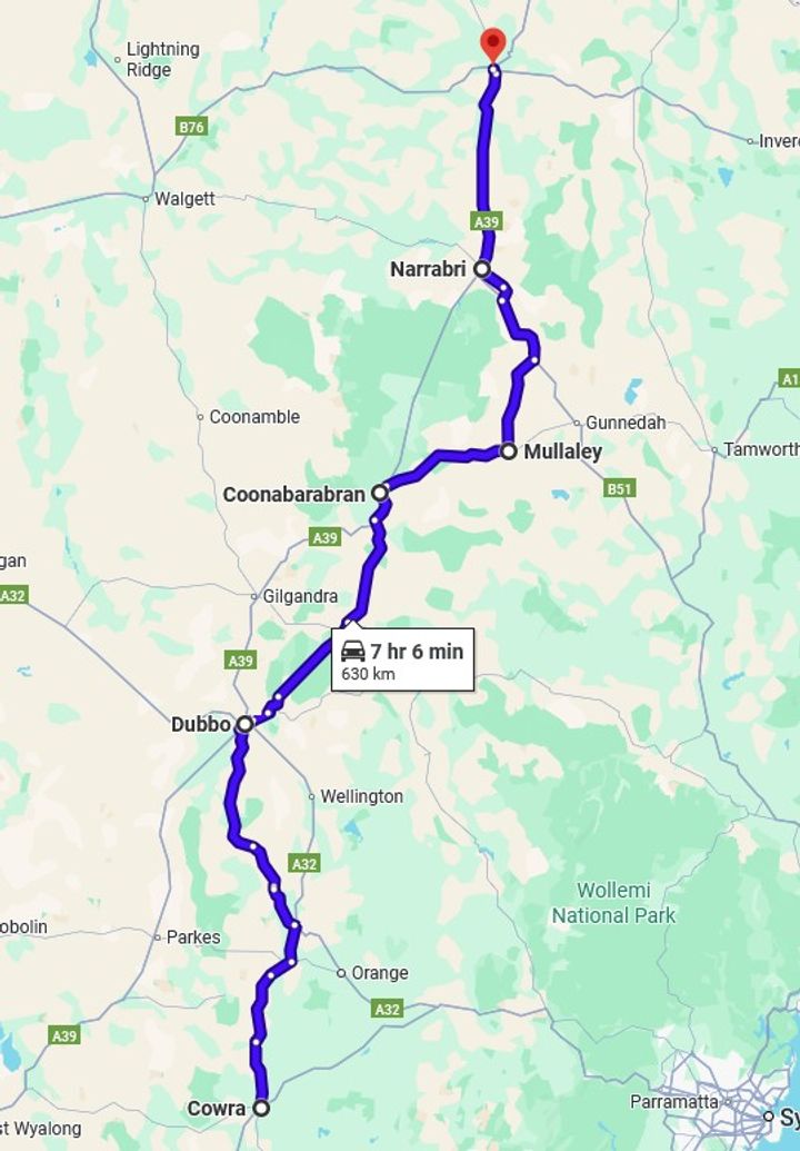
Day 1: Home to Cowra NSW – 665 km (413 miles)
We left at 9:30…and again at 9:50 after we returned to collect the road trip snacks and lock the screen door because someone forgot. We headed to Wallan to join the Hume Highway (M31) which is the main Melbourne to Sydney route. Fortunately, it was open again after a huge fire started on the road the week before. We passed about 50m of central reservation that was burnt, and it then ran off south and wiped out a huge area.
First stop was Glenrowan, one of several places that links itself to the famous bushranger Ned Kelly. In fact, it is home of the Big Ned Kelly (excuse the tourist – he was foreign).

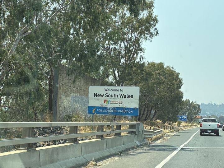
After a quick pit stop and a drink, we headed off and before too long we were entering enemy territory…sorry, New South Wales.
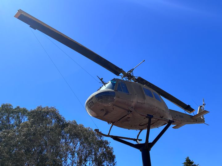
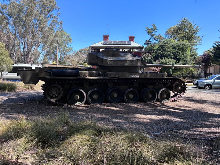
Next stop was Holbrook which was originally called Germanton. In 1915 it was deemed inappropriate and renamed Holbrook in honour of Lt Norman Douglas Holbrook who was a submarine captain and awarded the Victoria Cross. That explains why it has this in the main street:
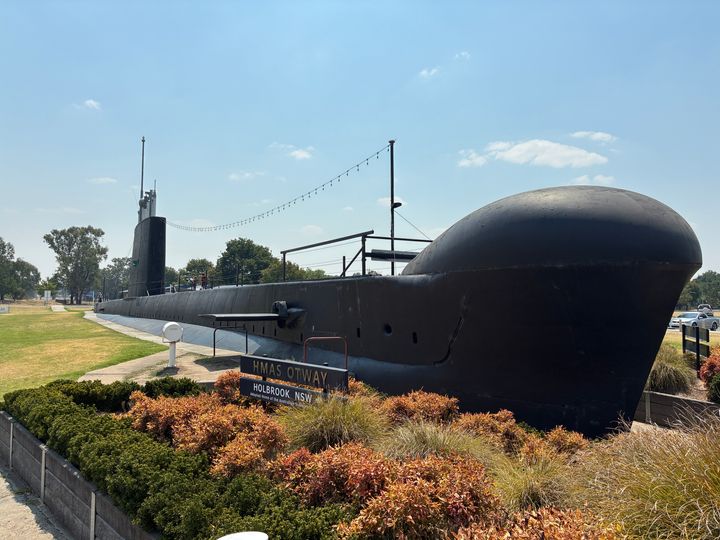
Yes, that is the entire above the water structure of HMAS Otway, an Oberon Class submarine (which was built in Greenock by Scotts).
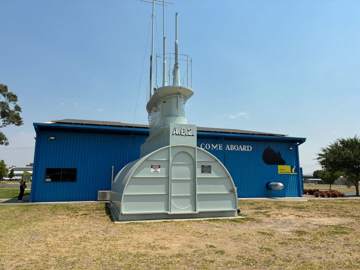
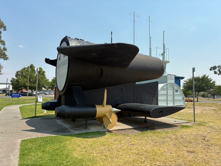
There are also various other submarine related things in the same park, including a small museum.
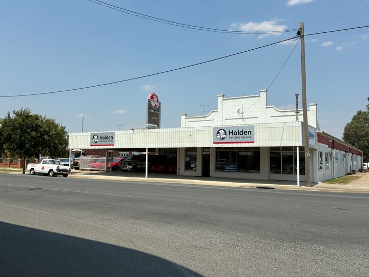
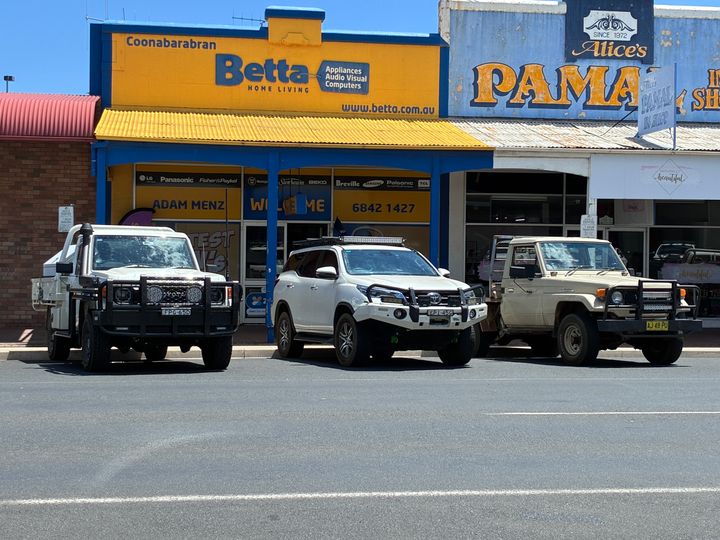
There was also a sort of semi-abandoned Holden dealership with what appear to be brand new but unsold cars kicking about.
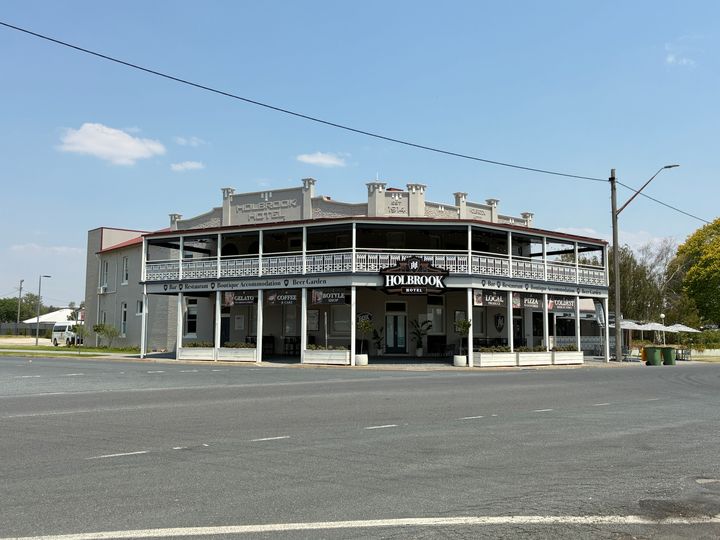
And an impressive looking pub
Lunch was had, and we set off again.
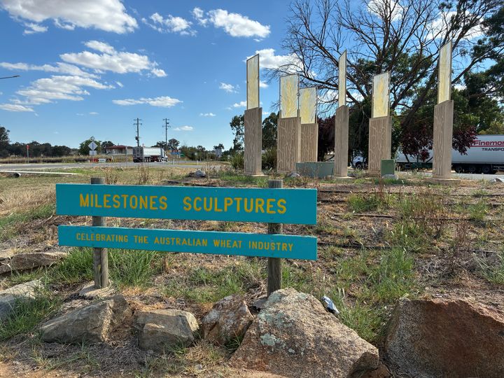
We could have stayed on the Hume, but that involves going to the a hole of a place that is Sydney, so instead we turned left at Coolac and headed up to Cootamundra where we joined the Olympic Highway (A41). Cootamundra looked interesting, but it was hot (mid-30s) and we were on a mission so we didn’t stop and instead carried on to my next planned stop which was Wallendbeen…which was also very hot and not very interesting - it was a roundabout with a sculpture, a servo (petrol station) and a “picnic” area. Have a pic so you can see what I mean and put it on your “avoid stopping there” list.
For some reason the pic I took of the other sculpture (a pile of rocks) won't upload - probably a small mercy tbh. To be fair there is a small town, we just didn’t venture in. It might be lovely.
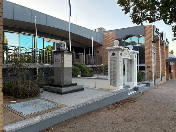
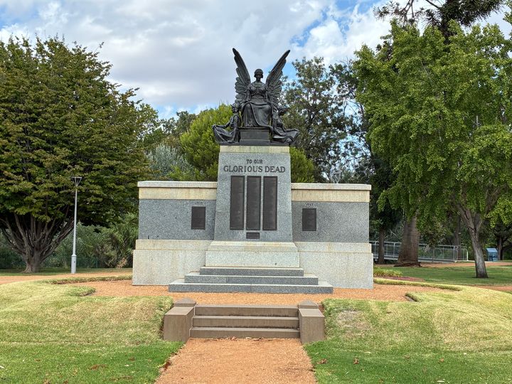
From Wallendbeen we did the last leg for the day and arrived in Cowra. We stayed at the motel which is attached to the Services Club. One thing NSW really like is a war memorial and a Services Club – every town seems to have one, and some of them are massive. The motel was very good and the food in the Services Club was excellent.
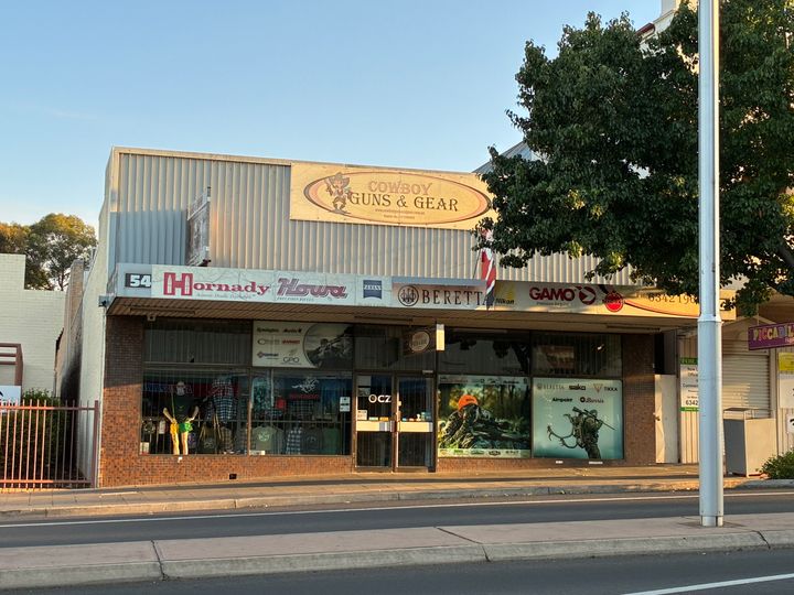
As for Cowra itself – there seemed to be a lot of neck tattoos, and there was a gun shop in the main street, which also had some rather grand buildings
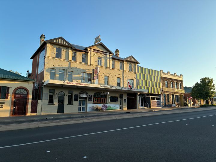
Part of the massive Services Club
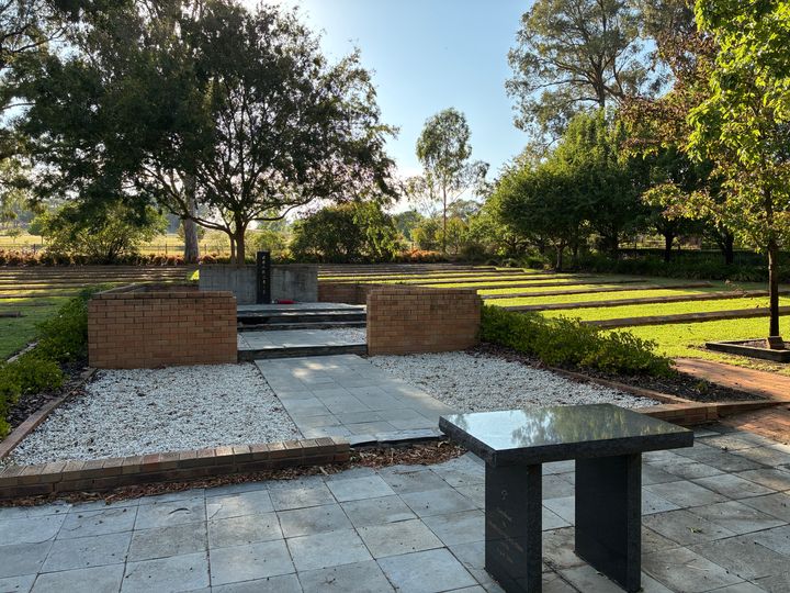
Cowra was the site of a POW Camp during WW2. Initially it housed Italians, but later in the war Japanese were also held there. On the 5th of August 1944 the Japanese staged a breakout. Over 300 escaped and 231 were killed or committed suicide. The dead are buried in the Cowra Japanese War Cemetery which subsequently became the Japanese War Cemetery for Australia and had all the Japanese war dead in Australia buried there.
That is day 1 done.
We’ve just returned from a road trip holiday, driving from just outside Melbourne in Victoria to near Noosa in Queensland. I didn’t go the most direct route and instead went a “maybe we’ll see some interesting things” way – although to be honest there are really only 2 ways to go: inland or across to Sydney and up the coast.
We did a figure of 8 loop through parts that most people, particularly overseas tourists, won’t venture in to, so hopefully this shows a little bit of Australia away from the state capitals and the urban sprawl (about 70% of the population live in the cities, and 90% live within 50km of the coast).
I didn’t go all PH “powerfully built director” and attempt to dominate the trip by doing it in one go while amped up on Redbull. Instead, I split the trip across 3 days each way, aiming for about 7 hours of driving + 2 hours of breaks every day.
To be honest, you could probably spend a week (if not longer) each way if you did a half day of driving and then stopped to experience the local touristy things in each largish town. As a result, this is a bit of a flying visit with first impressions.
The car I used is irrelevant (it is nothing special – it’s a white SUV) suffice to say it coped with no issues.
I'll add each day as a separate post to avoid any massive quoting issues
Day 1: Home to Cowra NSW – 665 km (413 miles)
We left at 9:30…and again at 9:50 after we returned to collect the road trip snacks and lock the screen door because someone forgot. We headed to Wallan to join the Hume Highway (M31) which is the main Melbourne to Sydney route. Fortunately, it was open again after a huge fire started on the road the week before. We passed about 50m of central reservation that was burnt, and it then ran off south and wiped out a huge area.
First stop was Glenrowan, one of several places that links itself to the famous bushranger Ned Kelly. In fact, it is home of the Big Ned Kelly (excuse the tourist – he was foreign).
After a quick pit stop and a drink, we headed off and before too long we were entering enemy territory…sorry, New South Wales.
Next stop was Holbrook which was originally called Germanton. In 1915 it was deemed inappropriate and renamed Holbrook in honour of Lt Norman Douglas Holbrook who was a submarine captain and awarded the Victoria Cross. That explains why it has this in the main street:
Yes, that is the entire above the water structure of HMAS Otway, an Oberon Class submarine (which was built in Greenock by Scotts).
There are also various other submarine related things in the same park, including a small museum.
There was also a sort of semi-abandoned Holden dealership with what appear to be brand new but unsold cars kicking about.
And an impressive looking pub
Lunch was had, and we set off again.
We could have stayed on the Hume, but that involves going to the a
hole of a place that is Sydney, so instead we turned left at Coolac and headed up to Cootamundra where we joined the Olympic Highway (A41). Cootamundra looked interesting, but it was hot (mid-30s) and we were on a mission so we didn’t stop and instead carried on to my next planned stop which was Wallendbeen…which was also very hot and not very interesting - it was a roundabout with a sculpture, a servo (petrol station) and a “picnic” area. Have a pic so you can see what I mean and put it on your “avoid stopping there” list.For some reason the pic I took of the other sculpture (a pile of rocks) won't upload - probably a small mercy tbh. To be fair there is a small town, we just didn’t venture in. It might be lovely.
From Wallendbeen we did the last leg for the day and arrived in Cowra. We stayed at the motel which is attached to the Services Club. One thing NSW really like is a war memorial and a Services Club – every town seems to have one, and some of them are massive. The motel was very good and the food in the Services Club was excellent.
As for Cowra itself – there seemed to be a lot of neck tattoos, and there was a gun shop in the main street, which also had some rather grand buildings
Part of the massive Services Club
Cowra was the site of a POW Camp during WW2. Initially it housed Italians, but later in the war Japanese were also held there. On the 5th of August 1944 the Japanese staged a breakout. Over 300 escaped and 231 were killed or committed suicide. The dead are buried in the Cowra Japanese War Cemetery which subsequently became the Japanese War Cemetery for Australia and had all the Japanese war dead in Australia buried there.
That is day 1 done.
Day 2: Cowra (NSW) to Moree (still in NSW) – 648 km (403 miles)
We set off at 8am, and after a quick Maccas breakfast headed off up the B81 and then the A32 (Mitchell Highway) towards Dubbo. On the way we stopped in Wellington for a break – nothing much there except some typically elaborate war memorials.
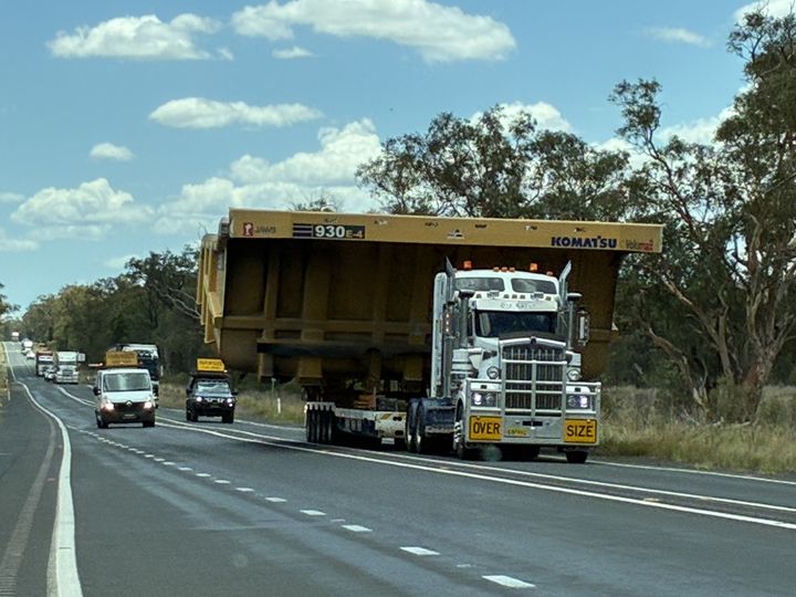
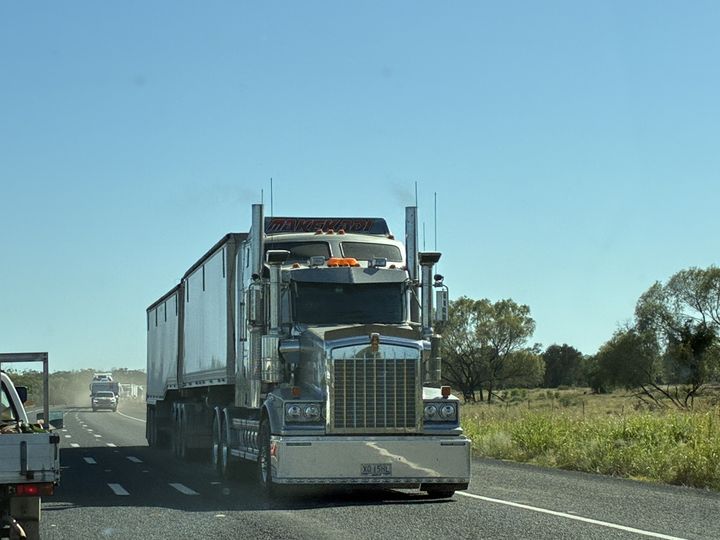
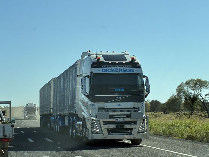
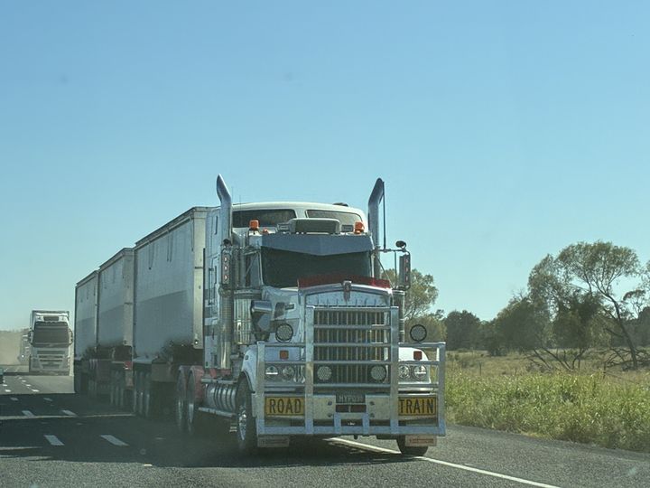
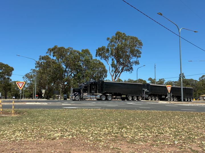
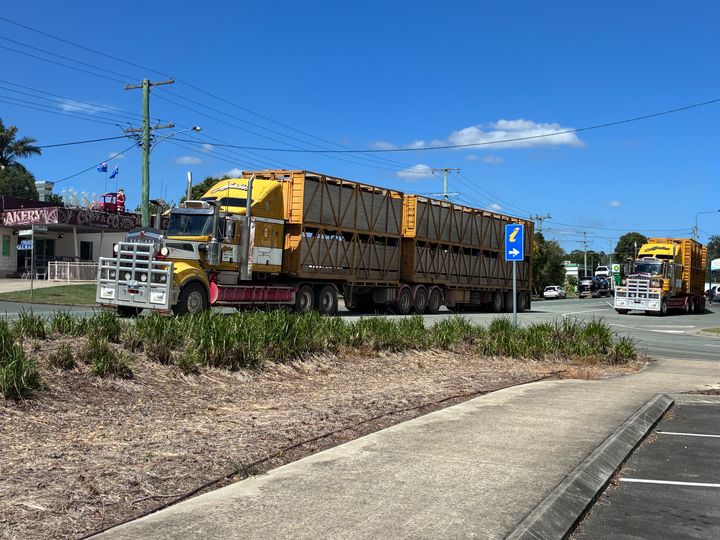
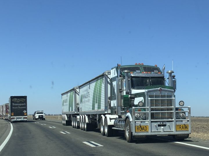
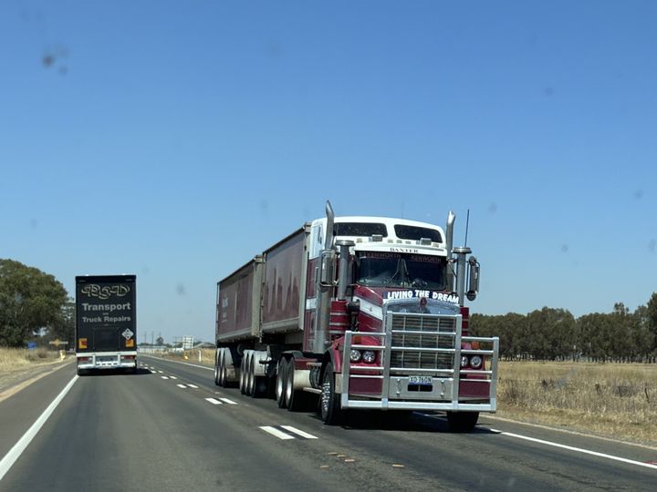
From Wellington we stopped in Dubbo for fuel and then joined the Newell Highway (A39) which is the longest road in NSW – it stretches from Tocumwal at the Victorian border to Goondiwindi in Queensland – 1058km (657 miles) in total. Other than some short sections through towns (and there are not a lot of them – maybe 15 to 20 total), it is all single carriageway although there are overtaking lanes fairly frequently. It is a main freight route and carries a lot of trucks – about 20 to 50% of the traffic depending on where you are. It is also Road Train designated so they are BIG trucks (albeit only doubles, not triples). Fortunately, the speed limit is 110 km/h, and the trucks here are capable of (just over) 100 km/h so even if you catch one it doesn’t really hold you up.
We were getting a bit fed up, and the OH wanted lunch, so we stopped in Gilgandra. DO NOT STOP in Gilgandra. We walked into a bakery and it was like something out of a film – everyone seemed to stare at us.
We retreated to the airconditioned safety of the car and kept going…for about 10 minutes when, just as we reached the end of the first overtaking lane section outside Gilgandra, we saw a van coming the other way frantically flashing its lights. It had orange beacons going and a big yellow sign on the roof. Now I’ve watched enough Outback Truckers to know what this meant, so I stopped and pulled to the side.
Sure enough, it was a Pilot vehicle, and as it passed the driver waved a “Stop” sign out the window. About a minute later a Police car passed us, and then another Pilot vehicle stopped and the woman had a chat with us. It was a “10 metre” (i.e. wide load – again Outback Truckers came in handy) and she was less than complementary about the “idiot” truck drivers who had been told to wait at Gilgandra until it passed but had headed on anyway. We chatted until another Police car appeared in the distance at which point she moved off, and a few minutes later this thundered past (it was not hanging about!).
I’m glad we met it where we did, otherwise we’d have been on a single carriageway bit!
The next place with anything in it is Coonabarabran, so we stopped there for lunch. I’d recommend the bakery for a sandwich. While there I got to watch some big trucks rumble past.
From Coonabarabran the plan was to head through the Pilliga Forest to Narrabri but while we were having lunch an unmarked Police Landcruiser (a proper one, not a Prado) shot out of the side street and screamed off up the highway. A couple of minutes later a marked up Pajero did the same thing. A few minutes later we heard the sirens of a fire truck. Hmm…
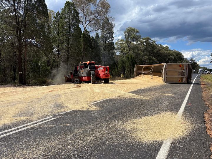
We finished lunch and headed off, just north of Coonabarabran the road forks – left stays on the Newell, right is the Oxley Highway (B56). As we got to the fork we found the unmarked Landcruiser parked up, with a bloke in a sunhat and a gun in a holster standing beside it. A quick chat with the most laid-back cop ever confirmed the road was shut and the advice was to go “that way” (the right fork) and turn right to get to Narrabri via Mullaley.
FB provided pics of why it was shut – a grain trailer had fallen over.
So we headed off through the NSW countryside, eventually caught up to a fuel tanker, and just followed him because he was heading the same direction as us (and the OH wasn’t too keen on overtaking).
Eventually we got to Narrabri, and then on to Moree where we stayed the night in the motel attached to the Services Club. The motel was good, the Service Club was average, and Moree felt a bit sketchy. Add it to your “do not stay” list as well.
That is day 2 done.
We set off at 8am, and after a quick Maccas breakfast headed off up the B81 and then the A32 (Mitchell Highway) towards Dubbo. On the way we stopped in Wellington for a break – nothing much there except some typically elaborate war memorials.
From Wellington we stopped in Dubbo for fuel and then joined the Newell Highway (A39) which is the longest road in NSW – it stretches from Tocumwal at the Victorian border to Goondiwindi in Queensland – 1058km (657 miles) in total. Other than some short sections through towns (and there are not a lot of them – maybe 15 to 20 total), it is all single carriageway although there are overtaking lanes fairly frequently. It is a main freight route and carries a lot of trucks – about 20 to 50% of the traffic depending on where you are. It is also Road Train designated so they are BIG trucks (albeit only doubles, not triples). Fortunately, the speed limit is 110 km/h, and the trucks here are capable of (just over) 100 km/h so even if you catch one it doesn’t really hold you up.
We were getting a bit fed up, and the OH wanted lunch, so we stopped in Gilgandra. DO NOT STOP in Gilgandra. We walked into a bakery and it was like something out of a film – everyone seemed to stare at us.
We retreated to the airconditioned safety of the car and kept going…for about 10 minutes when, just as we reached the end of the first overtaking lane section outside Gilgandra, we saw a van coming the other way frantically flashing its lights. It had orange beacons going and a big yellow sign on the roof. Now I’ve watched enough Outback Truckers to know what this meant, so I stopped and pulled to the side.
Sure enough, it was a Pilot vehicle, and as it passed the driver waved a “Stop” sign out the window. About a minute later a Police car passed us, and then another Pilot vehicle stopped and the woman had a chat with us. It was a “10 metre” (i.e. wide load – again Outback Truckers came in handy) and she was less than complementary about the “idiot” truck drivers who had been told to wait at Gilgandra until it passed but had headed on anyway. We chatted until another Police car appeared in the distance at which point she moved off, and a few minutes later this thundered past (it was not hanging about!).
I’m glad we met it where we did, otherwise we’d have been on a single carriageway bit!
The next place with anything in it is Coonabarabran, so we stopped there for lunch. I’d recommend the bakery for a sandwich. While there I got to watch some big trucks rumble past.
From Coonabarabran the plan was to head through the Pilliga Forest to Narrabri but while we were having lunch an unmarked Police Landcruiser (a proper one, not a Prado) shot out of the side street and screamed off up the highway. A couple of minutes later a marked up Pajero did the same thing. A few minutes later we heard the sirens of a fire truck. Hmm…
We finished lunch and headed off, just north of Coonabarabran the road forks – left stays on the Newell, right is the Oxley Highway (B56). As we got to the fork we found the unmarked Landcruiser parked up, with a bloke in a sunhat and a gun in a holster standing beside it. A quick chat with the most laid-back cop ever confirmed the road was shut and the advice was to go “that way” (the right fork) and turn right to get to Narrabri via Mullaley.
FB provided pics of why it was shut – a grain trailer had fallen over.
So we headed off through the NSW countryside, eventually caught up to a fuel tanker, and just followed him because he was heading the same direction as us (and the OH wasn’t too keen on overtaking).
Eventually we got to Narrabri, and then on to Moree where we stayed the night in the motel attached to the Services Club. The motel was good, the Service Club was average, and Moree felt a bit sketchy. Add it to your “do not stay” list as well.
That is day 2 done.
Day 3: Moree to Noosa (QLD) 613 km (381 miles)
We left Moree at 8am for the first leg of the day, 125 km (78 miles) to Goondiwindi (pronounced Gundiwindi) in Queensland. The road passes through one other town, Bogabilla, which is 115km (71.5 miles) from Moree. That is over 100km of nothing. Literally nothing.
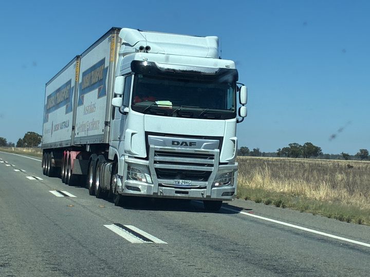
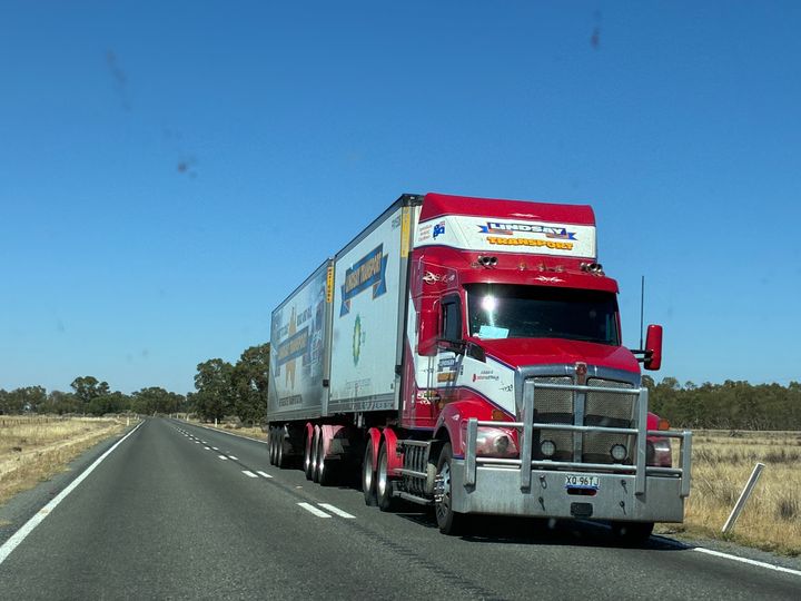
Well, there was something roadworks. Which meant I was able to get some pics of a variety of trucks because I was stopped.
After a slight delay due to the roadworks, we arrived in Goondiwindi, Queensland, and civilisation!
A quick stop in Goondiwindi and on to the next bit 96 km (60 miles) to Moonie up the Leichhardt Highway (A5), again through no towns.
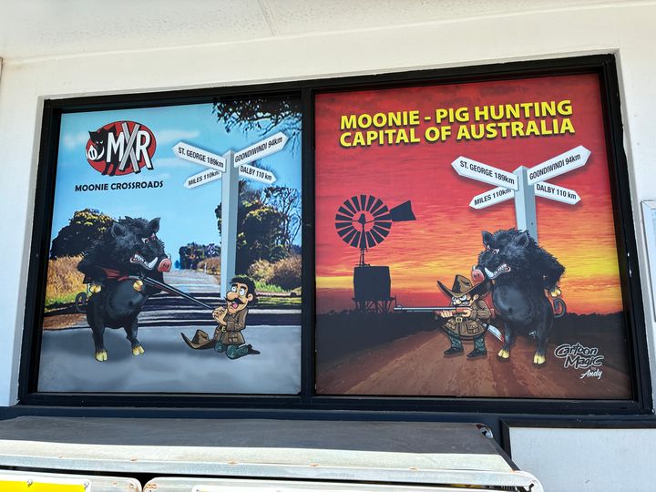
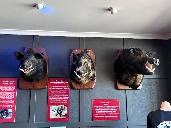
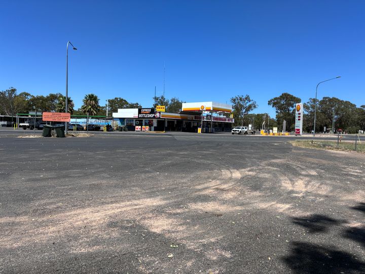
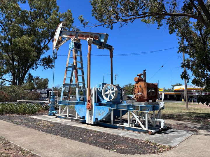
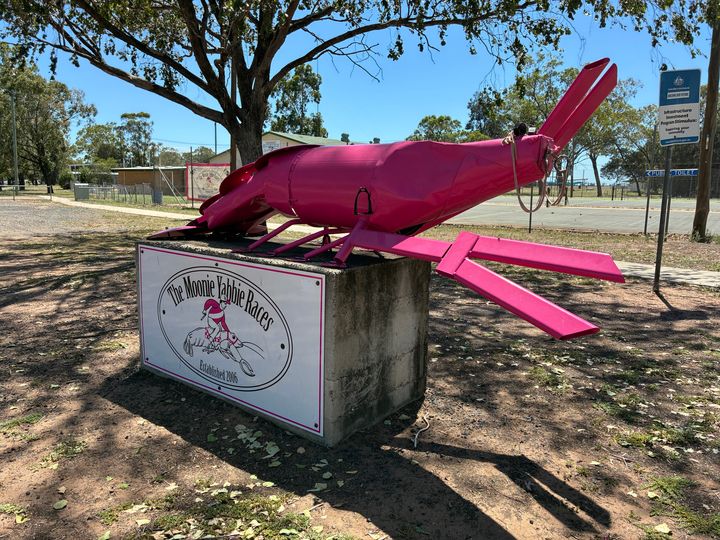
Moonie is a crossroads it has a hotel , a caravan park, a couple of servos, a post office / library / tourist information, a school, and handful of houses, and a sports oval. It must serve all the various properties and farms round about. It is also the site of Australia's first commercial oil field.
It was the closest we came to the outback
After a wander about we turned right on to the Moonie Highway (State Route 49) and headed off towards Dalby another 115km (71.5 miles) through no towns. That means that from Moree to Dalby is 337km (209 miles) and you pass through 3 places (2 of which, Bogabilla and Goondiwindi, are next to each other, and one of which, Moonie, is basically not a lot). There is an awful lot of nothing!
We filled up in Dalby, and then headed across various country roads to Kilcoy for a quick stop
before heading down past Australia Zoo to pick up the Bruce Highway and finally arriving at our destination (after a quick stop at the Big Pineapple).

We left Moree at 8am for the first leg of the day, 125 km (78 miles) to Goondiwindi (pronounced Gundiwindi) in Queensland. The road passes through one other town, Bogabilla, which is 115km (71.5 miles) from Moree. That is over 100km of nothing. Literally nothing.
Well, there was something roadworks. Which meant I was able to get some pics of a variety of trucks because I was stopped.
After a slight delay due to the roadworks, we arrived in Goondiwindi, Queensland, and civilisation!
A quick stop in Goondiwindi and on to the next bit 96 km (60 miles) to Moonie up the Leichhardt Highway (A5), again through no towns.
Moonie is a crossroads it has a hotel , a caravan park, a couple of servos, a post office / library / tourist information, a school, and handful of houses, and a sports oval. It must serve all the various properties and farms round about. It is also the site of Australia's first commercial oil field.
It was the closest we came to the outback
After a wander about we turned right on to the Moonie Highway (State Route 49) and headed off towards Dalby another 115km (71.5 miles) through no towns. That means that from Moree to Dalby is 337km (209 miles) and you pass through 3 places (2 of which, Bogabilla and Goondiwindi, are next to each other, and one of which, Moonie, is basically not a lot). There is an awful lot of nothing!
We filled up in Dalby, and then headed across various country roads to Kilcoy for a quick stop
before heading down past Australia Zoo to pick up the Bruce Highway and finally arriving at our destination (after a quick stop at the Big Pineapple).
Edited by Jader1973 on Monday 26th January 04:56
A little bit of background on that Holden dealership
https://www.drive.com.au/caradvice/this-country-to...
https://www.drive.com.au/caradvice/this-country-to...
So, after 6 days on the Sunshine Coast doing holiday type things we had to head back down.
Day 4: Noosa to Armidale (NSW) – 609km (378 miles)
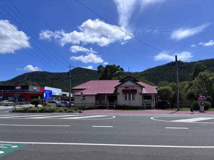
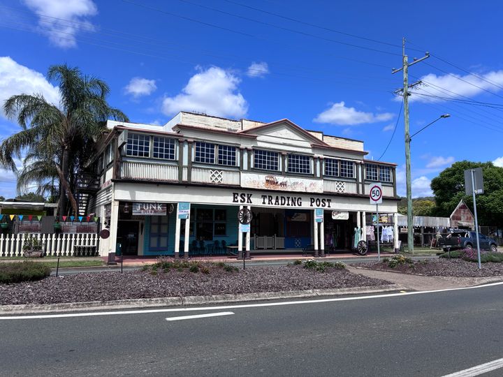
I was going to drop down the Bruce to Brisbane, and then out to Warwick, but a nightmare return journey from Brisbane (what should have taken an hour and a half took 3 and a half because the highway was shut due to an accident) reminded me that the Bruce is an absolute st of a road if anything happens, and it often happens, so instead we went back out through Kilcoy and down the Brisbane Valley Highway (State Route 85) to Esk. Esk was quite nice.
From Esk we dropped down to Gatton (which has a Road Train Assembly area – they aren’t allowed further east, so they stage them there before heading out west to Toowoomba to pick up the A39 (which becomes the Newell at NSW) and head down south. I wasn’t allowed to go and have a look at it
From Gatton we headed SW over the Gatton Clifton Road to get to Warwick. This road is very picturesque and “interesting”: one section, at Mount Whitestone, is affected by a “slow moving landslide” and is slowly sliding down the hill . The limit drops to 40 km/h, and there are barriers with a sign that has a number to call if the barriers are down – I assume the road is monitored and if it starts to move rapidly then the barriers drop. There are also signs that say not to stop, that there may be falling rocks, and to call a number if you need help. The road surface is all over the place, and you can clearly see sections where it has moved to relative to the next bit. It is the most unnerving piece of road I have ever driven on!
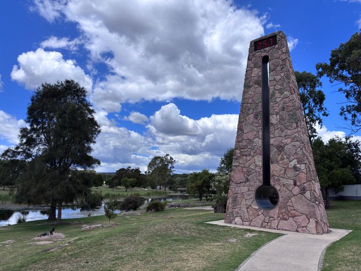
Once we got to Warwick we picked up the New England Highway (A15) and headed south. Next stop Stanthorpe – home of the Big Thermometer.
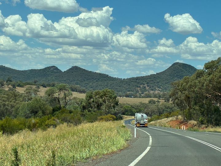
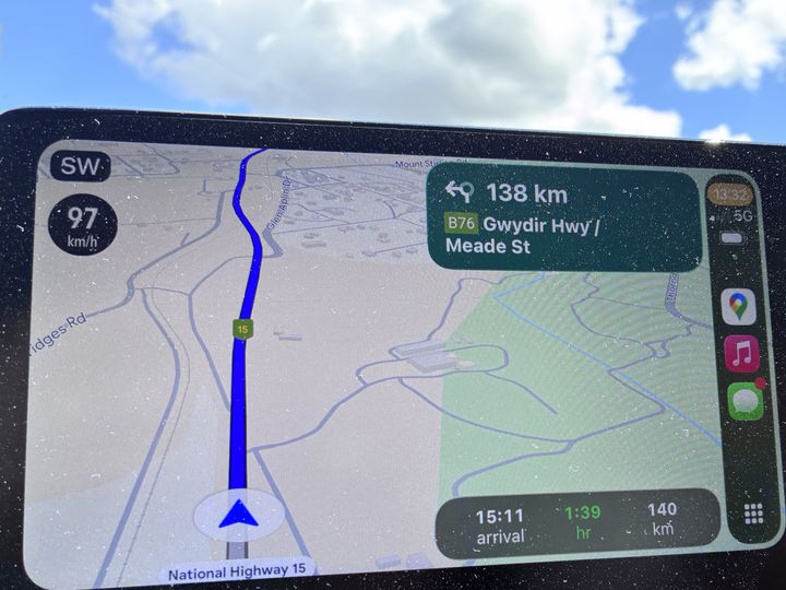
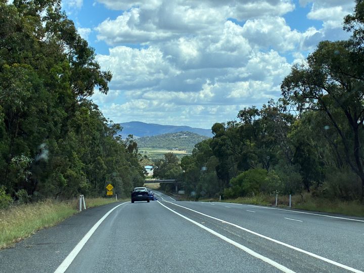
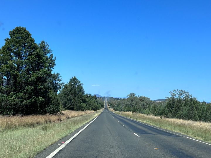
From there we headed south to Glen Innes. I was hoping to get some pics to show the time changing (QLD is an hour behind NSW when daylight savings is on) but I missed it. Instead, here is a pic showing that the next turn is 138km away, and the some of the countryside between Stanthorpe and Glen Innes.
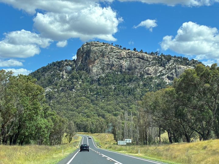
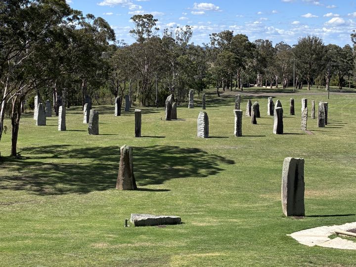
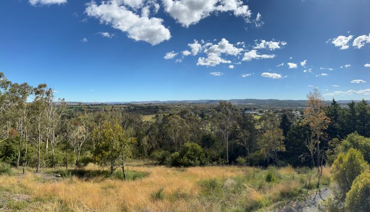
Glen Innes is a self-proclaimed Celtic town (hard C, not the opposite of Rangers, although it did have a massive Catholic Church and a very impressive nunnery so maybe…). Anyway, it is home to the Australian Standing Stones, so have pic of them, and the view out over NSW from a nearby viewpoint.
This whole bit was slightly surreal. I’m used to places having British names (including nice bits being named after not so nice UK bits) but the New England Highway passes through Warwick, Dundee, Stonehenge, Glencoe, Llangothlin to name a few.
It also passes through Guyra, home of the highest caravan park in Australia at around 1330m above sea level. That also means it is home to the highest Rugby League Club in Australia – the Guyra Super Spuds (yes, really).
Anyway, we arrived in Armidale and stayed there for a night. It was okay. I suspect it is quite nice, but we didn’t get to see any of it.
Day 4: Noosa to Armidale (NSW) – 609km (378 miles)
I was going to drop down the Bruce to Brisbane, and then out to Warwick, but a nightmare return journey from Brisbane (what should have taken an hour and a half took 3 and a half because the highway was shut due to an accident) reminded me that the Bruce is an absolute s
t of a road if anything happens, and it often happens, so instead we went back out through Kilcoy and down the Brisbane Valley Highway (State Route 85) to Esk. Esk was quite nice.From Esk we dropped down to Gatton (which has a Road Train Assembly area – they aren’t allowed further east, so they stage them there before heading out west to Toowoomba to pick up the A39 (which becomes the Newell at NSW) and head down south. I wasn’t allowed to go and have a look at it
From Gatton we headed SW over the Gatton Clifton Road to get to Warwick. This road is very picturesque and “interesting”: one section, at Mount Whitestone, is affected by a “slow moving landslide” and is slowly sliding down the hill
. The limit drops to 40 km/h, and there are barriers with a sign that has a number to call if the barriers are down – I assume the road is monitored and if it starts to move rapidly then the barriers drop. There are also signs that say not to stop, that there may be falling rocks, and to call a number if you need help. The road surface is all over the place, and you can clearly see sections where it has moved to relative to the next bit. It is the most unnerving piece of road I have ever driven on!Once we got to Warwick we picked up the New England Highway (A15) and headed south. Next stop Stanthorpe – home of the Big Thermometer.
From there we headed south to Glen Innes. I was hoping to get some pics to show the time changing (QLD is an hour behind NSW when daylight savings is on) but I missed it. Instead, here is a pic showing that the next turn is 138km away, and the some of the countryside between Stanthorpe and Glen Innes.
Glen Innes is a self-proclaimed Celtic town (hard C, not the opposite of Rangers, although it did have a massive Catholic Church and a very impressive nunnery so maybe…). Anyway, it is home to the Australian Standing Stones, so have pic of them, and the view out over NSW from a nearby viewpoint.
This whole bit was slightly surreal. I’m used to places having British names (including nice bits being named after not so nice UK bits) but the New England Highway passes through Warwick, Dundee, Stonehenge, Glencoe, Llangothlin to name a few.
It also passes through Guyra, home of the highest caravan park in Australia at around 1330m above sea level. That also means it is home to the highest Rugby League Club in Australia – the Guyra Super Spuds (yes, really).
Anyway, we arrived in Armidale and stayed there for a night. It was okay. I suspect it is quite nice, but we didn’t get to see any of it.
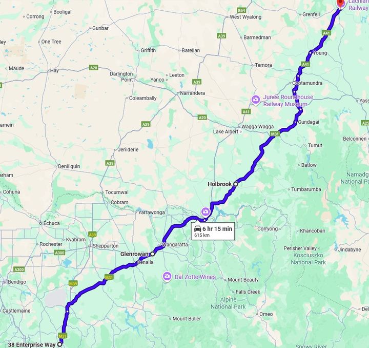
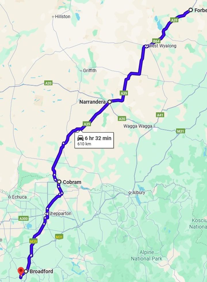
Day 5: Armidale to Forbes – 614km (381.5 miles)
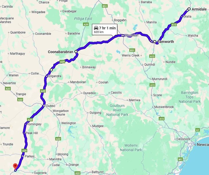
We left Armidale and headed to Tamworth (we did not stop – the Country Music Festival was on so it was very busy) and then on to the Oxley Highway (B56) to Gunnedah where we stopped for fuel. This is the road we detoured on when the Newell was shut on the way up.
From there it was back to Coonabarabran to pick up the Newell – our companion for the next 715 km (444 miles) over the rest of Day 5 and part of Day 6. The drive to Coonabarabran ran through farmland apart from the final few km which run through forest, a huge contrast to the previous day which was rather scenic. This stretch included what I think is the longest straight bit we encountered at roughly 16km (10 miles) long.
The start of the straight
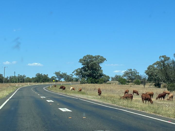
And 10 minutes later the end of the straight, with added cows wandering about just to make it more interesting.
Back in Coonabarabran for lunch (bakery again) and I got a pic of, from left to right, a BULLBAR, a bullbar, and a Bullbar.
We then headed to Parkes, which was 260km (161 miles) away.
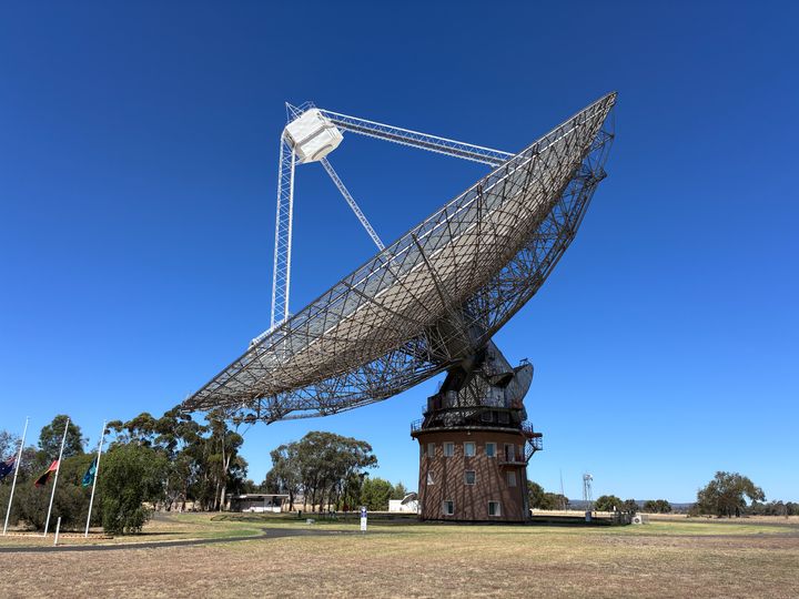
Parkes is the home of The Dish – the radio telescope that was used to beam most of the Apollo 11 moon landing back to earth. It is well worth a visit if you get the chance.
From Parkes we headed down to Forbes (only 25 minutes away) and stayed the night at the motel next to the golf club. It was pretty good. We ate at the Forbes Inn Hotel which was excellent.
We left Armidale and headed to Tamworth (we did not stop – the Country Music Festival was on so it was very busy) and then on to the Oxley Highway (B56) to Gunnedah where we stopped for fuel. This is the road we detoured on when the Newell was shut on the way up.
From there it was back to Coonabarabran to pick up the Newell – our companion for the next 715 km (444 miles) over the rest of Day 5 and part of Day 6. The drive to Coonabarabran ran through farmland apart from the final few km which run through forest, a huge contrast to the previous day which was rather scenic. This stretch included what I think is the longest straight bit we encountered at roughly 16km (10 miles) long.
The start of the straight
And 10 minutes later the end of the straight, with added cows wandering about just to make it more interesting.
Back in Coonabarabran for lunch (bakery again) and I got a pic of, from left to right, a BULLBAR, a bullbar, and a Bullbar.
We then headed to Parkes, which was 260km (161 miles) away.
Parkes is the home of The Dish – the radio telescope that was used to beam most of the Apollo 11 moon landing back to earth. It is well worth a visit if you get the chance.
From Parkes we headed down to Forbes (only 25 minutes away) and stayed the night at the motel next to the golf club. It was pretty good. We ate at the Forbes Inn Hotel which was excellent.
Nearly there!
Day 6: Forbes to home 673km (418 miles)
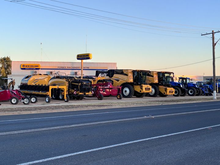
Opposite the motel in Forbes there was an agricultural machinery dealer with some serious pieces of kit parked in the yard.
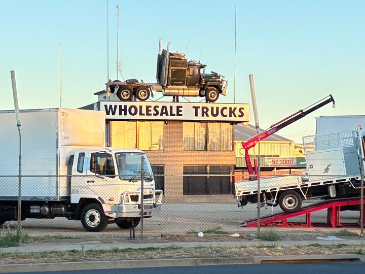
There was also a truck dealer with a Mack on the roof
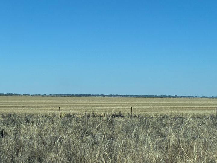
Anyway, back to the agricultural stuff. As we started heading south in the morning, from Forbes to about Narrandera which is 241km (150 miles) away the countryside is basically flat and covered in wheat fields as far as the eye can see. It s very hard to describe, and photos don t capture the sheer scale of it. The best I can do is this grab from a NSW Government site that shows the land use the yellow is cropping which based on what I saw is wheat / grain.
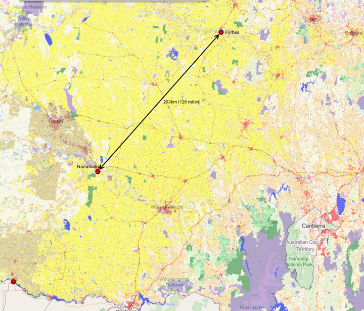
The straight line distance between Forbes and Narrandera is 200km so that yellow cropping area is about 200km by 200km = 40,000 sq km, or 15,400 sq miles. Wales is 8,007 sq miles according to Wikipedia. That is an awful lot of crops!
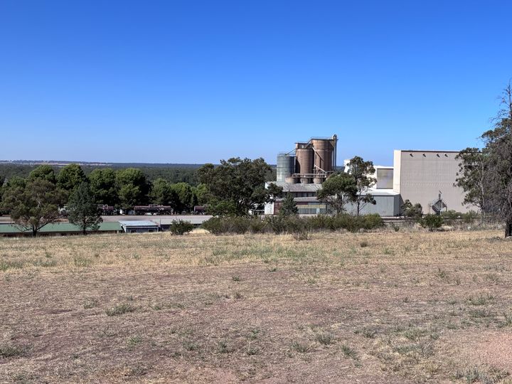
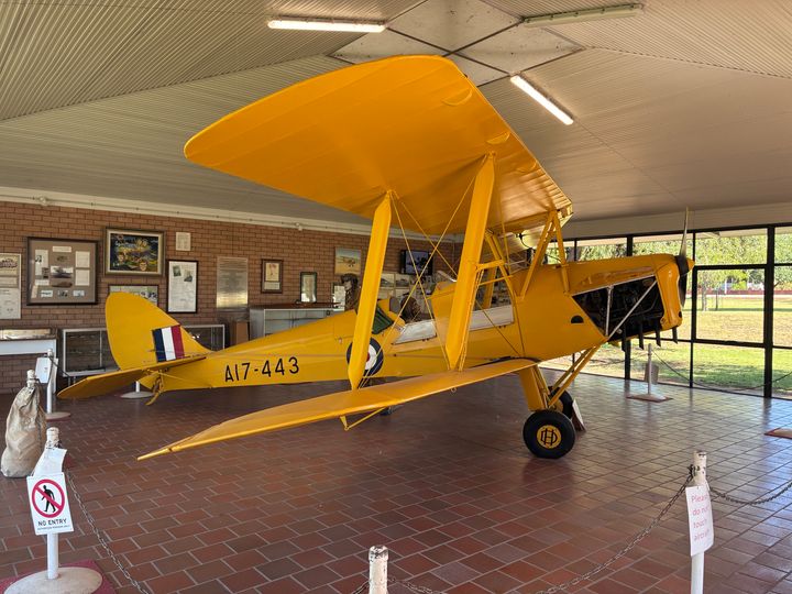
Next stop Narrandera not surprisingly dominated by a grain plant of some sort. It has Water Tank art, and there was a Tiger Moth in a building to commemorate a nearby pilot training school that was used during WW2.

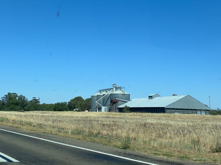
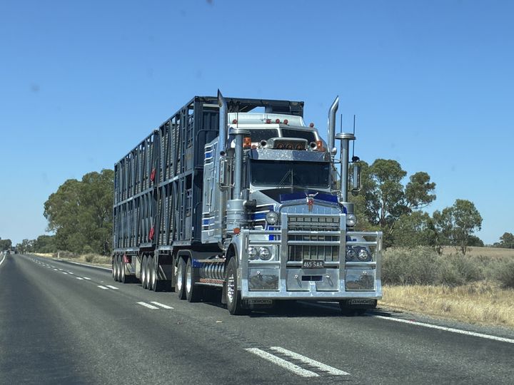
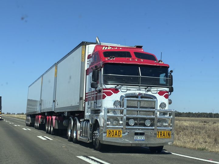
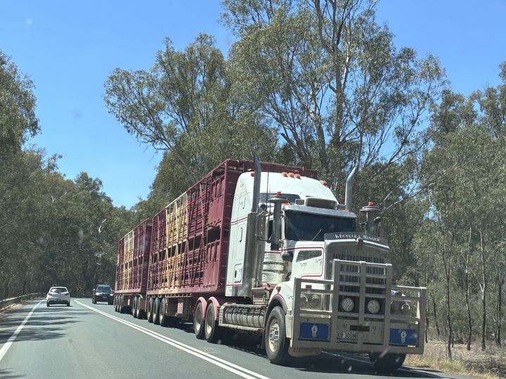
I didn t drive the next leg 182km (113 miles) to Cobram so here pics of things, including some that attempt to show the crops.
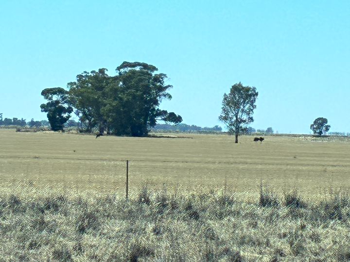
This one is my favourite if you look closely you ll see 3 black shapes (2 are to the left of the leftmost tree). Those are emus! There was a whole flock of them. Kangaroos are everywhere but I ve never seen a wild emu before.
And because I wasn t driving, I was able to take pics of trucks.
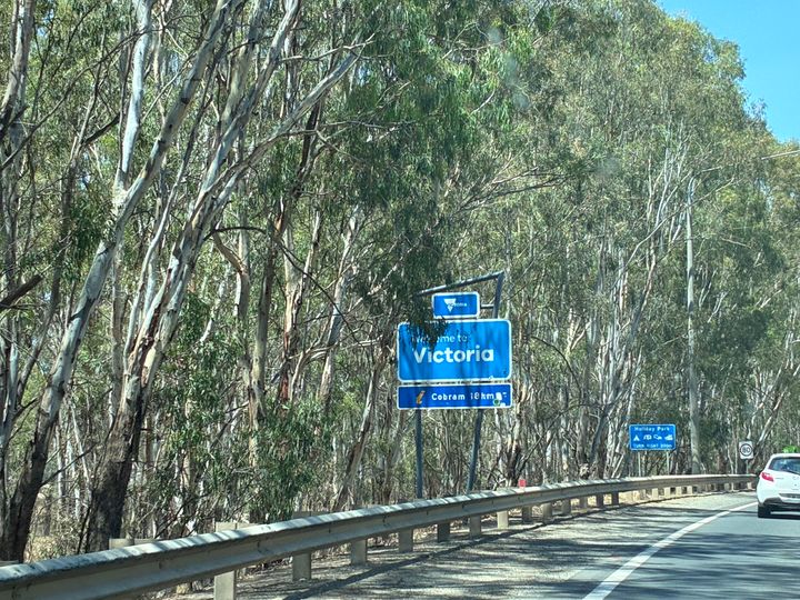
The Victorian border. Back to civilisation! (although to be fair the road got a bit worse as soon as we crossed the border).
Next stop was Cobram for lunch (no pics), and then off to Seymour (150km / 93 miles) with a quick (unplanned) stop at Katamatite to see the Silo Art.

Then the final fuel stop at Seymour for fuel and a look at the Vietnam memorial before heading home (which was still over an hour away).
Overall, the trip there and back was 3,882km (2,412 miles) plus another 625km when we were in Queensland so 4,447km (2,763 miles) all up.
The driving wasn t bad, it s just a different mindset that is needed when you encounter a truck I found it was best to just accept you d be doing between 90 and 100 for a bit and wait for the next overtaking lane. Exceeding the speed limit while overtaking is frowned upon: the expectation is you pass a Road Train doing 100km/h at no more than 110 km/h, which goes completely against the idea of minimising your time on the wrong side of the road - that means it just isn't worth "speeding" to overtake on a single carriageway bit of road.
In terms of fuel, I ve had to estimate the bit from the final stop to home, but I reckon it is 356 litres in total, so about 8 litres per 100km on average, which is 35.31 mpg.
Total cost, about $630 in fuel plus $900 for accommodation and roughly $500 for food across the 6 days (dinners were not particularly cheap) comes to $2030 all up.
I'd do it again, but tweak the route to stay at nicer / more interesting places, and maybe take a day longer so we could spend a bit more time in the more interesting ones.
Hopefully some of that is of interest or useful for anyone planning anything similar.
Day 6: Forbes to home 673km (418 miles)
Opposite the motel in Forbes there was an agricultural machinery dealer with some serious pieces of kit parked in the yard.
There was also a truck dealer with a Mack on the roof
Anyway, back to the agricultural stuff. As we started heading south in the morning, from Forbes to about Narrandera which is 241km (150 miles) away the countryside is basically flat and covered in wheat fields as far as the eye can see. It s very hard to describe, and photos don t capture the sheer scale of it. The best I can do is this grab from a NSW Government site that shows the land use the yellow is cropping which based on what I saw is wheat / grain.
The straight line distance between Forbes and Narrandera is 200km so that yellow cropping area is about 200km by 200km = 40,000 sq km, or 15,400 sq miles. Wales is 8,007 sq miles according to Wikipedia. That is an awful lot of crops!
Next stop Narrandera not surprisingly dominated by a grain plant of some sort. It has Water Tank art, and there was a Tiger Moth in a building to commemorate a nearby pilot training school that was used during WW2.
I didn t drive the next leg 182km (113 miles) to Cobram so here pics of things, including some that attempt to show the crops.
This one is my favourite if you look closely you ll see 3 black shapes (2 are to the left of the leftmost tree). Those are emus! There was a whole flock of them. Kangaroos are everywhere but I ve never seen a wild emu before.
And because I wasn t driving, I was able to take pics of trucks.
The Victorian border. Back to civilisation! (although to be fair the road got a bit worse as soon as we crossed the border).
Next stop was Cobram for lunch (no pics), and then off to Seymour (150km / 93 miles) with a quick (unplanned) stop at Katamatite to see the Silo Art.
Then the final fuel stop at Seymour for fuel and a look at the Vietnam memorial before heading home (which was still over an hour away).
Overall, the trip there and back was 3,882km (2,412 miles) plus another 625km when we were in Queensland so 4,447km (2,763 miles) all up.
The driving wasn t bad, it s just a different mindset that is needed when you encounter a truck I found it was best to just accept you d be doing between 90 and 100 for a bit and wait for the next overtaking lane. Exceeding the speed limit while overtaking is frowned upon: the expectation is you pass a Road Train doing 100km/h at no more than 110 km/h, which goes completely against the idea of minimising your time on the wrong side of the road - that means it just isn't worth "speeding" to overtake on a single carriageway bit of road.
In terms of fuel, I ve had to estimate the bit from the final stop to home, but I reckon it is 356 litres in total, so about 8 litres per 100km on average, which is 35.31 mpg.
Total cost, about $630 in fuel plus $900 for accommodation and roughly $500 for food across the 6 days (dinners were not particularly cheap) comes to $2030 all up.
I'd do it again, but tweak the route to stay at nicer / more interesting places, and maybe take a day longer so we could spend a bit more time in the more interesting ones.
Hopefully some of that is of interest or useful for anyone planning anything similar.
Edited by Jader1973 on Monday 26th January 04:35
Zolvaro said:
A little bit of background on that Holden dealership
https://www.drive.com.au/caradvice/this-country-to...
Thanks for that.https://www.drive.com.au/caradvice/this-country-to...
The article is slightly wrong in that Holden ceased to exist in Dec 2020 so it has only been 5 years. Still, it is interesting that they are so dedicated to the brand despite the time that has passed.
Nicely done! Away from the obvious tourist routes there is an odd combo of both more and less to see. Some of the small towns are enjoyable stops (others less so…!!) and places like Holbrook and Parkes have quirky histories.
And then there’s the great lengths of nothing where the next town is 100km away when you’ve got to just go with it and take in just how big this place is - I enjoy those bits.
You didn’t fancy stopping at Western Plains Zoo at Dubbo? If you’ve not been before, it is worth stopping for a night or two especially if you’ve got kids with you.
PomBstard said:
Nicely done! Away from the obvious tourist routes there is an odd combo of both more and less to see. Some of the small towns are enjoyable stops (others less so !!) and places like Holbrook and Parkes have quirky histories.
And then there s the great lengths of nothing where the next town is 100km away when you ve got to just go with it and take in just how big this place is - I enjoy those bits.
You didn t fancy stopping at Western Plains Zoo at Dubbo? If you ve not been before, it is worth stopping for a night or two especially if you ve got kids with you.
More and less to see is a great way of putting it.And then there s the great lengths of nothing where the next town is 100km away when you ve got to just go with it and take in just how big this place is - I enjoy those bits.
You didn t fancy stopping at Western Plains Zoo at Dubbo? If you ve not been before, it is worth stopping for a night or two especially if you ve got kids with you.
I didn’t know there was a zoo at Dubbo until we saw the signs. I’m not sure our grumpy 17 year old would have appreciated a stop though!
Jader1973 said:
More and less to see is a great way of putting it.
I didn t know there was a zoo at Dubbo until we saw the signs. I m not sure our grumpy 17 year old would have appreciated a stop though!
WP Zoo is open enclosure type of place and they have lots of experiences for the kids, plus you can choose to stay overnight on the zoo or in one of the cabins that overlook the zoo. We ve been a couple of times, I think the grumpy teen would ve been OK with it I didn t know there was a zoo at Dubbo until we saw the signs. I m not sure our grumpy 17 year old would have appreciated a stop though!

https://taronga.org.au/dubbo-zoo
Edited to add link to Zoo for others…
Edited by PomBstard on Tuesday 27th January 05:27
I am a big believer in fate. It is just something I like to convince myself why things happen. Or it might be coincidence - it doesn't really matter!
I love road trips, and am concentrating currently on the USA and Canada, but this piqued my interest. One of my best friends from my early RN days emigrated in the early 2000s to Brisbane. Sadly he passed away on New Years Day - I promised my friend toward on the last time we spoke I would make the effort to go out and see him, not realising his time was so short. Speaking to his widow over the weekend I mentioned I would like to go out and visit the family, and his grave, which is in a ex-serviceman's area. I don't know when though, as I have plans being planned!
As I was lying trying to sleep last night, I was wondering the best way to visit - and obviously I thought get a road trip in! And then I see this thread today.
Great info, great photos. Thanks for posting, really interesting and likely to be useful.
Thanks for sharing, which brings back memories. I Did Vic to Qld a few times a long time ago, and it is a long old drive. I'm sure I have stayed in Moree during one of the trips as a kid.
Does the Newell Highway still have Sleeping Policemen in the junctions in the one horse towns? I first came across one on a trip to the Gold Coast with my mates for an end of year break from uni. A few hours into NSW, during a stinking hot summers day I came up to a junction, sliding my overheated tyres over the melting tarmac to see a lump of metal in the middle of the road (Victoria doesn't have them, so had never seen them before), blackened from the trucks driving over it, and now I'm heading straight for it, somehow, with luck I managed to just miss it.
And you didn't stop for Dog a on Tuckerbox at Gundagai?!?!
smack said:
Thanks for sharing, which brings back memories. I Did Vic to Qld a few times a long time ago, and it is a long old drive. I'm sure I have stayed in Moree during one of the trips as a kid.
Does the Newell Highway still have Sleeping Policemen in the junctions in the one horse towns? I first came across one on a trip to the Gold Coast with my mates for an end of year break from uni. A few hours into NSW, during a stinking hot summers day I came up to a junction, sliding my overheated tyres over the melting tarmac to see a lump of metal in the middle of the road (Victoria doesn't have them, so had never seen them before), blackened from the trucks driving over it, and now I'm heading straight for it, somehow, with luck I managed to just miss it.
And you didn't stop for Dog a on Tuckerbox at Gundagai?!?!
I didn’t see any sleeping policemen.Does the Newell Highway still have Sleeping Policemen in the junctions in the one horse towns? I first came across one on a trip to the Gold Coast with my mates for an end of year break from uni. A few hours into NSW, during a stinking hot summers day I came up to a junction, sliding my overheated tyres over the melting tarmac to see a lump of metal in the middle of the road (Victoria doesn't have them, so had never seen them before), blackened from the trucks driving over it, and now I'm heading straight for it, somehow, with luck I managed to just miss it.
And you didn't stop for Dog a on Tuckerbox at Gundagai?!?!
As for Dog on a Tuckerbox, I had planned on stopping there but I either missed the signs or there are no signs and I missed the turn off
Gassing Station | Holidays & Travel | Top of Page | What's New | My Stuff