Height chart of M6 motorway
Discussion


Does anyone on here know where I can see a chart showing the height elevation along the length of the M6? I seem to spend a lot of time on it and thought it would be interesting and informative. Something like this, but for the M6, showing places or junctions or something!
https://images.app.goo.gl/XzBAAhanoYcaSirt5
Cheers!
https://images.app.goo.gl/XzBAAhanoYcaSirt5
Cheers!
maccboy said:
Does anyone on here know where I can see a chart showing the height elevation along the length of the M6? I seem to spend a lot of time on it and thought it would be interesting and informative. Something like this, but for the M6, showing places or junctions or something!
https://images.app.goo.gl/XzBAAhanoYcaSirt5
Cheers!
You could use the OS MAPS app https://images.app.goo.gl/XzBAAhanoYcaSirt5
Cheers!
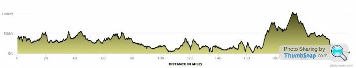
https://www.plotaroute.com seems to do a relatively good job (mainly used it for cycle/walk routes but there's a follow road option. Don't just click the start and end and let it work out inbetween. For some reason it knows best, and sometimes thinks going through the middle of a town is a better idea than following the road/path around the town.
Ian Lancs said:
https://www.plotaroute.com seems to do a relatively good job (mainly used it for cycle/walk routes but there's a follow road option. Don't just click the start and end and let it work out inbetween. For some reason it knows best, and sometimes thinks going through the middle of a town is a better idea than following the road/path around the town.
Because thats how you would walk or be able to cycle. You would drive round the outskirts but cycle or walk straight through the centre.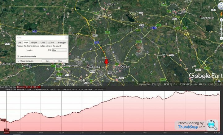
Gary C said:
I do know that Shap is the highest bit 
Freddie Starr sang about that....https://www.youtube.com/watch?v=fb0blY-BeG4https://www.youtube.com/watch?v=fb0blY-BeG4
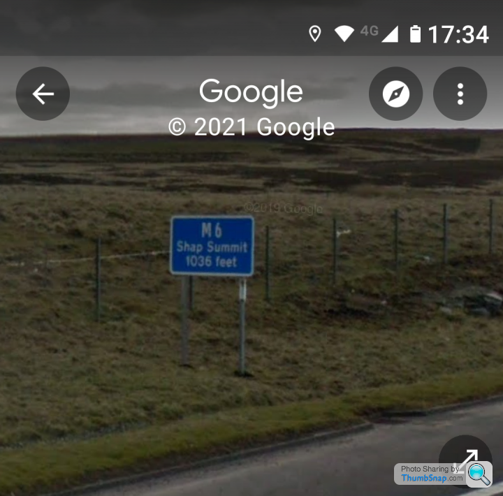

 The motorway isn't professing to be the high point, which is obviously that higher bit past the sign. It's a sign which is saying "this is the summit of this motorway, at shap".
Gassing Station | Roads | Top of Page | What's New | My Stuff