
Land / public right of way dispute
Discussion


For what its worth a solicitor is looking to get a public right of way (PROW) moved anyway but I'd appreciate some wider opinions on a problem within a problem.
On the definitive PROW maps (these are the legal basis for recording public rights of way as I understand it), a public footbath reaches the corner of our field before changing direction, the path clearly does not enter the field and even the council agree the path did not enter our field as drawn back in the day. This map was drawn up some 50+ years ago.
However, the council have now overlaid modern satellite imagary onto the definitive map and the accuracy of the field borders is out by a couple of meters, and in doing so have determined that the PROW enters our field for about 2 meters then turns to exit. It serves no useful purpose to enter our field, the OS map does not show it entering our land, and nobody in their right mind would want to try and enter our land to only exit again when there is a direct route literally 1-2 meters to the side which avoids it. The council are now threatening legal action unless we remove the post and rail fence and allow a path through for this short distance.
What I don't understand is how such issues get resolved as there must be thousands of spots where 50 years ago a man with a theodolite trying to mark up a map was out by a meter or more and where more accurate modern maps show a difference. The council are refusing to accept the field boundary is the same one and it's just a slight inaccuracy (which in turn would mean the accuracy of the path is also slightly inaccurate as its using the field corner as the turning point). For context, even the nearest buildings are are out slightly between the maps although some other buildings further afield are aligned. There are also ancient field posts which mark the old boundary as being one and the same as where it is.
Any thoughts on arguments to why I shouldn't just metaphorically shoot them next time they try to enter my land?
On the definitive PROW maps (these are the legal basis for recording public rights of way as I understand it), a public footbath reaches the corner of our field before changing direction, the path clearly does not enter the field and even the council agree the path did not enter our field as drawn back in the day. This map was drawn up some 50+ years ago.
However, the council have now overlaid modern satellite imagary onto the definitive map and the accuracy of the field borders is out by a couple of meters, and in doing so have determined that the PROW enters our field for about 2 meters then turns to exit. It serves no useful purpose to enter our field, the OS map does not show it entering our land, and nobody in their right mind would want to try and enter our land to only exit again when there is a direct route literally 1-2 meters to the side which avoids it. The council are now threatening legal action unless we remove the post and rail fence and allow a path through for this short distance.
What I don't understand is how such issues get resolved as there must be thousands of spots where 50 years ago a man with a theodolite trying to mark up a map was out by a meter or more and where more accurate modern maps show a difference. The council are refusing to accept the field boundary is the same one and it's just a slight inaccuracy (which in turn would mean the accuracy of the path is also slightly inaccurate as its using the field corner as the turning point). For context, even the nearest buildings are are out slightly between the maps although some other buildings further afield are aligned. There are also ancient field posts which mark the old boundary as being one and the same as where it is.
Any thoughts on arguments to why I shouldn't just metaphorically shoot them next time they try to enter my land?
Heres Johnny said:
For what its worth a solicitor is looking to get a public right of way (PROW) moved anyway but I'd appreciate some wider opinions on a problem within a problem.
On the definitive PROW maps (these are the legal basis for recording public rights of way as I understand it), a public footbath reaches the corner of our field before changing direction, the path clearly does not enter the field and even the council agree the path did not enter our field as drawn back in the day. This map was drawn up some 50+ years ago.
However, the council have now overlaid modern satellite imagary onto the definitive map and the accuracy of the field borders is out by a couple of meters, and in doing so have determined that the PROW enters our field for about 2 meters then turns to exit. It serves no useful purpose to enter our field, the OS map does not show it entering our land, and nobody in their right mind would want to try and enter our land to only exit again when there is a direct route literally 1-2 meters to the side which avoids it. The council are now threatening legal action unless we remove the post and rail fence and allow a path through for this short distance.
What I don't understand is how such issues get resolved as there must be thousands of spots where 50 years ago a man with a theodolite trying to mark up a map was out by a meter or more and where more accurate modern maps show a difference. The council are refusing to accept the field boundary is the same one and it's just a slight inaccuracy (which in turn would mean the accuracy of the path is also slightly inaccurate as its using the field corner as the turning point). For context, even the nearest buildings are are out slightly between the maps although some other buildings further afield are aligned. There are also ancient field posts which mark the old boundary as being one and the same as where it is.
Any thoughts on arguments to why I shouldn't just metaphorically shoot them next time they try to enter my land?
I was involved with a disputed right of way some years ago. I was a member of a local walking group, and a favourite was one that ran away from a pub car park where the landlord encouraged walkers to park all day, knowing that they’d be thirsty and hungry when they returned.On the definitive PROW maps (these are the legal basis for recording public rights of way as I understand it), a public footbath reaches the corner of our field before changing direction, the path clearly does not enter the field and even the council agree the path did not enter our field as drawn back in the day. This map was drawn up some 50+ years ago.
However, the council have now overlaid modern satellite imagary onto the definitive map and the accuracy of the field borders is out by a couple of meters, and in doing so have determined that the PROW enters our field for about 2 meters then turns to exit. It serves no useful purpose to enter our field, the OS map does not show it entering our land, and nobody in their right mind would want to try and enter our land to only exit again when there is a direct route literally 1-2 meters to the side which avoids it. The council are now threatening legal action unless we remove the post and rail fence and allow a path through for this short distance.
What I don't understand is how such issues get resolved as there must be thousands of spots where 50 years ago a man with a theodolite trying to mark up a map was out by a meter or more and where more accurate modern maps show a difference. The council are refusing to accept the field boundary is the same one and it's just a slight inaccuracy (which in turn would mean the accuracy of the path is also slightly inaccurate as its using the field corner as the turning point). For context, even the nearest buildings are are out slightly between the maps although some other buildings further afield are aligned. There are also ancient field posts which mark the old boundary as being one and the same as where it is.
Any thoughts on arguments to why I shouldn't just metaphorically shoot them next time they try to enter my land?
The way went across the centre of a field from corner to corner. There was a way-marker in the middle of the field and maps given out by the walking group, and available free of charge from the pub, emphasised the need to keep to the RoW and not to wander around.
Walkers found their way blocked by farm implements, a farmer carrying a shotgun, threats about dogs were common and said farmer was once seen driving a tractor backwards and forwards, churning up the field, near a style.
Approaches to the farmer, all recorded, were treated with contempt and more threats were made. The matter was going to go to court and we had fund-raising events. Another group organised a mass invasion of said RoW. Not a good idea I thought.
The farmer’s brief got in touch with the walker’s brief and a remote discussion was arranged. In came the council RoW chap and suggested the route should go around the edge of the field. This was what many walkers did anyway as it gave a lovely view. It seems that rerouting to cope with changes is hardly unknown.
There was a cost to reroute (no idea why) and ‘my’ group refused to assist, mentioning the abuse suffered and the attempts at meetings. Eventually the route was changed (for the better) and a couple of groups funded way markers.
Suggestions of antagonism towards walkers exercising their rights used to raise no problem, but things have changed. Keep civil and you might find that walkers will cooperate and raise no objections. Your last sentence can irritate those who know their rights (of way).
What I will say though is that some walkers are a right PitA and will refuse to countenance any changes, newcomers to an area especially. One chap, a lawyer (damn gentrification) brought up ancient legislation on barbed wire and also copses which, I was told, the RoW chap had a healthy disregard of.
If the definitive map shows it’s actually in the wrong place you make an application for a DMMO (definitive map modification order), and start form filling and gathering your evidence. This is £free because it’s in the public interest.
If it’s in the right place but you want it moved, then you can apply for a permanent diversion. This will costs many, many £hundreds because it’s in your interest.
If it’s in the right place but you want it moved, then you can apply for a permanent diversion. This will costs many, many £hundreds because it’s in your interest.

Derek Smith said:
I was involved with a disputed right of way some years ago. I was a member of a local walking group, and a favourite was one that ran away from a pub car park where the landlord encouraged walkers to park all day, knowing that they’d be thirsty and hungry when they returned.
The way went across the centre of a field from corner to corner. There was a way-marker in the middle of the field and maps given out by the walking group, and available free of charge from the pub, emphasised the need to keep to the RoW and not to wander around.
Walkers found their way blocked by farm implements, a farmer carrying a shotgun, threats about dogs were common and said farmer was once seen driving a tractor backwards and forwards, churning up the field, near a style.
Approaches to the farmer, all recorded, were treated with contempt and more threats were made. The matter was going to go to court and we had fund-raising events. Another group organised a mass invasion of said RoW. Not a good idea I thought.
The farmer’s brief got in touch with the walker’s brief and a remote discussion was arranged. In came the council RoW chap and suggested the route should go around the edge of the field. This was what many walkers did anyway as it gave a lovely view. It seems that rerouting to cope with changes is hardly unknown.
There was a cost to reroute (no idea why) and ‘my’ group refused to assist, mentioning the abuse suffered and the attempts at meetings. Eventually the route was changed (for the better) and a couple of groups funded way markers.
Suggestions of antagonism towards walkers exercising their rights used to raise no problem, but things have changed. Keep civil and you might find that walkers will cooperate and raise no objections. Your last sentence can irritate those who know their rights (of way).
What I will say though is that some walkers are a right PitA and will refuse to countenance any changes, newcomers to an area especially. One chap, a lawyer (damn gentrification) brought up ancient legislation on barbed wire and also copses which, I was told, the RoW chap had a healthy disregard of.
Thanks - just to clarify the last sentence was aimed at the council, not at walkers. The way went across the centre of a field from corner to corner. There was a way-marker in the middle of the field and maps given out by the walking group, and available free of charge from the pub, emphasised the need to keep to the RoW and not to wander around.
Walkers found their way blocked by farm implements, a farmer carrying a shotgun, threats about dogs were common and said farmer was once seen driving a tractor backwards and forwards, churning up the field, near a style.
Approaches to the farmer, all recorded, were treated with contempt and more threats were made. The matter was going to go to court and we had fund-raising events. Another group organised a mass invasion of said RoW. Not a good idea I thought.
The farmer’s brief got in touch with the walker’s brief and a remote discussion was arranged. In came the council RoW chap and suggested the route should go around the edge of the field. This was what many walkers did anyway as it gave a lovely view. It seems that rerouting to cope with changes is hardly unknown.
There was a cost to reroute (no idea why) and ‘my’ group refused to assist, mentioning the abuse suffered and the attempts at meetings. Eventually the route was changed (for the better) and a couple of groups funded way markers.
Suggestions of antagonism towards walkers exercising their rights used to raise no problem, but things have changed. Keep civil and you might find that walkers will cooperate and raise no objections. Your last sentence can irritate those who know their rights (of way).
What I will say though is that some walkers are a right PitA and will refuse to countenance any changes, newcomers to an area especially. One chap, a lawyer (damn gentrification) brought up ancient legislation on barbed wire and also copses which, I was told, the RoW chap had a healthy disregard of.
It's impossible at the moment for walkers to follow the council deemed PROW on their digital map, however the one on the gound, marked on OS maps, even the council has a footpath marker and stile showing it, and is at least spiritually reflected in the definitive map, is available and there are no issues to its use. The lawyer is seeking to change it to allow a more conducive path for a different land owner which may resolve the issue anyway but anyone following the OS map are trespassing acording to the councils route even thought they placed a stile and sign on the route thats being used and not the route marked now.
bigandclever said:
If the definitive map shows it’s actually in the wrong place you make an application for a DMMO (definitive map modification order), and start form filling and gathering your evidence. This is £free because it’s in the public interest.
If it’s in the right place but you want it moved, then you can apply for a permanent diversion. This will costs many, many £hundreds because it’s in your interest.
Thanks - I might look into this more, the council told me it wouldn't work because they council don't see it being wrong, only the bounday relative to it is wrong - but common sense dictates otherwise.. I suspect they just don't want to do any work and change things and make it my problem.If it’s in the right place but you want it moved, then you can apply for a permanent diversion. This will costs many, many £hundreds because it’s in your interest.
I wonder how the council overlayed the map and satellite images.
I often look at the Georeferenced Maps site of the National Library of Scotland
https://maps.nls.uk/geo/explore/#zoom=5&lat=55...
It is quite common for the satellite images and the maps to fail to line up very accurately. You can see this especially if you compare the overlays of older buildings and roads. Some maps are better than others.
If they are using something like this I am not at all surprised that there are discrepancies between paths and field boundaries.
I often look at the Georeferenced Maps site of the National Library of Scotland
https://maps.nls.uk/geo/explore/#zoom=5&lat=55...
It is quite common for the satellite images and the maps to fail to line up very accurately. You can see this especially if you compare the overlays of older buildings and roads. Some maps are better than others.
If they are using something like this I am not at all surprised that there are discrepancies between paths and field boundaries.
The satellite image is no more ground truth than the OS map (or any other map). That image is simply being laid over a geoid. It has been along time since I dealt with it on a day to day basis, but ~25 years ago all our jets used WGS84 and all the OS maps were in Britgrid. My recollection is the difference was a couple hundred meters. The question is whether the satellite image map they have produced is using the same datum as the old OS maps. If not, have they done a proper correction?
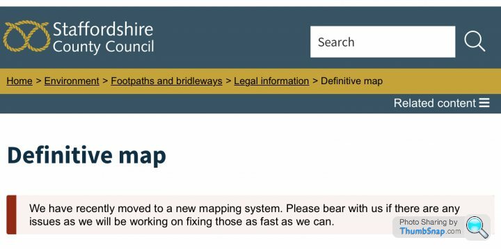
bigandclever said:
Not as discrete as I wanted to be!Useful info though. I’ve also since been sent some interesting case law examples which also support my argument and where the council can’t just move it onto the other side of a marked boundary. I’ve probably got enough if the solicitor doesn’t manage to move the prow altogether.
Gassing Station | Speed, Plod & the Law | Top of Page | What's New | My Stuff