GPS Route Loggers
Discussion


Hi guys,
Im currently interested in GPS route loggers,
i have seen this one
G-TREK GPS ROUTE LOGGER
and am wondering if its any good, or is there a better option out there. ( maybe one with a gsm chip so it can be tracked realtime on the web, as well as being able to offload into google maps ? )
thanks
Im currently interested in GPS route loggers,
i have seen this one
G-TREK GPS ROUTE LOGGER
and am wondering if its any good, or is there a better option out there. ( maybe one with a gsm chip so it can be tracked realtime on the web, as well as being able to offload into google maps ? )
thanks

ive also found this.
reason im asking is that i need a way to track my leaflet distributors, and you guys will have the most experiance in using this type of equipment
the first one i posted is about £100 and the battery is good for about 25hrs ( great )
the seccond one, is smaller, weather proof ( essential ) and battery is good for 24hrs
both claim to be able to log to google maps, but all the demo pics show google earth, can anyone show me a screenshot of gps data uploaded to google maps please ?
Edited by SystemParanoia on Wednesday 6th May 12:50
and to add, it has to be an independant device, as i dont want to rely on my staff having suitable phones, and besides, the chances of them allowing me to mess with their phones is slim to non existant 
at the moment im leaning towards the trackstick, but if theres any gsm options that im missing at the moment.....
at the moment im leaning towards the trackstick, but if theres any gsm options that im missing at the moment.....
http://www.snooperuk.com/products/snooper_tracker/...
not sure if it's 'realtime' or not, but is gsm.....
not sure if it's 'realtime' or not, but is gsm.....
Brilliant!
found this for £25.99
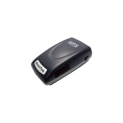
RoyalTek BlueTooth xTrac II GPS Receiver + Data-Logger
it performs the sames functions as the ones ive shown above, just cheaper and only gets 10hrs battery life ( no problem really )
one annoying thing is it only has connectivity via bluetooth rather than by cable... but for this cost, it wont hurt if a few get stolen at all!
i think im sold on this one
found this for £25.99
RoyalTek BlueTooth xTrac II GPS Receiver + Data-Logger
it performs the sames functions as the ones ive shown above, just cheaper and only gets 10hrs battery life ( no problem really )
one annoying thing is it only has connectivity via bluetooth rather than by cable... but for this cost, it wont hurt if a few get stolen at all!
i think im sold on this one
Dave^ said:
how about nokia's sportstracker - if you have an N-Series Nokia....
thanks for this suggestion Dave^i have an N95 and have just given it a test run... PERFECT!
i will give it further testing so i can be sure this is the direction i want to go before committing to spending any money!
brilliant
quick test map to check all is well
http://maps.google.com/maps/ms?ie=UTF&msa=0&am...
guess i'll have to increase the sample rate for driving.. but should be perfect for walking
oh yeah, nokia software saves it in GPX format, which googlemaps cant import, but http://www.gpsvisualizer.com/ is a converter website which can convert it to kmz format, or just put it straight onto a google maps map for you... great
Edited by SystemParanoia on Wednesday 6th May 20:25

guys, ive done my first live run with the system.
and whiles you can see that "something" has happened.
there is alot of randomness happening.
any idea
this was done using my n95 with nokia sports tracker.
does anyone know if the standalone gps units will be more accurate ?
and whiles you can see that "something" has happened.
there is alot of randomness happening.
any idea
this was done using my n95 with nokia sports tracker.
does anyone know if the standalone gps units will be more accurate ?
Edited by SystemParanoia on Saturday 9th May 23:52
that's down to poor gps signal by the looks of it....
i tend to use a bluetooth gps receiver with my N95.... stick it on the dash for a better, more accurate signal.....
i've also used the bluetooth reciever on my bike for riding down the canal.... works fine, just needs clear view of the sky..... even works in the p155ing rain......
i tend to use a bluetooth gps receiver with my N95.... stick it on the dash for a better, more accurate signal.....
i've also used the bluetooth reciever on my bike for riding down the canal.... works fine, just needs clear view of the sky..... even works in the p155ing rain......
Edited by Dave^ on Saturday 9th May 18:40
download "trails" from the APP store, then you can either download tracks or set up your own ones, done both very good.
once you have finished your route, you can edit way points, look at speed, amount climbed and decent, you can view it as a map, hybrid or satalite.
once youve finished fannying around with on the phone you can export it via email in GPX file, or as i do to www.everytrail.com and you can be really anal and export it to facebook!
i'll be recording this weekends efforts around afan, then boring everyone with, maps, average speed and then facebook!
Gassing Station | Pedal Powered | Top of Page | What's New | My Stuff