Dragon Loop - Scenic Driving Road Circuit in Wales
Discussion


To be fair GoSafe the camera partnership publish the locations they can use for siting the vans at https://www.gosafe.org/camera-map/
They also regularly publish the locations they are going to focus on each month, such as - https://www.dailypost.co.uk/news/north-wales-news/...
A limited number of locations and an even more limited number of GoSafe vehicles.
They also regularly publish the locations they are going to focus on each month, such as - https://www.dailypost.co.uk/news/north-wales-news/...
A limited number of locations and an even more limited number of GoSafe vehicles.
And if you look at that list for the next 30 days they could be anywhere, as it covers most laybys in Wales. And they move from one to another every hour or 2.
Just saying be aware, and don't break the limit in side the 40mph limit in in Bala as chances are there will be a van parked up. They have at least 4 spots they use within a couple of miles, and that list only list Bala once. If you view the list each month it is the same, I can't guarantee it is exactly the same but it certainly looks that way.
Expect to see a van, or a handheld camera.
But then as said it's not much different to other places and you are just as likely to be caught in England on your way to Wales.
Just wanted to say thanks for putting the route together
Needed to get up to Bangor for a stag do and decided to take the scenic route! Did the west half of the loop on the way up and east on the return.
Great roads I never would have found without you putting it together.
Worryingly I don't recall seeing any speed vans and only a couple of static cameras so I may have some letters on the way.
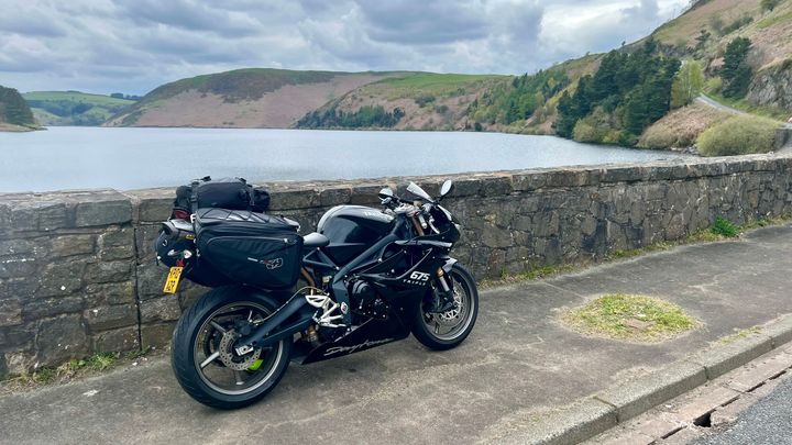
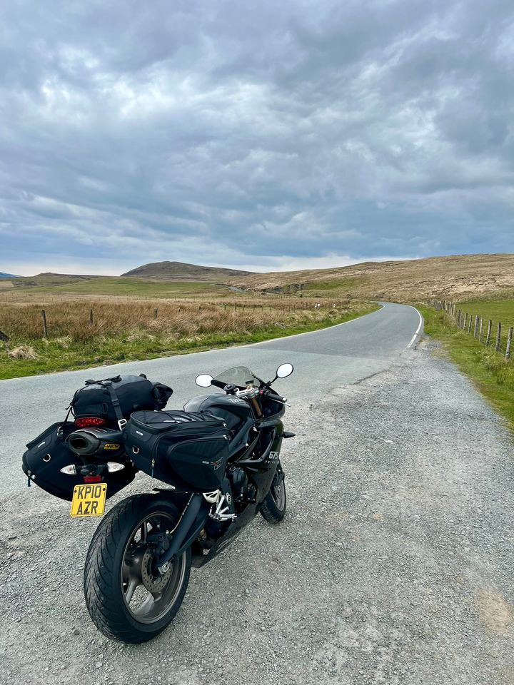
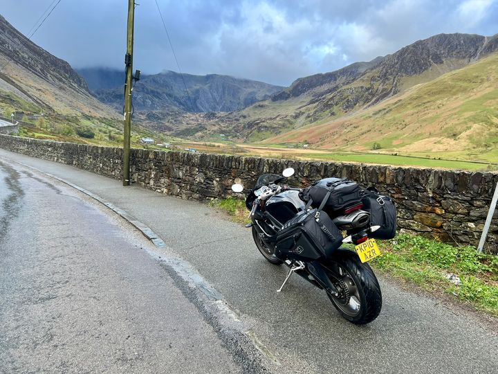
Some gratuitous pictures
Needed to get up to Bangor for a stag do and decided to take the scenic route! Did the west half of the loop on the way up and east on the return.
Great roads I never would have found without you putting it together.
Worryingly I don't recall seeing any speed vans and only a couple of static cameras so I may have some letters on the way.
Some gratuitous pictures
Robb F said:
1. Bwlch-y-Gle Dam, Clywedog reservoir - https://maps.app.goo.gl/7HM4vSMumXQzpVBu62. West of Dylife - https://maps.app.goo.gl/S2w7ssBpVh9z8Buv8
3. Nant Ffrancon - https://maps.app.goo.gl/8hAqRY1caD8ipnEL7
Red Devil said:
1. Bwlch-y-Gle Dam, Clywedog reservoir - https://maps.app.goo.gl/7HM4vSMumXQzpVBu6
2. West of Dylife - https://maps.app.goo.gl/S2w7ssBpVh9z8Buv8
3. Nant Ffrancon - https://maps.app.goo.gl/8hAqRY1caD8ipnEL7
I'd got Clywedog and Nant Ffrancon, but #2 ws eluding me! 2. West of Dylife - https://maps.app.goo.gl/S2w7ssBpVh9z8Buv8
3. Nant Ffrancon - https://maps.app.goo.gl/8hAqRY1caD8ipnEL7

Looks like a great route. I'm flying into Manchester airport this Thursday and scheduled to land at 08:20. I'm hiring a car with the intention of enjoying some of the great Welsh roads. I'd imagine by the time that I land and pick up the car, hopefully will be on the road by about 09:30. I'm staying overnight in Manchester and would like to be back in Manchester for 17:00 at the latest and would prefer to be early, i.e. arrive back at 16:00, rather than later, i.e. arrive back at 18:00.
I'm guessing that based on this itinerary, this might mean the dragon loop posted here won't be feasible in that timeframe. I have driven the Evo triangle in the post and loved it, but know that there are cameras there now. I have read that the speed limit is 40mph, but when I went on one section on Google maps, it appeared to be national speed limit, so 60mph. Even if there are cameras now, this still seems like you could enjoy the route at that speed limit. Can anyone confirm what the actual speed limit is for the majority of it.
Also, open to any other routes that people might suggest. I worked in Wales when I was younger for Dwr Cymru and remember some absolutely amazing roads and stunning scenery, just can't really remember which routes are the best ones.
Edited by NSNO on Monday 6th May 13:13
Krikkit said:
How did you get on? I was going to suggest a few slight tweaks to avoid the average speed camera bits, and bring in one of my favourite roads - A548 from Denbigh to Llanwryst
Great thanks. It was a beautiful day for it, so there were plenty of people about and as the weather was good, was able to enjoy all of the stunning scenery in all its glory. Parts of it were fairly busy, but still managed to enjoy it on the whole and I think that stayed within the average speed part.Another huge thank you for putting the route together - my wife and I completed it from Monday-Thursday last week and had a fabulous time 
A few people have commented on navigation planning - I mapped and saved the entire route on google maps before our trip, adding waypoints to force google mapping to follow the preferred route, not the route google mapping thought was 'best'. I had to do it in about 10 segments due to the maximum of 9 or 10 waypoints which google maps permits. Slightly clunky but generally worked well. Here's an example of a mapped segment; if others might find these useful then I'm happy to post the full set
https://www.google.com/maps/dir/53.2000604,-4.1068...
Two things to note on these routes:
i) If you load this in maps it will say 'preview' or similar, until you're physically near the start point then you'll get the usual 'start' option
ii) some of the routes start/finish at our daily hotels , for obvious reasons, but might still be a useful start point for others to adjust as necessary
Some hotel recommendations more or less en-route (all with good safe & spacious parking - we were in my 3-month old 992 Targa 4S and I'm a bit paranoid about parking!), we stayed and had dinner at all of these:
Ffarm Country House, Betws-yn-Rhos, Abergele LL22 8AR (slightly north of evo triangle at 'top' of route, our Night 1)
Ty'n y Cornel Hotel, Tal-y-llyn, Tywyn LL36 9AJ (southern end of Snowdonia, Night 2)
Elan Valley Hotel, Nr.Rhayader Rhayder LD6 5HN UK (Rhayader - almost southern tip of route, Night 3 - definitely the best place we stayed and ate)
Also one to avoid, at all costs!:
Harrisons Hall, Hafod Road, Gernmynydd, Mold, CH7 5JS (Night 4, 'Mold' says it all really, before heaidng home to the north east next day via Chester zoo)
Edited by beedj on Tuesday 11th June 21:27
beedj said:
Here's an example of a mapped segment; if others might find these useful then I'm happy to post the full set
https://www.google.com/maps/dir/53.2000604,-4.1068...
That's great. If you could post others it would be really useful.https://www.google.com/maps/dir/53.2000604,-4.1068...
No problem, obviously these will need some personalisation depending on how many days, hotels etc, but much of it will be reusable
We started north of the route, joining the loop at the Evo Triangle then following the route anti-clockwise. I've included days/hotels so you can see how we broke the route up
Sunday 2nd June
Hotel: Ffarm Country House, Betws-yn-Rhos, Abergele LL22 8AR
Monday 3rd June
Route #1 (1hr 53min), EvoTriangle, Ogwen Valley,
https://www.google.com/maps/dir/Ffarm+Country+Hous...
Route 2 (1hr 9 mins), Pen-y-Pass, Llanberis Pass:
https://www.google.com/maps/dir/53.2000604,-4.1068...
Route #3 (47 mins), Trawsfynydd : https://www.google.com/maps/dir/52.9375781,-3.9476...
Route 4, Bwlch Oerddrws: https://www.google.com/maps/dir/Cross+Foxes+Inn,+D...
Hotel: Ty'n y Cornel Hotel, Tal-y-llyn, Tywyn LL36 9AJ
Tuesday 4th June
Navigate from hotel to Machynlleth centre
Route 5 (1hr 18 min), Llyn Clywedog Mountain Road:
https://www.google.com/maps/dir/Machynlleth+Town+C...
Route 6 (57 mins), Elan Valley:
https://www.google.com/maps/dir/Heol-Y-Bont,+Penpa...
Hotel: Elan Valley Hotel, Nr.Rhayader Rhayder LD6 5HN UK
Wednesday 5th June
Route 7 (1hr 27 min), Powys Zig Zags: https://www.google.com/maps/dir/Elan+Valley+Hotel,...
Route 8 (2 hrs 8 mins):
https://www.google.com/maps/dir/Llanfyllin+Workhou...
Hotel: Harrisons Hall, Hafod Road, Gernmynydd, Mold, CH7 5JS
beedj said:
A few people have commented on navigation planning - I mapped and saved the entire route on google maps before our trip, adding waypoints to force google mapping to follow the preferred route, not the route google mapping thought was 'best'. I had to do it in about 10 segments due to the maximum of 9 or 10 waypoints which google maps permits. Slightly clunky but generally worked well. Here's an example of a mapped segment; if others might find these useful then I'm happy to post the full set.
That 10 waypoint limitation in Google Maps is a PITA. However this handy tool allows you to combine them.Just use the end point of segment 1 as the start point for segment 2 - https://www.morethan10.com/home
In the rare event of needing more than 20 waypoints, simply repeat the exercise.
I use it every time I visit the Highlands to plot each day's route (ranging from 150 to 300 miles).
The longer ones can often contain 30+ waypoints.
I then daisy chain each day's route using the same process to create a master map for my archive.
beedj said:
1. South of Cadair Viewpoint - https://maps.app.goo.gl/TxUi3PGdETouxEQ3AA shame the weather was unkind. The viewing platform just to the right of the trees is a memorial to Wynford Vaughan Thomas
https://www.stayinwales.co.uk/wales_picture.cfm?p=...
2. Aberystwyth-Rhyader Mountain Road - https://maps.app.goo.gl/uYwKNHaVauUB4XrM9
Red Devil said:
A shame the weather was unkind. The viewing platform just to the right of the trees is a memorial to Wynford Vaughan Thomas
https://www.stayinwales.co.uk/wales_picture.cfm?p=...
Here you go to make up for the weather you had.https://www.stayinwales.co.uk/wales_picture.cfm?p=...
The great thing about living near these roads Is I don't need a map any more.
tropicalpalmtree said:
Hello. I have compiled a driving route that i think is the best is North/Mid Wales. This takes in the best roads and best scenery this part of the country has to offer. I live in this area and have tried and tested to find the best roads to create a full circuit for people to enjoy. This is the finished product. It's approximately 300 miles long.
https://www.google.com/maps/d/u/0/edit?mid=1nl9trE...
If this post garners enough interest i can go into more detail on the route layout, some diversions and suggestions, but for now i will leave you the map and hope you get chance to drive it.
Thanks for this, how can I download/save as a gpx for my bike?https://www.google.com/maps/d/u/0/edit?mid=1nl9trE...
If this post garners enough interest i can go into more detail on the route layout, some diversions and suggestions, but for now i will leave you the map and hope you get chance to drive it.
Edited by tropicalpalmtree on Sunday 2nd July 22:06
Gassing Station | Roads | Top of Page | What's New | My Stuff