The wet and windy, with occasional snow, 2018/2019 thread
Discussion


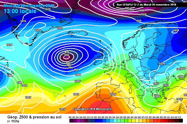
So, we need to start concentrating on the first half of next week. A large area of low pressure in the Atlantic is edging east towards UK. This is not a standard storm situation where low pressure flies by on the jet stream. The high pressure and colder air remains to our east.
There is a chance of a classic battle ground scenario, where the low bumps into the high pressure and lucky areas get dumped on. Due to the time of year, current chart positions and sods law - high up northern areas are most likely... Plus it's quite far out, and could all change. Watchful eye time.
There is a chance of a classic battle ground scenario, where the low bumps into the high pressure and lucky areas get dumped on. Due to the time of year, current chart positions and sods law - high up northern areas are most likely... Plus it's quite far out, and could all change. Watchful eye time.
Bill said:
It's certainly ramping up for a massive disappointment. 
Every year! Models are in complete disarray. One minute showing snowmeggedon and next showing a hair dryer from the SW.
What this generally means is no jet stream - they are all programmed to consider our weather coming from the Atlantic with streams of lows as the number one weather type. When it just isn't going to happen, they flounder.
colin_p said:
More serious than I understood then if it has a name.
Is Diana the 4th being "D" and do all countries use the same naming convention? Interested to know how far down the alphabet it has ever got.
This is their own naming convention - but if a storm is previously named elsewhere, we never rename it. Is Diana the 4th being "D" and do all countries use the same naming convention? Interested to know how far down the alphabet it has ever got.
To put some meat on the bones, models are currently showing possibility of Scandi High in a week or so. Also the polar vortex is getting a real bashing from the weather systems and possibility of a sudden stratospheric warming is high. All in all, I'm thinking of placing a bet on a white Christmas before the news starts leaking out.
Lemming Train said:
You said the exact same thing 2 weeks ago but it's 15C outside right now and not snowmageddon like you predicted.
There were some hopeful signs back then. But then I amended the forecast to predict the wet and windy 
This is looking far more likely - but again, it's so far out that things can and will change.
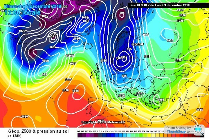
A likely scenario at this point is that Sunday will see bitter northerlies - these winds are often dry away from the east coast. The high pressure that sits to our west causing the notherlies will then meander to sit over Scandinavia - bringing a brief easterly. Models are currently forecasting a battleground scenario, with possible short term heavy snow.
After that - most likely that warmer wetter weather arrives again. Low pressure likely to shunt the high away. If it doesn't - then game on.
After that - most likely that warmer wetter weather arrives again. Low pressure likely to shunt the high away. If it doesn't - then game on.

No good news at the is point really. The cold northerly and easterly winds have watered down. At least the Atlantic will be quieter for a short period.
As always, plenty of hopeful signs for the mid-future, but they keep getting pushed back. We're at the point now of losing a cold/white Xmas, for the usual warm wet, brown/green guff.

Usually when I throw in the towel, within 24 hours we're staring down the barrel of a severe cold spell - here's hoping
As always, plenty of hopeful signs for the mid-future, but they keep getting pushed back. We're at the point now of losing a cold/white Xmas, for the usual warm wet, brown/green guff.
Usually when I throw in the towel, within 24 hours we're staring down the barrel of a severe cold spell - here's hoping
MentalSarcasm said:
So the Atlantic is what's blocking our cold? What is it that makes it stop blocking it? XD (I'm sure I ask this every year but I can never remember all the different set ups and what they cause)
The Atlantic is our eternal source of warmer than average weather because the Earth turns and generates the constant west to east winds. Hence why the UK is MUCH warmer than Labrador in Canada. The same happens on the western coast of North America. As for current patterns... A quieter week starts today. High pressure starts forming to the south, and slowly migrates towards Scandinavia. Eventually bringing some form of easterly winds by Weds/Thurs. No Beast from East though, not at this point.
Models are REALLY struggling with what happens later this week. Current forecast is for an Atlantic/High Pressure battleground over the UK. Really not cold enough for a mass snow event, but don't rule it out. Plus, the high pressure is slowly being modelled as stronger and stronger.
Towards Xmas we see increasing signs (from low!) for cold weather around the festive time of year. Most likely a northerly wind, which generally doesn't last long.
PLUS - sudden strasopheric warming around the Xmas period is being shown with more and more possibility. This takes time to spread its effects, so January is looking more and more likely for a proper spell of winter. Effects from SSW can be very random, so again - this is not a certain forecast!
Lack of posting recently due to issues using the site on my phone - anyone else suffering with massive lagging and trouble opening links?
Glad I pointed out the high pressure was gaining strength and the charts were under estimating it. Tonight's charts showing the Atlantic getting locked out, across the board.
Again though, Europe just isn't cold enough to generate a beast. So it will be cool, pleasant, dry.
Christmas could be cold...
Again though, Europe just isn't cold enough to generate a beast. So it will be cool, pleasant, dry.
Christmas could be cold...

Gassing Station | The Lounge | Top of Page | What's New | My Stuff