The hiking gear and adventures thread...
Discussion


KobayashiMaru86 said:
In Anglesey in May for a few days, wanted to attempt some the peaks around Tryfan with the dog. Been told it's easier from the South for a dog and he is good at climbing. Been using AlllTrails to plan routes. Any issues with this? May do Cader or Yr Wyddfa on the way back on the last day but I know those.

You see that small body of water to the left of Foel Goch, it'll be boggy even in the middle of a drought. It can easily reach up to your knees if your luck isn't with you.The other thing to beware of are low-flying jet fighters cresting the Glyders.
boxedin said:
KobayashiMaru86 said:
In Anglesey in May for a few days, wanted to attempt some the peaks around Tryfan with the dog. Been told it's easier from the South for a dog and he is good at climbing. Been using AlllTrails to plan routes. Any issues with this? May do Cader or Yr Wyddfa on the way back on the last day but I know those.
You see that small body of water to the left of Foel Goch, it'll be boggy even in the middle of a drought. It can easily reach up to your knees if your luck isn't with you.The other thing to beware of are low-flying jet fighters cresting the Glyders.
StoutBench said:
boxedin said:
KobayashiMaru86 said:
In Anglesey in May for a few days, wanted to attempt some the peaks around Tryfan with the dog. Been told it's easier from the South for a dog and he is good at climbing. Been using AlllTrails to plan routes. Any issues with this? May do Cader or Yr Wyddfa on the way back on the last day but I know those.
You see that small body of water to the left of Foel Goch, it'll be boggy even in the middle of a drought. It can easily reach up to your knees if your luck isn't with you.The other thing to beware of are low-flying jet fighters cresting the Glyders.
boxedin said:
You see that small body of water to the left of Foel Goch, it'll be boggy even in the middle of a drought. It can easily reach up to your knees if your luck isn't with you.
Llyn Caseg-fraith is one of the classic Tryfan photo-spots. It's boggy around there but usually better keeping to the S.There's basically three routes between Tryfan and the Glyderau - from W to E : Bristly Ridge, Bristly Screes and the Miner's track. Bristly Ridge is a fairly graded scramble with no escape routes and the screes are steep, loose and generally unpleasant. I'd take the miners's track both ways.
The route you've shown is a big day out, regardless. With Tryfan, that's 20k and around 1600m of ascent.
silentbrown said:
boxedin said:
You see that small body of water to the left of Foel Goch, it'll be boggy even in the middle of a drought. It can easily reach up to your knees if your luck isn't with you.
Llyn Caseg-fraith is one of the classic Tryfan photo-spots. It's boggy around there but usually better keeping to the S.There's basically three routes between Tryfan and the Glyderau - from W to E : Bristly Ridge, Bristly Screes and the Miner's track. Bristly Ridge is a fairly graded scramble with no escape routes and the screes are steep, loose and generally unpleasant. I'd take the miners's track both ways.
The route you've shown is a big day out, regardless. With Tryfan, that's 20k and around 1600m of ascent.
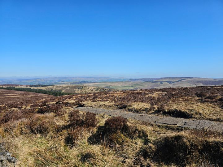
We stayed on The Gower last week and covered pretty much all the decent bits of the coastal path. I say decent bits as some bits aren't great eg from Crofty to Gowerton on the north coast the path is just the pavement on the coast road.
If anyone else is heading that way, we can give the pubs in Llanmadoc (Britannia Inn), Llangennith (Kings Head Inn) and Reynoldston (King Arthur Hotel) a thumbs up. The food in the Britannia was excellent and the Gower Gold went down very nicely
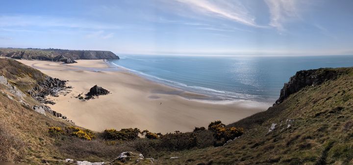
Biggest day we did was Rhossili to Port Eynon and back. 22km with 505m ascent so a good day but not as brutal as the SWCP as you actually had some flat bits. Finished on the beach to watch the sunset. The little dot in the water to the right of the sun is Mrs Harpoon having a post-walk swim, whereas I just stuck to a paddle.

Panorama looking over Three Cliffs Bay taken when we walked Oxwich to Southgate & return. On the day you could see the North Devon coastline across the Bristol Channel. At least that what I think it was as it would have been around 35km away. Total for the week was around 50 miles, a few pints and many ice creams
If anyone else is heading that way, we can give the pubs in Llanmadoc (Britannia Inn), Llangennith (Kings Head Inn) and Reynoldston (King Arthur Hotel) a thumbs up. The food in the Britannia was excellent and the Gower Gold went down very nicely
Biggest day we did was Rhossili to Port Eynon and back. 22km with 505m ascent so a good day but not as brutal as the SWCP as you actually had some flat bits. Finished on the beach to watch the sunset. The little dot in the water to the right of the sun is Mrs Harpoon having a post-walk swim, whereas I just stuck to a paddle.
Panorama looking over Three Cliffs Bay taken when we walked Oxwich to Southgate & return. On the day you could see the North Devon coastline across the Bristol Channel. At least that what I think it was as it would have been around 35km away. Total for the week was around 50 miles, a few pints and many ice creams
KobayashiMaru86 said:
AllTrails has it at 12 miles and 5000f of elevation. Will be a big day. Looking at the map the climb to Y Garn then on to Castell Y Gwynt will be the tougher bits and I'm hoping I'll be into it by then so the rest will be a bit better. 15 mile hikes are the norm for us. We've been doing a lot around the Dragon's back recently. I've done, Cader, Yr Wyddfa, Ben Nevis and Scafell before. Hills don't ever get easier but I get a bit fitter and faster each time.
 Black Mountains is my local patch. I went up Twmpa from Gospel Pass this morning, and it was windy as hell, cold and cloudy. Very little shelter from the southerly winds so I beat a retreat!
Re your route - I'd head back to Ogwen past Llyn Bochlywyd rather than through Cwm Tryfan and the A5. (Unless of course, you're parked on the A5!)
I've learnt that Black Mountain miles are a lot easier then Eryri miles

silentbrown said:
KobayashiMaru86 said:
AllTrails has it at 12 miles and 5000f of elevation. Will be a big day. Looking at the map the climb to Y Garn then on to Castell Y Gwynt will be the tougher bits and I'm hoping I'll be into it by then so the rest will be a bit better. 15 mile hikes are the norm for us. We've been doing a lot around the Dragon's back recently. I've done, Cader, Yr Wyddfa, Ben Nevis and Scafell before. Hills don't ever get easier but I get a bit fitter and faster each time.
Black Mountains is my local patch. I went up Twmpa from Gospel Pass this morning, and it was windy as hell, cold and cloudy. Very little shelter from the southerly winds so I beat a retreat!Re your route - I'd head back to Ogwen past Llyn Bochlywyd rather than through Cwm Tryfan and the A5. (Unless of course, you're parked on the A5!)
I've learnt that Black Mountain miles are a lot easier then Eryri miles
silentbrown said:
Llyn Caseg-fraith is one of the classic Tryfan photo-spots. It's boggy around there but usually better keeping to the S.
There's basically three routes between Tryfan and the Glyderau - from W to E : Bristly Ridge, Bristly Screes and the Miner's track. Bristly Ridge is a fairly graded scramble with no escape routes and the screes are steep, loose and generally unpleasant. I'd take the miners's track both ways.
The route you've shown is a big day out, regardless. With Tryfan, that's 20k and around 1600m of ascent.
This. The descent from the Glyders to the col before Tryfan is proper scrambling.There's basically three routes between Tryfan and the Glyderau - from W to E : Bristly Ridge, Bristly Screes and the Miner's track. Bristly Ridge is a fairly graded scramble with no escape routes and the screes are steep, loose and generally unpleasant. I'd take the miners's track both ways.
The route you've shown is a big day out, regardless. With Tryfan, that's 20k and around 1600m of ascent.
Bill said:
silentbrown said:
Llyn Caseg-fraith is one of the classic Tryfan photo-spots. It's boggy around there but usually better keeping to the S.
There's basically three routes between Tryfan and the Glyderau - from W to E : Bristly Ridge, Bristly Screes and the Miner's track. Bristly Ridge is a fairly graded scramble with no escape routes and the screes are steep, loose and generally unpleasant. I'd take the miners's track both ways.
The route you've shown is a big day out, regardless. With Tryfan, that's 20k and around 1600m of ascent.
This. The descent from the Glyders to the col before Tryfan is proper scrambling.There's basically three routes between Tryfan and the Glyderau - from W to E : Bristly Ridge, Bristly Screes and the Miner's track. Bristly Ridge is a fairly graded scramble with no escape routes and the screes are steep, loose and generally unpleasant. I'd take the miners's track both ways.
The route you've shown is a big day out, regardless. With Tryfan, that's 20k and around 1600m of ascent.
KobayashiMaru86 said:
Ok, so this should be better. Stay high, leave Tryfan until last as there's a good chance I won't get that one anyway, back to the carpark past the lake.
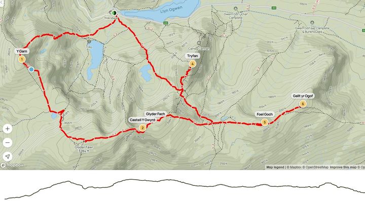
Looks good! The carpark at Ogwen Cottage is small so be there early. The north ridge of Y Garn is nice, and away from the crowds. It's bit of a slog from Llyn y Cwn to Glyder Fawr, but well worth it.
Tryfan via the S ridge is a lot easier. Still some big drops and exposure to the East near the top, so keep your dog close

thebraketester said:
Not really a hike as such, but yesterday I walked from Home in Hertfordshire to work in London. 28.5 miles. It look me about 8.5 hours, not overly scenic as you might expect.. The best bit of all is that I managed to raise over £4000 for charity.
That's some going! Congratulations on the achievement... 
(The brave man you are, putting an image of yourself on PH. Look what happened to Chemical Chaos and Bobbers!)
Edit: if you haven't seen it... the Bobbers thread: https://www.pistonheads.com/gassing/topic.asp?h=0&...
thebraketester said:
Not really a hike as such, but yesterday I walked from Home in Hertfordshire to work in London. 28.5 miles. It look me about 8.5 hours, not overly scenic as you might expect.. The best bit of all is that I managed to raise over £4000 for charity.
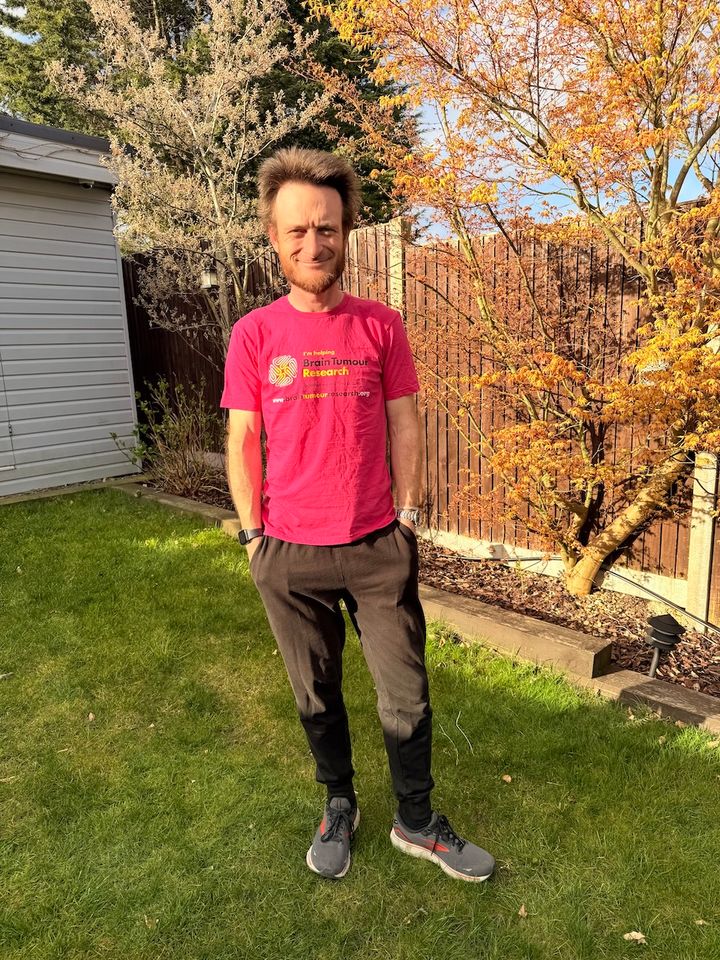
Good effort, there's something very satisfying walking a long distance for a purpose. Not sure what you'd call it if not a hike. I don't think I've done 28+ miles in a day since my 20s!
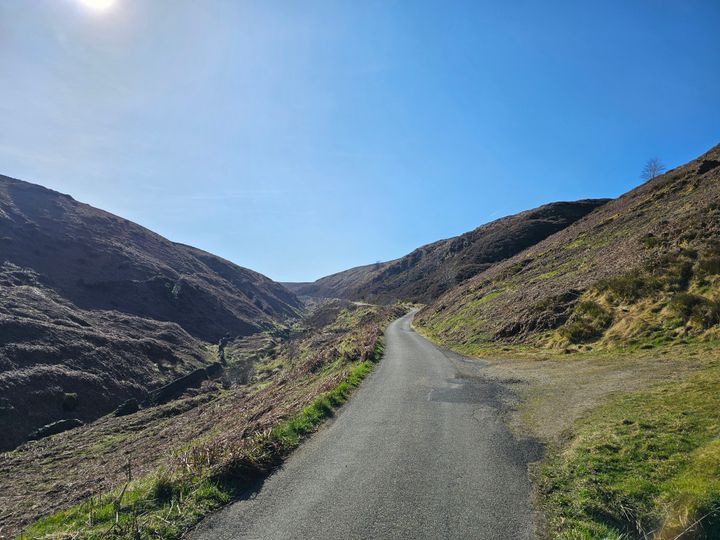
Another 10 mile training hike done with my SWCP 17KG pack: Shining Tor>Cat's Tor loop in the Peaks.
No aches, pains or other issues to report: walk was done in just over 5 hours... had lots of breaks though as it was a nice day. We (my missus and I) wanted a quiet walk with no issues after last weeks drama on Kinder Scout.

No aches, pains or other issues to report: walk was done in just over 5 hours... had lots of breaks though as it was a nice day. We (my missus and I) wanted a quiet walk with no issues after last weeks drama on Kinder Scout.
Edited by Faust66 on Saturday 5th April 21:28
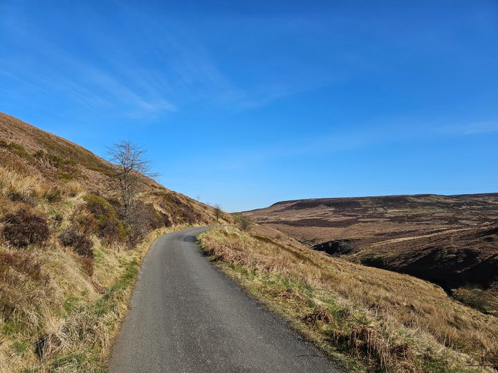
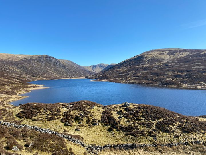
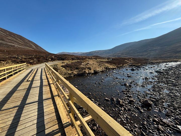
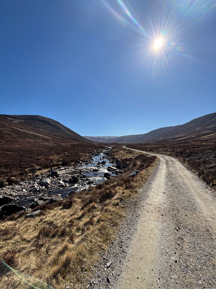
Headed up to Loch Callater today, just south of Braemar. Simply stunning day, t-shirt weather, and slight patches of snow visible on the highest tops. Not really a hike, as it was a simple 12km gravel path to the loch, but whets the appetite for more adventures through the year as we’re privileged to live very close by.
Highlight was seeing a white tailed eagle with its distinctive shaped tail, hover right above us, so elegant!
No photos of the bird, but plenty of the walk. Hope everyone else is getting out in this amazing weather!
Highlight was seeing a white tailed eagle with its distinctive shaped tail, hover right above us, so elegant!
No photos of the bird, but plenty of the walk. Hope everyone else is getting out in this amazing weather!
Edited by thepritch on Sunday 6th April 19:19
Edited by thepritch on Sunday 6th April 19:20
Gassing Station | Holidays & Travel | Top of Page | What's New | My Stuff